Hill Air Force Base elevation
Hill Air Force Base (Utah, Davis County), United States elevation is 1461 meters and Hill Air Force Base elevation in feet is 4793 ft above sea level [src 1]. Hill Air Force Base is a populated place (feature code) with elevation that is 1182 meters (3878 ft) bigger than average city elevation in United States.
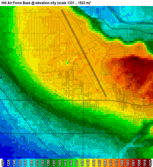
Below is the Elevation map of Hill Air Force Base, which displays elevation range with different colors. Scale of the first map is from 1331 to 1523 m (4367 to 4997 ft) with average elevation of 1418.7 meters (=4655 ft) [note 1]
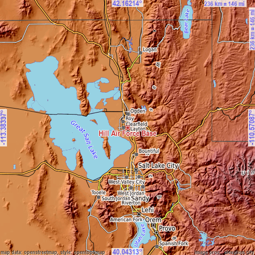
These maps also provides idea of topography and contour of this city, they are displayed at different zoom levels. More info about maps, scale and edge coordinates you can find below images.
| \ | Map #1 | Topo.Map |
| Scale [m] | 1331..1523 m | × |
| Scale [ft] | 4367..4997 ft | × |
| Average | 1418.7 m = 4655 ft | × |
| Width | 7.36 km = 4.6 mi | 235.6 km = 146.4 mi |
| Height | 7.36 km = 4.6 mi | 235.6 km = 146.4 mi |
| ↑Max Latitude | 41.144282° | 42.16214° |
| Latitude at center | 41.11118° | 41.11118° |
| ↓Min Latitude | 41.078062° | 40.04313° |
| ← Min Longitude | -112.021065° | -113.38337° |
| Longitude center | -111.97712° | -111.97712° |
| →Max Longitude | -111.933175° | -110.57087° |
Nearby cities:
Cities around Hill Air Force Base sort by population:
• Layton elevation 1327 m
5.7 km,  174°
174°
• Roy 1385 m
7 km,  323°
323°
• Clearfield 1365 m
4.1 km,  269°
269°
• Kaysville 1332 m
9 km,  159°
159°
• Syracuse 1308 m
7.7 km,  251°
251°
• Clinton 1339 m
6.9 km,  297°
297°
• South Ogden 1359 m
9 km,  3°
3°
• Washington Terrace 1407 m
6.8 km, 0°
• Riverdale 1334 m
7.6 km,  342°
342°
• South Weber 1380 m
4.6 km,  58°
58°
• Sunset 1378 m
5.3 km, 301°
• Uintah 1385 m
5.8 km,  50°
50°
Multilingual:
 En español:
Hill Air Force Base elevación 1461 m.
 En France:
Hill Air Force Base élévation 1461 m.
 Auf Deutsch:
Hill Air Force Base höhe über dem Meeresspiegel ist 1461 m.
 На русском:
Hill Air Force Base высота над уровнем моря 1461 м
Sources and notes:
- [note 1] Map square and city borders are not equal. Map elevation data is calculated only from area inside that square.
- [src 1] Elevation data from geonames database provided with same terms of usage.
- [src 2] The elevation map of Hill Air Force Base is generated using elevation data from NASA's 3 arcsec (90m) resolution SRTM data.
- [src 3] Base (background) map © OpenStreetMap contributors tiles are generated by Geofabrik and OpenTopoMap.
Copyright & License:
This Hill Air Force Base Elevation Map is licensed under CC BY-SA. You may reuse any part from this page, if you give a proper credit by linking to this URL:
 More info on terms of use page.