Clark-Fulton elevation
Clark-Fulton (Ohio, Cuyahoga County), United States elevation is 210 meters and Clark-Fulton elevation in feet is 689 ft above sea level [src 1]. Clark-Fulton is a populated place (feature code) with elevation that is 69 meters (226 ft) smaller than average city elevation in United States.
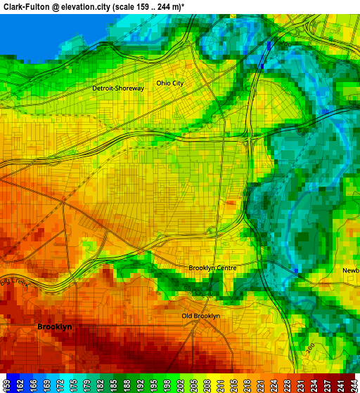
Below is the Elevation map of Clark-Fulton, which displays elevation range with different colors. Scale of the first map is from 159 to 244 m (522 to 801 ft) with average elevation of 204.8 meters (=672 ft) [note 1]
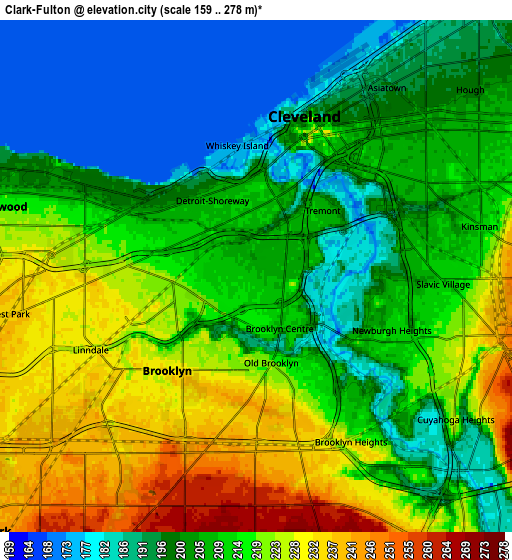
These maps also provides idea of topography and contour of this city, they are displayed at different zoom levels. More info about maps, scale and edge coordinates you can find below images.
| \ | Map #1 | Map #2 | Topo.Map |
| Scale [m] | 159..244 m | 159..278 m | × |
| Scale [ft] | 522..801 ft | 522..912 ft | × |
| Average | 204.8 m = 672 ft | 209.6 m = 688 ft | × |
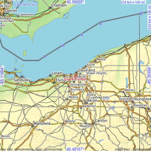
| Width | 7.32 km = 4.5 mi | 14.65 km = 9.1 mi | 234.3 km = 145.6 mi |
| Height | 7.32 km = 4.5 mi | 14.65 km = 9.1 mi | 234.3 km = 145.6 mi |
| ↑Max Latitude | 41.496943° | 41.529849° | 42.50925° |
| Latitude at center | 41.46402° | 41.46402° | 41.46402° |
| ↓Min Latitude | 41.43108° | 41.398124° | 40.40167° |
| ← Min Longitude | -81.753735° | -81.797681° | -83.11604° |
| Longitude center | -81.70979° | -81.70979° | -81.70979° |
| →Max Longitude | -81.665845° | -81.621899° | -80.30354° |
Nearby cities:
Cities around Clark-Fulton sort by population:
• Cleveland elevation 204 m
4.1 km,  16°
16°
• Parma 264 m
6.7 km,  189°
189°
• Lakewood 216 m
7.6 km,  285°
285°
• Garfield Heights 290 m
10.1 km,  121°
121°
• Parma Heights 262 m
9.2 km,  206°
206°
• Brook Park 241 m
10.8 km,  227°
227°
• Detroit-Shoreway 208 m
2.3 km,  312°
312°
• Hough 201 m
8.1 km,  48°
48°
• Seven Hills 271 m
8.1 km,  159°
159°
• Brooklyn 233 m
3.4 km,  218°
218°
• Newburgh Heights 211 m
4.2 km,  111°
111°
• Brooklyn Heights 233 m
4.7 km, 157°
Multilingual:
 En español:
Clark-Fulton elevación 210 m.
 En France:
Clark-Fulton élévation 210 m.
 Auf Deutsch:
Clark-Fulton höhe über dem Meeresspiegel ist 210 m.

Sources and notes:
- [note 1] Map square and city borders are not equal. Map elevation data is calculated only from area inside that square.
- [src 1] Elevation data from geonames database provided with same terms of usage.
- [src 2] The elevation map of Clark-Fulton is generated using elevation data from NASA's 3 arcsec (90m) resolution SRTM data.
- [src 3] Base (background) map © OpenStreetMap contributors tiles are generated by Geofabrik and OpenTopoMap.
Copyright & License:
This Clark-Fulton Elevation Map is licensed under CC BY-SA. You may reuse any part from this page, if you give a proper credit by linking to this URL:
 More info on terms of use page.