Garfield Heights elevation
Garfield Heights (Ohio, Cuyahoga County), United States elevation is 290 meters and Garfield Heights elevation in feet is 951 ft above sea level [src 1]. Garfield Heights is a populated place (feature code) with elevation that is 11 meters (36 ft) bigger than average city elevation in United States.
Below is the Elevation map of Garfield Heights, which displays elevation range with different colors. Scale of the first map is from 167 to 307 m (548 to 1007 ft) with average elevation of 250.8 meters (=823 ft) [note 1]
These maps also provides idea of topography and contour of this city, they are displayed at different zoom levels. More info about maps, scale and edge coordinates you can find below images.
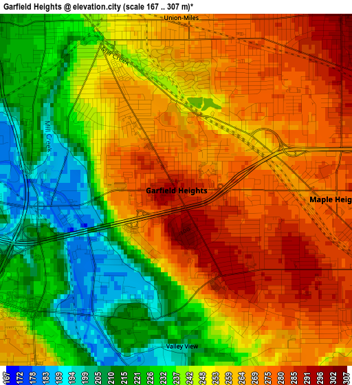
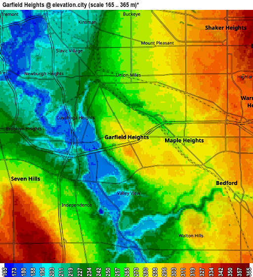
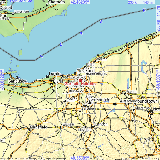
| \ | Map #1 | Map #2 | Topo.Map |
| Scale [m] | 167..307 m | 165..365 m | × |
| Scale [ft] | 548..1007 ft | 541..1198 ft | × |
| Average | 250.8 m = 823 ft | 262 m = 860 ft | × |
| Width | 7.33 km = 4.6 mi | 14.66 km = 9.1 mi | 234.5 km = 145.7 mi |
| Height | 7.33 km = 4.6 mi | 14.66 km = 9.1 mi | 234.5 km = 145.7 mi |
| ↑Max Latitude | 41.449947° | 41.482877° | 42.46299° |
| Latitude at center | 41.417° | 41.417° | 41.417° |
| ↓Min Latitude | 41.384036° | 41.351056° | 40.35389° |
| ← Min Longitude | -81.649905° | -81.693851° | -83.01221° |
| Longitude center | -81.60596° | -81.60596° | -81.60596° |
| →Max Longitude | -81.562015° | -81.518069° | -80.19971° |
Nearby cities:
Cities around Garfield Heights sort by population:
• Maple Heights elevation 277 m
3.3 km,  93°
93°
• Warrensville Heights 318 m
6.2 km,  70°
70°
• Bedford 289 m
6.4 km,  114°
114°
• Seven Hills 271 m
6.3 km,  247°
247°
• Bedford Heights 317 m
6.6 km, 90°
• Independence 261 m
6 km,  206°
206°
• Walton Hills 302 m
6.8 km,  146°
146°
• Glendale 285 m
5.8 km, 112°
• Newburgh Heights 211 m
6 km,  307°
307°
• Valley View 199 m
3.2 km,  177°
177°
• Brooklyn Heights 233 m
6.9 km,  277°
277°
• North Randall 317 m
7 km, 73°
Multilingual:
 En español:
Garfield Heights elevación 290 m.
 En France:
Garfield Heights élévation 290 m.
 Auf Deutsch:
Garfield Heights höhe über dem Meeresspiegel ist 290 m.

Sources and notes:
- [note 1] Map square and city borders are not equal. Map elevation data is calculated only from area inside that square.
- [src 1] Elevation data from geonames database provided with same terms of usage.
- [src 2] The elevation map of Garfield Heights is generated using elevation data from NASA's 3 arcsec (90m) resolution SRTM data.
- [src 3] Base (background) map © OpenStreetMap contributors tiles are generated by Geofabrik and OpenTopoMap.
Copyright & License:
This Garfield Heights Elevation Map is licensed under CC BY-SA. You may reuse any part from this page, if you give a proper credit by linking to this URL:
 More info on terms of use page.