Old Jamestown elevation
Old Jamestown (Missouri, Saint Louis County), United States elevation is 173 meters and Old Jamestown elevation in feet is 568 ft above sea level [src 1]. Old Jamestown is a populated place (feature code) with elevation that is 106 meters (348 ft) smaller than average city elevation in United States.
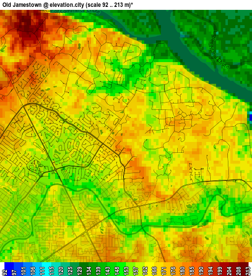
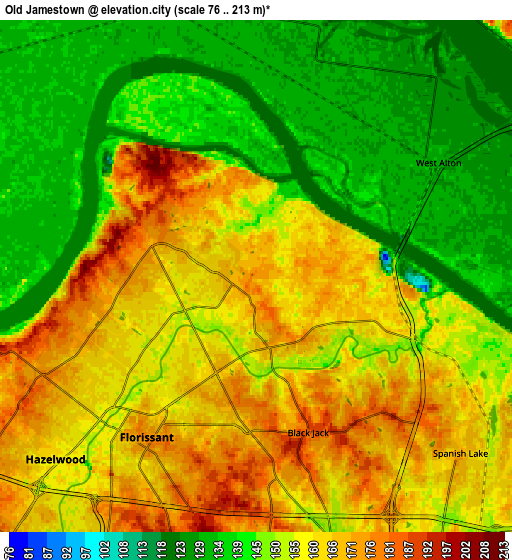
Below is the Elevation map of Old Jamestown, which displays elevation range with different colors. Scale of the first map is from 92 to 213 m (302 to 699 ft) with average elevation of 161.3 meters (=529 ft) [note 1]
These maps also provides idea of topography and contour of this city, they are displayed at different zoom levels. More info about maps, scale and edge coordinates you can find below images.
| \ | Map #1 | Map #2 | Topo.Map |
| Scale [m] | 92..213 m | 76..213 m | × |
| Scale [ft] | 302..699 ft | 249..699 ft | × |
| Average | 161.3 m = 529 ft | 152.6 m = 501 ft | × |
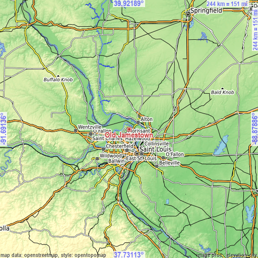
| Width | 7.61 km = 4.7 mi | 15.22 km = 9.5 mi | 243.6 km = 151.4 mi |
| Height | 7.61 km = 4.7 mi | 15.22 km = 9.5 mi | 243.6 km = 151.4 mi |
| ↑Max Latitude | 38.869163° | 38.90337° | 39.92189° |
| Latitude at center | 38.83494° | 38.83494° | 38.83494° |
| ↓Min Latitude | 38.8007° | 38.766444° | 37.73113° |
| ← Min Longitude | -90.329055° | -90.373001° | -91.69136° |
| Longitude center | -90.28511° | -90.28511° | -90.28511° |
| →Max Longitude | -90.241165° | -90.197219° | -88.87886° |
Nearby cities:
Cities around Old Jamestown sort by population:
• Florissant elevation 176 m
6 km,  212°
212°
• Alton 152 m
10.7 km,  54°
54°
• Hazelwood 173 m
10.3 km,  226°
226°
• Ferguson 155 m
10.2 km,  189°
189°
• Spanish Lake 171 m
8 km,  131°
131°
• Berkeley 161 m
9.8 km,  204°
204°
• Black Jack 185 m
4.9 km,  161°
161°
• Dellwood 167 m
9.5 km,  180°
180°
• Castle Point 155 m
9.1 km, 159°
• Riverview 167 m
11.6 km,  146°
146°
• Moline Acres 150 m
10.5 km, 158°
• Calverton Park 193 m
8.2 km, 197°
Multilingual:
 En español:
Old Jamestown elevación 173 m.
 En France:
Old Jamestown élévation 173 m.
 Auf Deutsch:
Old Jamestown höhe über dem Meeresspiegel ist 173 m.

Sources and notes:
- [note 1] Map square and city borders are not equal. Map elevation data is calculated only from area inside that square.
- [src 1] Elevation data from geonames database provided with same terms of usage.
- [src 2] The elevation map of Old Jamestown is generated using elevation data from NASA's 3 arcsec (90m) resolution SRTM data.
- [src 3] Base (background) map © OpenStreetMap contributors tiles are generated by Geofabrik and OpenTopoMap.
Copyright & License:
This Old Jamestown Elevation Map is licensed under CC BY-SA. You may reuse any part from this page, if you give a proper credit by linking to this URL:
 More info on terms of use page.