Berkeley elevation
Berkeley (Missouri, Saint Louis County), United States elevation is 161 meters and Berkeley elevation in feet is 528 ft above sea level [src 1]. Berkeley is a populated place (feature code) with elevation that is 118 meters (387 ft) smaller than average city elevation in United States.
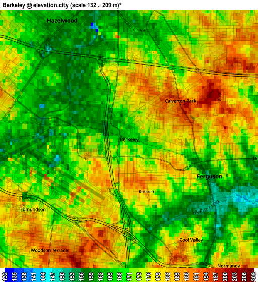
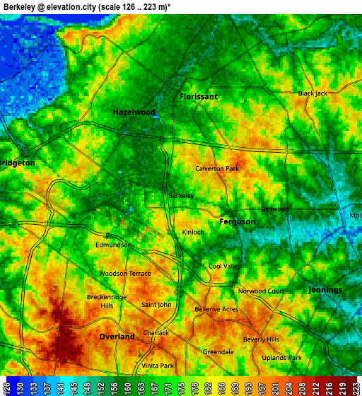
Below is the Elevation map of Berkeley, which displays elevation range with different colors. Scale of the first map is from 132 to 209 m (433 to 686 ft) with average elevation of 173 meters (=568 ft) [note 1]
These maps also provides idea of topography and contour of this city, they are displayed at different zoom levels. More info about maps, scale and edge coordinates you can find below images.
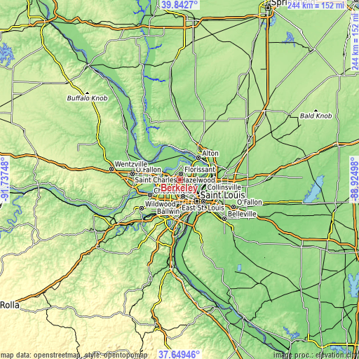
| \ | Map #1 | Map #2 | Topo.Map |
| Scale [m] | 132..209 m | 126..223 m | × |
| Scale [ft] | 433..686 ft | 413..732 ft | × |
| Average | 173 m = 568 ft | 171.8 m = 564 ft | × |
| Width | 7.62 km = 4.7 mi | 15.24 km = 9.5 mi | 243.9 km = 151.6 mi |
| Height | 7.62 km = 4.7 mi | 15.24 km = 9.5 mi | 243.9 km = 151.6 mi |
| ↑Max Latitude | 38.788762° | 38.823007° | 39.8427° |
| Latitude at center | 38.7545° | 38.7545° | 38.7545° |
| ↓Min Latitude | 38.720222° | 38.685927° | 37.64946° |
| ← Min Longitude | -90.375175° | -90.419121° | -91.73748° |
| Longitude center | -90.33123° | -90.33123° | -90.33123° |
| →Max Longitude | -90.287285° | -90.243339° | -88.92498° |
Nearby cities:
Cities around Berkeley sort by population:
• Florissant elevation 176 m
3.9 km,  10°
10°
• Hazelwood 173 m
3.9 km,  298°
298°
• Ferguson 155 m
2.5 km,  117°
117°
• Saint Johns 190 m
4.7 km,  192°
192°
• Saint John 201 m
4.6 km,  196°
196°
• Dellwood 167 m
4 km,  98°
98°
• Normandy 185 m
4.8 km,  141°
141°
• Breckenridge Hills 183 m
5.4 km,  215°
215°
• Woodson Terrace 196 m
4 km, 215°
• Bel-Ridge 187 m
5 km,  174°
174°
• Calverton Park 193 m
1.9 km,  53°
53°
• Cool Valley 185 m
3.5 km,  148°
148°
Multilingual:
 En español:
Berkeley elevación 161 m.
 En France:
Berkeley élévation 161 m.
 Auf Deutsch:
Berkeley höhe über dem Meeresspiegel ist 161 m.

Sources and notes:
- [note 1] Map square and city borders are not equal. Map elevation data is calculated only from area inside that square.
- [src 1] Elevation data from geonames database provided with same terms of usage.
- [src 2] The elevation map of Berkeley is generated using elevation data from NASA's 3 arcsec (90m) resolution SRTM data.
- [src 3] Base (background) map © OpenStreetMap contributors tiles are generated by Geofabrik and OpenTopoMap.
Copyright & License:
This Berkeley Elevation Map is licensed under CC BY-SA. You may reuse any part from this page, if you give a proper credit by linking to this URL:
 More info on terms of use page.