Normandy elevation
Normandy (Missouri, Saint Louis County), United States elevation is 185 meters and Normandy elevation in feet is 607 ft above sea level [src 1]. Normandy is a populated place (feature code) with elevation that is 94 meters (308 ft) smaller than average city elevation in United States.
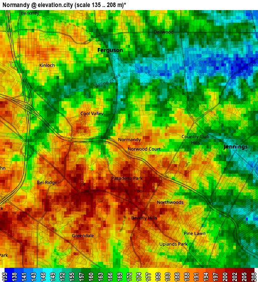
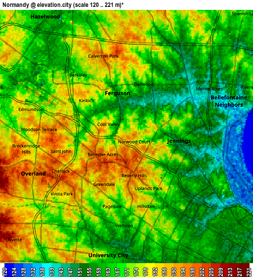
Below is the Elevation map of Normandy, which displays elevation range with different colors. Scale of the first map is from 135 to 208 m (443 to 682 ft) with average elevation of 174.1 meters (=571 ft) [note 1]
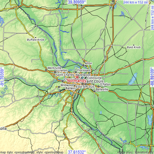
These maps also provides idea of topography and contour of this city, they are displayed at different zoom levels. More info about maps, scale and edge coordinates you can find below images.
| \ | Map #1 | Map #2 | Topo.Map |
| Scale [m] | 135..208 m | 120..221 m | × |
| Scale [ft] | 443..682 ft | 394..725 ft | × |
| Average | 174.1 m = 571 ft | 168.7 m = 553 ft | × |
| Width | 7.62 km = 4.7 mi | 15.25 km = 9.5 mi | 244 km = 151.6 mi |
| Height | 7.62 km = 4.7 mi | 15.25 km = 9.5 mi | 244 km = 151.6 mi |
| ↑Max Latitude | 38.755158° | 38.78942° | 39.80959° |
| Latitude at center | 38.72088° | 38.72088° | 38.72088° |
| ↓Min Latitude | 38.686586° | 38.652275° | 37.61532° |
| ← Min Longitude | -90.341285° | -90.385231° | -91.70359° |
| Longitude center | -90.29734° | -90.29734° | -90.29734° |
| →Max Longitude | -90.253395° | -90.209449° | -88.89109° |
Nearby cities:
Cities around Normandy sort by population:
• Ferguson elevation 155 m
2.7 km,  344°
344°
• Jennings 156 m
3.2 km,  93°
93°
• Saint Johns 190 m
4.1 km,  258°
258°
• Dellwood 167 m
3.3 km,  17°
17°
• Northwoods 180 m
2.2 km,  146°
146°
• Pine Lawn 190 m
3.4 km, 145°
• Bel-Ridge 187 m
2.7 km,  242°
242°
• Bel-Nor 196 m
2.7 km,  218°
218°
• Velda Village 191 m
3.4 km,  175°
175°
• Country Club Hills 164 m
2 km, 90°
• Cool Valley 185 m
1.4 km,  304°
304°
• Velda Village Hills 177 m
3.5 km,  165°
165°
Multilingual:
 En español:
Normandy elevación 185 m.
 En France:
Normandy élévation 185 m.
 Auf Deutsch:
Normandy höhe über dem Meeresspiegel ist 185 m.

Sources and notes:
- [note 1] Map square and city borders are not equal. Map elevation data is calculated only from area inside that square.
- [src 1] Elevation data from geonames database provided with same terms of usage.
- [src 2] The elevation map of Normandy is generated using elevation data from NASA's 3 arcsec (90m) resolution SRTM data.
- [src 3] Base (background) map © OpenStreetMap contributors tiles are generated by Geofabrik and OpenTopoMap.
Copyright & License:
This Normandy Elevation Map is licensed under CC BY-SA. You may reuse any part from this page, if you give a proper credit by linking to this URL:
 More info on terms of use page.