Tamalpais-Homestead Valley elevation
Tamalpais-Homestead Valley (California, Marin County), United States elevation is 12 meters and Tamalpais-Homestead Valley elevation in feet is 39 ft above sea level [src 1]. Tamalpais-Homestead Valley is a populated place (feature code) with elevation that is 267 meters (876 ft) smaller than average city elevation in United States.
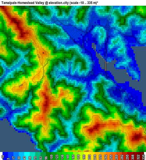
Below is the Elevation map of Tamalpais-Homestead Valley, which displays elevation range with different colors. Scale of the first map is from -10 to 335 m (-33 to 1099 ft) with average elevation of 103.4 meters (=339 ft) [note 1]
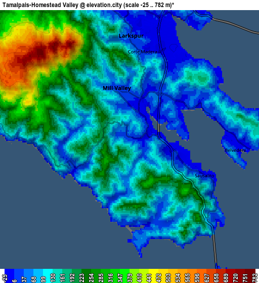
These maps also provides idea of topography and contour of this city, they are displayed at different zoom levels. More info about maps, scale and edge coordinates you can find below images.
| \ | Map #1 | Map #2 | Topo.Map |
| Scale [m] | -10..335 m | -25..782 m | × |
| Scale [ft] | -33..1099 ft | -82..2566 ft | × |
| Average | 103.4 m = 339 ft | 163.2 m = 535 ft | × |
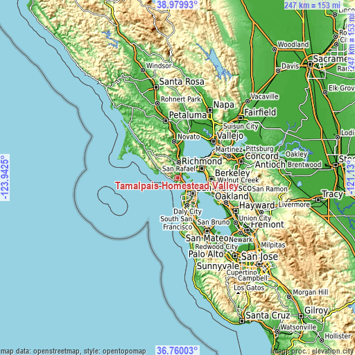
| Width | 7.71 km = 4.8 mi | 15.43 km = 9.6 mi | 246.8 km = 153.4 mi |
| Height | 7.71 km = 4.8 mi | 15.43 km = 9.6 mi | 246.8 km = 153.4 mi |
| ↑Max Latitude | 37.913019° | 37.947681° | 38.97993° |
| Latitude at center | 37.87834° | 37.87834° | 37.87834° |
| ↓Min Latitude | 37.843645° | 37.808934° | 36.76003° |
| ← Min Longitude | -122.580195° | -122.624141° | -123.9425° |
| Longitude center | -122.53625° | -122.53625° | -122.53625° |
| →Max Longitude | -122.492305° | -122.448359° | -121.13° |
Nearby cities:
Cities around Tamalpais-Homestead Valley sort by population:
• San Rafael elevation 13 m
10.6 km,  2°
2°
• Mill Valley 23 m
3.2 km,  346°
346°
• Larkspur 14 m
6.2 km, 0°
• Corte Madera 8 m
5.3 km,  8°
8°
• Tiburon 2 m
7 km,  94°
94°
• Sausalito 2 m
5 km,  115°
115°
• Tamalpais Valley 33 m
0.9 km,  279°
279°
• Kentfield 57 m
8.4 km, 347°
• Strawberry 66 m
3.2 km,  49°
49°
• Marin City 9 m
2.6 km,  114°
114°
• Ross 14 m
9.5 km, 350°
• Belvedere 15 m
6.3 km,  95°
95°
Multilingual:
 En español:
Tamalpais-Homestead Valley elevación 12 m.
 En France:
Tamalpais-Homestead Valley élévation 12 m.
 Auf Deutsch:
Tamalpais-Homestead Valley höhe über dem Meeresspiegel ist 12 m.
 На русском:
Tamalpais-Homestead Valley высота над уровнем моря 12 м
Sources and notes:
- [note 1] Map square and city borders are not equal. Map elevation data is calculated only from area inside that square.
- [src 1] Elevation data from geonames database provided with same terms of usage.
- [src 2] The elevation map of Tamalpais-Homestead Valley is generated using elevation data from NASA's 3 arcsec (90m) resolution SRTM data.
- [src 3] Base (background) map © OpenStreetMap contributors tiles are generated by Geofabrik and OpenTopoMap.
Copyright & License:
This Tamalpais-Homestead Valley Elevation Map is licensed under CC BY-SA. You may reuse any part from this page, if you give a proper credit by linking to this URL:
 More info on terms of use page.