Sierra Vista Southeast elevation
Sierra Vista Southeast (Arizona, Cochise County), United States elevation is 1386 meters and Sierra Vista Southeast elevation in feet is 4547 ft above sea level [src 1]. Sierra Vista Southeast is a populated place (feature code) with elevation that is 1107 meters (3632 ft) bigger than average city elevation in United States.
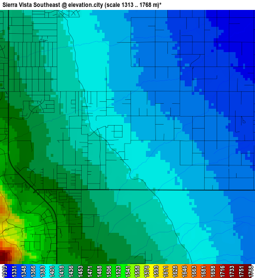
Below is the Elevation map of Sierra Vista Southeast, which displays elevation range with different colors. Scale of the first map is from 1313 to 1768 m (4308 to 5801 ft) with average elevation of 1402.1 meters (=4600 ft) [note 1]
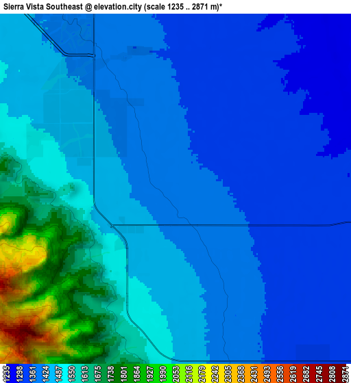
These maps also provides idea of topography and contour of this city, they are displayed at different zoom levels. More info about maps, scale and edge coordinates you can find below images.
| \ | Map #1 | Map #2 | Topo.Map |
| Scale [m] | 1313..1768 m | 1235..2871 m | × |
| Scale [ft] | 4308..5801 ft | 4052..9419 ft | × |
| Average | 1402.1 m = 4600 ft | 1472.4 m = 4831 ft | × |
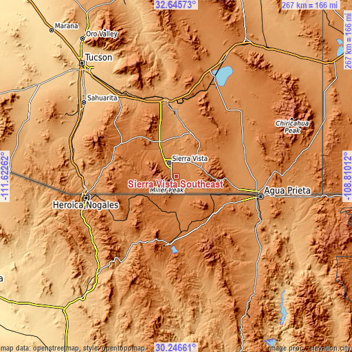
| Width | 8.34 km = 5.2 mi | 16.67 km = 10.4 mi | 266.8 km = 165.8 mi |
| Height | 8.34 km = 5.2 mi | 16.67 km = 10.4 mi | 266.8 km = 165.8 mi |
| ↑Max Latitude | 31.491331° | 31.528796° | 32.64573° |
| Latitude at center | 31.45385° | 31.45385° | 31.45385° |
| ↓Min Latitude | 31.416354° | 31.378844° | 30.24661° |
| ← Min Longitude | -110.260315° | -110.304261° | -111.62262° |
| Longitude center | -110.21637° | -110.21637° | -110.21637° |
| →Max Longitude | -110.172425° | -110.128479° | -108.81012° |
Nearby cities:
Cities around Sierra Vista Southeast sort by population:
• Sierra Vista elevation 1416 m
13.9 km,  323°
323°
• Douglas 1226 m
64.8 km,  100°
100°
• Bisbee 1694 m
27.3 km,  91°
91°
• Benson 1094 m
57.6 km,  352°
352°
• Whetstone 1237 m
57.2 km, 348°
• Whetstone 1330 m
29.9 km,  336°
336°
• Mescal 1241 m
63.1 km, 340°
• Huachuca City 1347 m
22.3 km,  330°
330°
• Pirtleville 1213 m
62.9 km, 99°
• Saint David 1126 m
50.1 km,  0°
0°
• Tombstone 1389 m
32.1 km,  26°
26°
• Naco 1410 m
28.7 km,  117°
117°
Multilingual:
 En español:
Sierra Vista Southeast elevación 1386 m.
 En France:
Sierra Vista Southeast élévation 1386 m.
 Auf Deutsch:
Sierra Vista Southeast höhe über dem Meeresspiegel ist 1386 m.
 На русском:
Sierra Vista Southeast высота над уровнем моря 1386 м
Sources and notes:
- [note 1] Map square and city borders are not equal. Map elevation data is calculated only from area inside that square.
- [src 1] Elevation data from geonames database provided with same terms of usage.
- [src 2] The elevation map of Sierra Vista Southeast is generated using elevation data from NASA's 3 arcsec (90m) resolution SRTM data.
- [src 3] Base (background) map © OpenStreetMap contributors tiles are generated by Geofabrik and OpenTopoMap.
Copyright & License:
This Sierra Vista Southeast Elevation Map is licensed under CC BY-SA. You may reuse any part from this page, if you give a proper credit by linking to this URL:
 More info on terms of use page.