Bonadelle Ranchos-Madera Ranchos elevation
Bonadelle Ranchos-Madera Ranchos (California, Madera County), United States elevation is 116 meters and Bonadelle Ranchos-Madera Ranchos elevation in feet is 381 ft above sea level [src 1]. Bonadelle Ranchos-Madera Ranchos is a populated place (feature code) with elevation that is 163 meters (535 ft) smaller than average city elevation in United States.
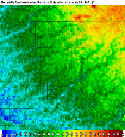
Below is the Elevation map of Bonadelle Ranchos-Madera Ranchos, which displays elevation range with different colors. Scale of the first map is from 95 to 147 m (312 to 482 ft) with average elevation of 114.1 meters (=374 ft) [note 1]
These maps also provides idea of topography and contour of this city, they are displayed at different zoom levels. More info about maps, scale and edge coordinates you can find below images.
| \ | Map #1 | Map #2 | Topo.Map |
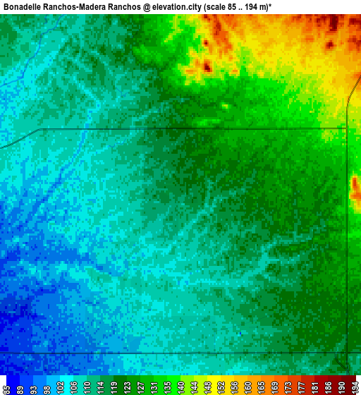
| Scale [m] | 95..147 m | 85..194 m | × |
| Scale [ft] | 312..482 ft | 279..636 ft | × |
| Average | 114.1 m = 374 ft | 117.1 m = 384 ft | × |
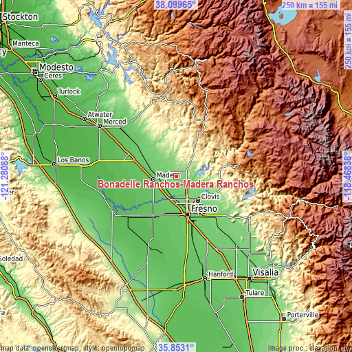
| Width | 7.81 km = 4.9 mi | 15.61 km = 9.7 mi | 249.8 km = 155.2 mi |
| Height | 7.81 km = 4.9 mi | 15.61 km = 9.7 mi | 249.8 km = 155.2 mi |
| ↑Max Latitude | 37.019765° | 37.054844° | 38.09965° |
| Latitude at center | 36.98467° | 36.98467° | 36.98467° |
| ↓Min Latitude | 36.949559° | 36.914431° | 35.8531° |
| ← Min Longitude | -119.918575° | -119.962521° | -121.28088° |
| Longitude center | -119.87463° | -119.87463° | -119.87463° |
| →Max Longitude | -119.830685° | -119.786739° | -118.46838° |
Nearby cities:
Cities around Bonadelle Ranchos-Madera Ranchos sort by population:
• Fresno elevation 99 m
27.9 km,  160°
160°
• Clovis 113 m
23.4 km,  139°
139°
• Madera 87 m
16.7 km,  261°
261°
• Madera Acres 88 m
17.5 km,  282°
282°
• Old Fig Garden 100 m
21.6 km, 163°
• Yosemite Lakes 393 m
24.7 km,  21°
21°
• Sunnyside 101 m
30.5 km,  149°
149°
• Tarpey Village 111 m
26.3 km, 144°
• Parksdale 86 m
13.8 km,  252°
252°
• Parkwood 83 m
16.4 km, 246°
• Biola 79 m
23.9 km,  211°
211°
• Fairmead 77 m
30 km,  289°
289°
Multilingual:
 En español:
Bonadelle Ranchos-Madera Ranchos elevación 116 m.
 En France:
Bonadelle Ranchos-Madera Ranchos élévation 116 m.
 Auf Deutsch:
Bonadelle Ranchos-Madera Ranchos höhe über dem Meeresspiegel ist 116 m.
 На русском:
Bonadelle Ranchos-Madera Ranchos высота над уровнем моря 116 м
Sources and notes:
- [note 1] Map square and city borders are not equal. Map elevation data is calculated only from area inside that square.
- [src 1] Elevation data from geonames database provided with same terms of usage.
- [src 2] The elevation map of Bonadelle Ranchos-Madera Ranchos is generated using elevation data from NASA's 3 arcsec (90m) resolution SRTM data.
- [src 3] Base (background) map © OpenStreetMap contributors tiles are generated by Geofabrik and OpenTopoMap.
Copyright & License:
This Bonadelle Ranchos-Madera Ranchos Elevation Map is licensed under CC BY-SA. You may reuse any part from this page, if you give a proper credit by linking to this URL:
 More info on terms of use page.