Wheatland elevation
Wheatland (Wyoming, Platte County), United States elevation is 1449 meters and Wheatland elevation in feet is 4754 ft above sea level [src 1]. Wheatland is a seat of a second-order administrative division (feature code) with elevation that is 1170 meters (3839 ft) bigger than average city elevation in United States.
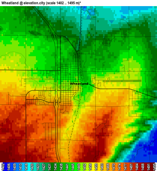
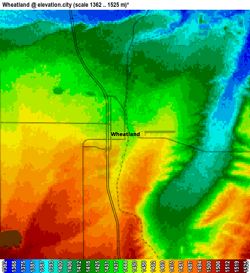
Below is the Elevation map of Wheatland, which displays elevation range with different colors. Scale of the first map is from 1402 to 1495 m (4600 to 4905 ft) with average elevation of 1450.9 meters (=4760 ft) [note 1]
These maps also provides idea of topography and contour of this city, they are displayed at different zoom levels. More info about maps, scale and edge coordinates you can find below images.
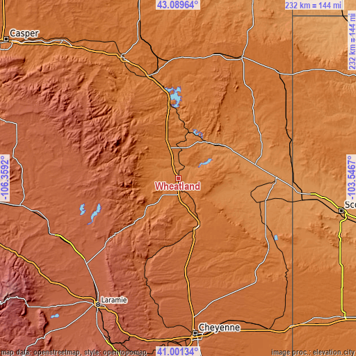
| \ | Map #1 | Map #2 | Topo.Map |
| Scale [m] | 1402..1495 m | 1362..1525 m | × |
| Scale [ft] | 4600..4905 ft | 4469..5003 ft | × |
| Average | 1450.9 m = 4760 ft | 1442 m = 4731 ft | × |
| Width | 7.26 km = 4.5 mi | 14.51 km = 9 mi | 232.2 km = 144.3 mi |
| Height | 7.26 km = 4.5 mi | 14.51 km = 9 mi | 232.2 km = 144.3 mi |
| ↑Max Latitude | 42.086692° | 42.119296° | 43.08964° |
| Latitude at center | 42.05407° | 42.05407° | 42.05407° |
| ↓Min Latitude | 42.021432° | 41.988777° | 41.00134° |
| ← Min Longitude | -104.996895° | -105.040841° | -106.3592° |
| Longitude center | -104.95295° | -104.95295° | -104.95295° |
| →Max Longitude | -104.909005° | -104.865059° | -103.5467° |
Nearby cities:
Cities around Wheatland sort by population:
• Cheyenne elevation 1866 m
102.2 km,  173°
173°
• Laramie 2190 m
98.1 km,  212°
212°
• Scottsbluff 1187 m
108.3 km,  101°
101°
• Torrington 1251 m
63.5 km,  89°
89°
• Douglas 1474 m
86 km,  335°
335°
• Ranchettes 1888 m
93.9 km, 171°
• South Greeley 1845 m
107.1 km, 173°
• Fox Farm-College 1828 m
105.7 km, 172°
• Mitchell 1203 m
95.4 km, 97°
• Lusk 1533 m
88.9 km,  27°
27°
• Guernsey 1326 m
29.6 km,  35°
35°
• Terrytown 1183 m
109.2 km, 102°
Multilingual:
 En español:
Wheatland elevación 1449 m.
 En France:
Wheatland élévation 1449 m.
 Auf Deutsch:
Wheatland höhe über dem Meeresspiegel ist 1449 m.

Sources and notes:
- [note 1] Map square and city borders are not equal. Map elevation data is calculated only from area inside that square.
- [src 1] Elevation data from geonames database provided with same terms of usage.
- [src 2] The elevation map of Wheatland is generated using elevation data from NASA's 3 arcsec (90m) resolution SRTM data.
- [src 3] Base (background) map © OpenStreetMap contributors tiles are generated by Geofabrik and OpenTopoMap.
Copyright & License:
This Wheatland Elevation Map is licensed under CC BY-SA. You may reuse any part from this page, if you give a proper credit by linking to this URL:
 More info on terms of use page.