West Valley elevation
West Valley (Washington, Yakima County), United States elevation is 360 meters and West Valley elevation in feet is 1181 ft above sea level [src 1]. West Valley is a populated place (feature code) with elevation that is 81 meters (266 ft) bigger than average city elevation in United States.
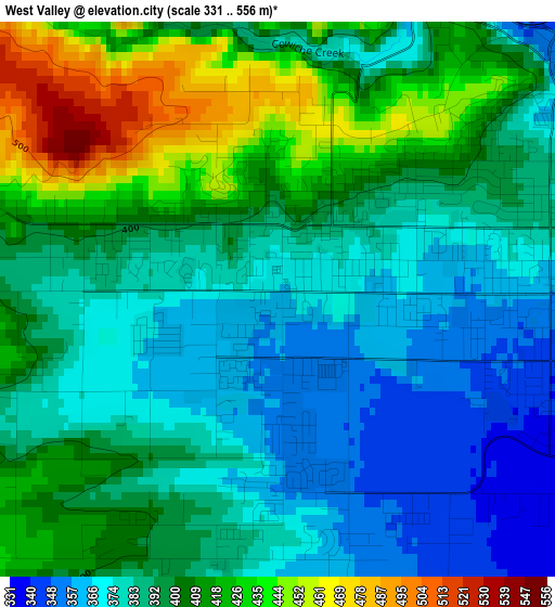
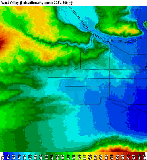
Below is the Elevation map of West Valley, which displays elevation range with different colors. Scale of the first map is from 331 to 556 m (1086 to 1824 ft) with average elevation of 394.9 meters (=1296 ft) [note 1]
These maps also provides idea of topography and contour of this city, they are displayed at different zoom levels. More info about maps, scale and edge coordinates you can find below images.
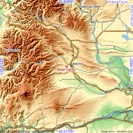
| \ | Map #1 | Map #2 | Topo.Map |
| Scale [m] | 331..556 m | 308..660 m | × |
| Scale [ft] | 1086..1824 ft | 1010..2165 ft | × |
| Average | 394.9 m = 1296 ft | 407.8 m = 1338 ft | × |
| Width | 6.72 km = 4.2 mi | 13.43 km = 8.3 mi | 214.9 km = 133.5 mi |
| Height | 6.72 km = 4.2 mi | 13.43 km = 8.3 mi | 214.9 km = 133.5 mi |
| ↑Max Latitude | 46.62226° | 46.652434° | 47.54982° |
| Latitude at center | 46.59207° | 46.59207° | 46.59207° |
| ↓Min Latitude | 46.561863° | 46.531639° | 45.61709° |
| ← Min Longitude | -120.649015° | -120.692961° | -122.01132° |
| Longitude center | -120.60507° | -120.60507° | -120.60507° |
| →Max Longitude | -120.561125° | -120.517179° | -119.19882° |
Nearby cities:
Cities around West Valley sort by population:
• Yakima elevation 325 m
7.7 km,  81°
81°
• Ellensburg 468 m
45.2 km,  5°
5°
• Toppenish 232 m
32.9 km,  136°
136°
• Selah 341 m
9 km,  39°
39°
• Terrace Heights 357 m
12.7 km, 82°
• Union Gap 297 m
10.7 km,  111°
111°
• Wapato 261 m
21.4 km, 138°
• Granger 222 m
42.4 km,  130°
130°
• Ahtanum 378 m
3.8 km,  199°
199°
• Zillah 246 m
33.7 km, 128°
• Gleed 379 m
7.4 km,  355°
355°
• Tieton 583 m
16.8 km,  316°
316°
Multilingual:
 En español:
West Valley elevación 360 m.
 En France:
West Valley élévation 360 m.
 Auf Deutsch:
West Valley höhe über dem Meeresspiegel ist 360 m.

Sources and notes:
- [note 1] Map square and city borders are not equal. Map elevation data is calculated only from area inside that square.
- [src 1] Elevation data from geonames database provided with same terms of usage.
- [src 2] The elevation map of West Valley is generated using elevation data from NASA's 3 arcsec (90m) resolution SRTM data.
- [src 3] Base (background) map © OpenStreetMap contributors tiles are generated by Geofabrik and OpenTopoMap.
Copyright & License:
This West Valley Elevation Map is licensed under CC BY-SA. You may reuse any part from this page, if you give a proper credit by linking to this URL:
 More info on terms of use page.