Mercer Island elevation
Mercer Island (Washington, King County), United States elevation is 103 meters and Mercer Island elevation in feet is 338 ft above sea level [src 1]. Mercer Island is a populated place (feature code) with elevation that is 176 meters (577 ft) smaller than average city elevation in United States.
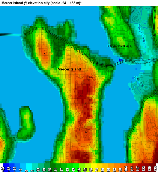
Below is the Elevation map of Mercer Island, which displays elevation range with different colors. Scale of the first map is from -24 to 135 m (-79 to 443 ft) with average elevation of 31.3 meters (=103 ft) [note 1]
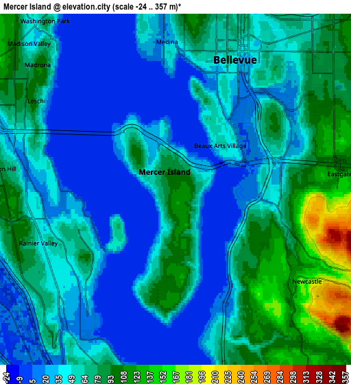
These maps also provides idea of topography and contour of this city, they are displayed at different zoom levels. More info about maps, scale and edge coordinates you can find below images.
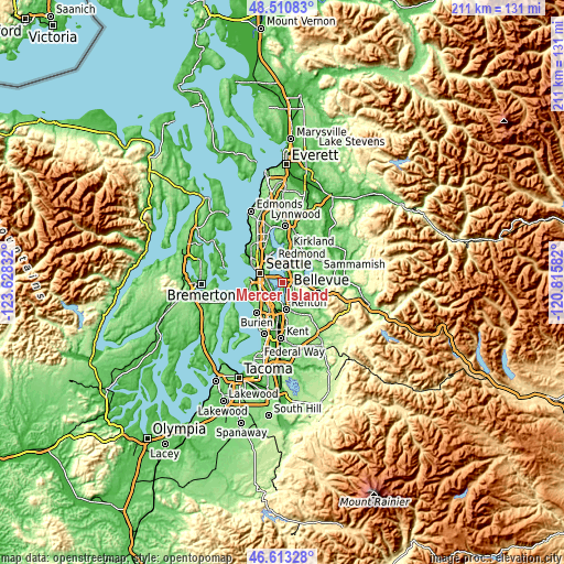
| \ | Map #1 | Map #2 | Topo.Map |
| Scale [m] | -24..135 m | -24..357 m | × |
| Scale [ft] | -79..443 ft | -79..1171 ft | × |
| Average | 31.3 m = 103 ft | 55.9 m = 183 ft | × |
| Width | 6.59 km = 4.1 mi | 13.19 km = 8.2 mi | 211 km = 131.1 mi |
| Height | 6.59 km = 4.1 mi | 13.19 km = 8.2 mi | 211 km = 131.1 mi |
| ↑Max Latitude | 47.600291° | 47.629915° | 48.51083° |
| Latitude at center | 47.57065° | 47.57065° | 47.57065° |
| ↓Min Latitude | 47.540993° | 47.511318° | 46.61328° |
| ← Min Longitude | -122.266015° | -122.309961° | -123.62832° |
| Longitude center | -122.22207° | -122.22207° | -122.22207° |
| →Max Longitude | -122.178125° | -122.134179° | -120.81582° |
Nearby cities:
Cities around Mercer Island sort by population:
• Seattle elevation 56 m
9.1 km,  295°
295°
• Bellevue 28 m
4.7 km,  19°
19°
• Renton 13 m
9.8 km,  177°
177°
• West Lake Sammamish 5 m
9.1 km,  85°
85°
• Bryn Mawr-Skyway 120 m
8.6 km,  189°
189°
• Newcastle 170 m
6.1 km,  125°
125°
• Riverton 105 m
11 km,  209°
209°
• Eastgate 113 m
5.7 km, 87°
• Clyde Hill 99 m
6.8 km,  2°
2°
• Medina 23 m
5.6 km,  355°
355°
• Newport 27 m
3.1 km, 88°
• Yarrow Point 46 m
8.4 km, 2°
Multilingual:
 En español:
Mercer Island elevación 103 m.
 En France:
Mercer Island élévation 103 m.
 Auf Deutsch:
Mercer Island höhe über dem Meeresspiegel ist 103 m.

Sources and notes:
- [note 1] Map square and city borders are not equal. Map elevation data is calculated only from area inside that square.
- [src 1] Elevation data from geonames database provided with same terms of usage.
- [src 2] The elevation map of Mercer Island is generated using elevation data from NASA's 3 arcsec (90m) resolution SRTM data.
- [src 3] Base (background) map © OpenStreetMap contributors tiles are generated by Geofabrik and OpenTopoMap.
Copyright & License:
This Mercer Island Elevation Map is licensed under CC BY-SA. You may reuse any part from this page, if you give a proper credit by linking to this URL:
 More info on terms of use page.