Medina elevation
Medina (Washington, King County), United States elevation is 23 meters and Medina elevation in feet is 75 ft above sea level [src 1]. Medina is a populated place (feature code) with elevation that is 256 meters (840 ft) smaller than average city elevation in United States.
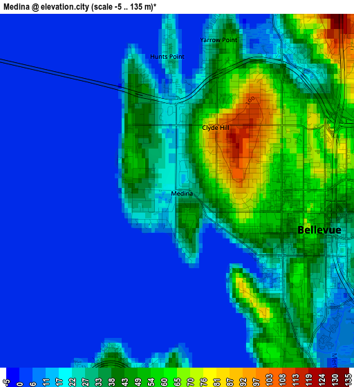
Below is the Elevation map of Medina, which displays elevation range with different colors. Scale of the first map is from -5 to 135 m (-16 to 443 ft) with average elevation of 24.4 meters (=80 ft) [note 1]
These maps also provides idea of topography and contour of this city, they are displayed at different zoom levels. More info about maps, scale and edge coordinates you can find below images.
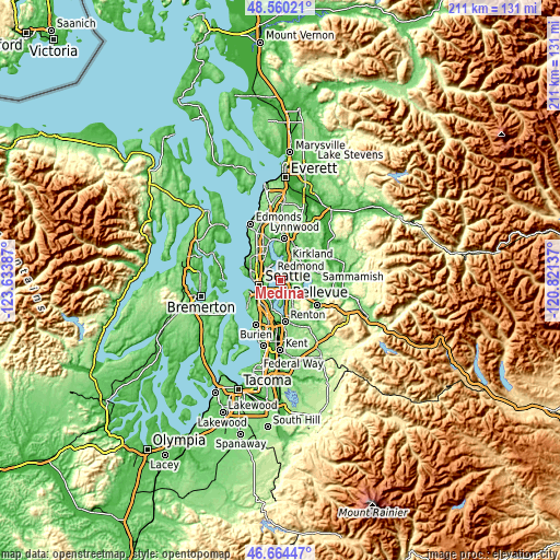
| \ | Map #1 | Topo.Map |
| Scale [m] | -5..135 m | × |
| Scale [ft] | -16..443 ft | × |
| Average | 24.4 m = 80 ft | × |
| Width | 6.59 km = 4.1 mi | 210.8 km = 131 mi |
| Height | 6.59 km = 4.1 mi | 210.8 km = 131 mi |
| ↑Max Latitude | 47.650542° | 48.56021° |
| Latitude at center | 47.62093° | 47.62093° |
| ↓Min Latitude | 47.591301° | 46.66447° |
| ← Min Longitude | -122.271565° | -123.63387° |
| Longitude center | -122.22762° | -122.22762° |
| →Max Longitude | -122.183675° | -120.82137° |
Nearby cities:
Cities around Medina sort by population:
• Seattle elevation 56 m
8 km,  258°
258°
• Bellevue 28 m
2.3 km,  120°
120°
• Kirkland 52 m
6.9 km,  11°
11°
• Redmond 15 m
9.9 km,  53°
53°
• West Lake Sammamish 5 m
10.6 km, 116°
• Mercer Island 103 m
5.6 km,  175°
175°
• Inglewood-Finn Hill 117 m
11.1 km,  358°
358°
• Newcastle 170 m
10.6 km,  149°
149°
• Eastgate 113 m
8.2 km,  131°
131°
• Clyde Hill 99 m
1.4 km,  31°
31°
• Newport 27 m
6.6 km, 147°
• Yarrow Point 46 m
2.9 km,  15°
15°
Multilingual:
 En español:
Medina elevación 23 m.
 En France:
Medina élévation 23 m.


Sources and notes:
- [note 1] Map square and city borders are not equal. Map elevation data is calculated only from area inside that square.
- [src 1] Elevation data from geonames database provided with same terms of usage.
- [src 2] The elevation map of Medina is generated using elevation data from NASA's 3 arcsec (90m) resolution SRTM data.
- [src 3] Base (background) map © OpenStreetMap contributors tiles are generated by Geofabrik and OpenTopoMap.
Copyright & License:
This Medina Elevation Map is licensed under CC BY-SA. You may reuse any part from this page, if you give a proper credit by linking to this URL:
 More info on terms of use page.