Mattawa elevation
Mattawa (Washington, Grant County), United States elevation is 231 meters and Mattawa elevation in feet is 758 ft above sea level [src 1]. Mattawa is a populated place (feature code) with elevation that is 48 meters (157 ft) smaller than average city elevation in United States.
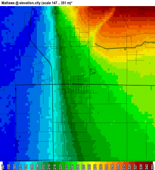
Below is the Elevation map of Mattawa, which displays elevation range with different colors. Scale of the first map is from 147 to 351 m (482 to 1152 ft) with average elevation of 218.9 meters (=718 ft) [note 1]
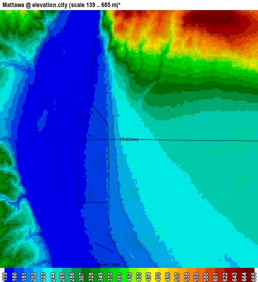
These maps also provides idea of topography and contour of this city, they are displayed at different zoom levels. More info about maps, scale and edge coordinates you can find below images.
| \ | Map #1 | Map #2 | Topo.Map |
| Scale [m] | 147..351 m | 139..685 m | × |
| Scale [ft] | 482..1152 ft | 456..2247 ft | × |
| Average | 218.9 m = 718 ft | 256.8 m = 843 ft | × |
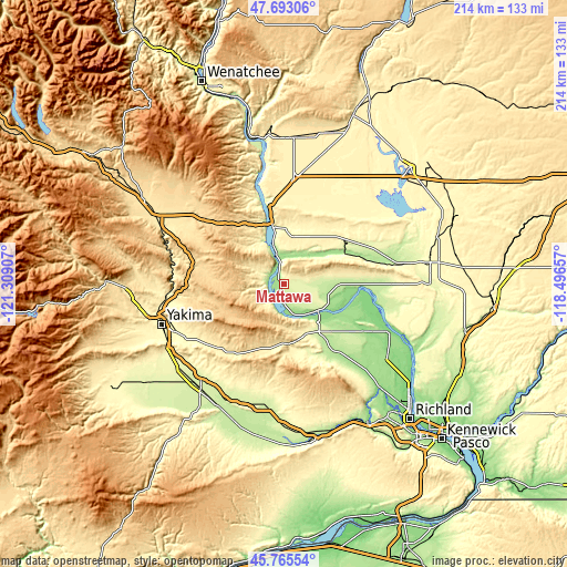
| Width | 6.7 km = 4.2 mi | 13.39 km = 8.3 mi | 214.3 km = 133.2 mi |
| Height | 6.7 km = 4.2 mi | 13.39 km = 8.3 mi | 214.3 km = 133.2 mi |
| ↑Max Latitude | 46.768019° | 46.798111° | 47.69306° |
| Latitude at center | 46.73791° | 46.73791° | 46.73791° |
| ↓Min Latitude | 46.707784° | 46.677642° | 45.76554° |
| ← Min Longitude | -119.946765° | -119.990711° | -121.30907° |
| Longitude center | -119.90282° | -119.90282° | -119.90282° |
| →Max Longitude | -119.858875° | -119.814929° | -118.49657° |
Nearby cities:
Cities around Mattawa sort by population:
• Yakima elevation 325 m
48.4 km,  251°
251°
• Sunnyside 227 m
46.8 km,  189°
189°
• Toppenish 232 m
50.7 km,  217°
217°
• Selah 341 m
48.7 km,  258°
258°
• Terrace Heights 357 m
43.5 km, 250°
• Union Gap 297 m
48.1 km, 245°
• Wapato 261 m
51 km,  230°
230°
• Granger 222 m
49.1 km,  206°
206°
• Zillah 246 m
46.3 km, 216°
• Royal City 323 m
27.5 km,  48°
48°
• Desert Aire 170 m
6.6 km, 189°
• Kittitas 502 m
47.7 km,  304°
304°
Multilingual:
 En español:
Mattawa elevación 231 m.
 En France:
Mattawa élévation 231 m.


Sources and notes:
- [note 1] Map square and city borders are not equal. Map elevation data is calculated only from area inside that square.
- [src 1] Elevation data from geonames database provided with same terms of usage.
- [src 2] The elevation map of Mattawa is generated using elevation data from NASA's 3 arcsec (90m) resolution SRTM data.
- [src 3] Base (background) map © OpenStreetMap contributors tiles are generated by Geofabrik and OpenTopoMap.
Copyright & License:
This Mattawa Elevation Map is licensed under CC BY-SA. You may reuse any part from this page, if you give a proper credit by linking to this URL:
 More info on terms of use page.