Maple Valley elevation
Maple Valley (Washington, King County), United States elevation is 126 meters and Maple Valley elevation in feet is 413 ft above sea level [src 1]. Maple Valley is a populated place (feature code) with elevation that is 153 meters (502 ft) smaller than average city elevation in United States.
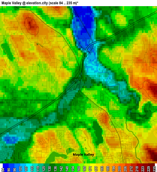
Below is the Elevation map of Maple Valley, which displays elevation range with different colors. Scale of the first map is from 84 to 235 m (276 to 771 ft) with average elevation of 157.8 meters (=518 ft) [note 1]
These maps also provides idea of topography and contour of this city, they are displayed at different zoom levels. More info about maps, scale and edge coordinates you can find below images.
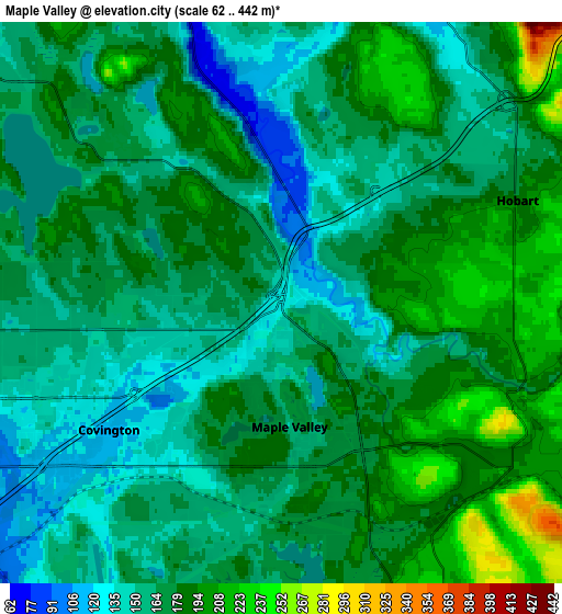
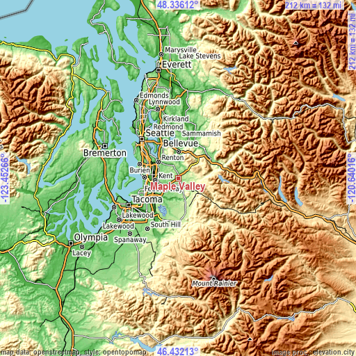
| \ | Map #1 | Map #2 | Topo.Map |
| Scale [m] | 84..235 m | 62..442 m | × |
| Scale [ft] | 276..771 ft | 203..1450 ft | × |
| Average | 157.8 m = 518 ft | 170.8 m = 560 ft | × |
| Width | 6.62 km = 4.1 mi | 13.23 km = 8.2 mi | 211.7 km = 131.5 mi |
| Height | 6.62 km = 4.1 mi | 13.23 km = 8.2 mi | 211.7 km = 131.5 mi |
| ↑Max Latitude | 47.422461° | 47.452186° | 48.33612° |
| Latitude at center | 47.39272° | 47.39272° | 47.39272° |
| ↓Min Latitude | 47.362962° | 47.333187° | 46.43213° |
| ← Min Longitude | -122.090355° | -122.134301° | -123.45266° |
| Longitude center | -122.04641° | -122.04641° | -122.04641° |
| →Max Longitude | -122.002465° | -121.958519° | -120.64016° |
Nearby cities:
Cities around Maple Valley sort by population:
• Kent elevation 14 m
14.2 km,  264°
264°
• East Hill-Meridian 156 m
9.8 km,  281°
281°
• Covington 111 m
6.9 km,  236°
236°
• Fairwood 161 m
10.4 km,  306°
306°
• Lea Hill 128 m
12.6 km,  233°
233°
• East Renton Highlands 165 m
11.4 km,  334°
334°
• Lake Morton-Berrydale 141 m
7.9 km,  212°
212°
• Hobart 176 m
6.4 km,  59°
59°
• Black Diamond 206 m
9.9 km,  160°
160°
• Mirrormont 249 m
8.6 km,  26°
26°
• Maple Heights-Lake Desire 236 m
6.9 km, 326°
• Ravensdale 190 m
6.5 km,  133°
133°
Multilingual:
 En español:
Maple Valley elevación 126 m.
 En France:
Maple Valley élévation 126 m.
 Auf Deutsch:
Maple Valley höhe über dem Meeresspiegel ist 126 m.

Sources and notes:
- [note 1] Map square and city borders are not equal. Map elevation data is calculated only from area inside that square.
- [src 1] Elevation data from geonames database provided with same terms of usage.
- [src 2] The elevation map of Maple Valley is generated using elevation data from NASA's 3 arcsec (90m) resolution SRTM data.
- [src 3] Base (background) map © OpenStreetMap contributors tiles are generated by Geofabrik and OpenTopoMap.
Copyright & License:
This Maple Valley Elevation Map is licensed under CC BY-SA. You may reuse any part from this page, if you give a proper credit by linking to this URL:
 More info on terms of use page.