Mission elevation
Mission (South Dakota, Todd County), United States elevation is 788 meters and Mission elevation in feet is 2585 ft above sea level [src 1]. Mission is a populated place (feature code) with elevation that is 509 meters (1670 ft) bigger than average city elevation in United States.
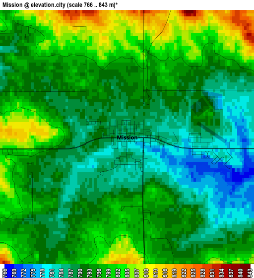
Below is the Elevation map of Mission, which displays elevation range with different colors. Scale of the first map is from 766 to 843 m (2513 to 2766 ft) with average elevation of 793.7 meters (=2604 ft) [note 1]
These maps also provides idea of topography and contour of this city, they are displayed at different zoom levels. More info about maps, scale and edge coordinates you can find below images.
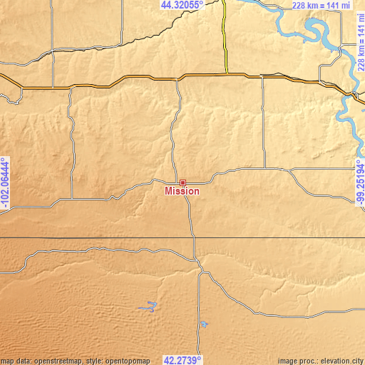
| \ | Map #1 | Topo.Map |
| Scale [m] | 766..843 m | × |
| Scale [ft] | 2513..2766 ft | × |
| Average | 793.7 m = 2604 ft | × |
| Width | 7.11 km = 4.4 mi | 227.6 km = 141.4 mi |
| Height | 7.11 km = 4.4 mi | 227.6 km = 141.4 mi |
| ↑Max Latitude | 43.337811° | 44.32055° |
| Latitude at center | 43.30584° | 43.30584° |
| ↓Min Latitude | 43.273852° | 42.2739° |
| ← Min Longitude | -100.702135° | -102.06444° |
| Longitude center | -100.65819° | -100.65819° |
| →Max Longitude | -100.614245° | -99.25194° |
Nearby cities:
Cities around Mission sort by population:
• Valentine elevation 788 m
48.9 km,  169°
169°
• Winner 599 m
65.1 km,  83°
83°
• Ainsworth 771 m
106.1 km,  142°
142°
• Rosebud 804 m
17.8 km,  242°
242°
• Gregory 660 m
99.7 km,  94°
94°
• Martin 1008 m
88.3 km,  260°
260°
• Kadoka 751 m
90.3 km,  310°
310°
• Burke 668 m
111.5 km,  97°
97°
• White River 651 m
30 km,  346°
346°
• Murdo 704 m
64.9 km,  356°
356°
• Kennebec 514 m
92.4 km,  43°
43°
• Springview 747 m
91.2 km,  125°
125°
Multilingual:
 En español:
Mission elevación 788 m.
 En France:
Mission élévation 788 m.


Sources and notes:
- [note 1] Map square and city borders are not equal. Map elevation data is calculated only from area inside that square.
- [src 1] Elevation data from geonames database provided with same terms of usage.
- [src 2] The elevation map of Mission is generated using elevation data from NASA's 3 arcsec (90m) resolution SRTM data.
- [src 3] Base (background) map © OpenStreetMap contributors tiles are generated by Geofabrik and OpenTopoMap.
Copyright & License:
This Mission Elevation Map is licensed under CC BY-SA. You may reuse any part from this page, if you give a proper credit by linking to this URL:
 More info on terms of use page.