Astoria elevation
Astoria (Oregon, Clatsop County), United States elevation is 10 meters and Astoria elevation in feet is 33 ft above sea level [src 1]. Astoria is a seat of a second-order administrative division (feature code) with elevation that is 269 meters (883 ft) smaller than average city elevation in United States.
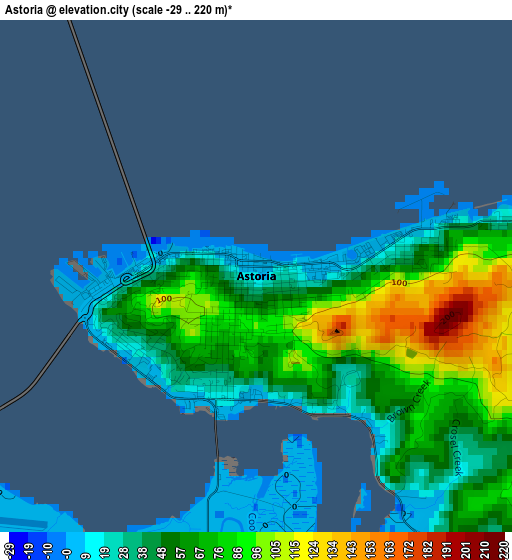
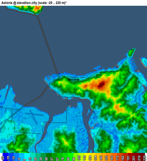
Below is the Elevation map of Astoria, which displays elevation range with different colors. Scale of the first map is from -29 to 220 m (-95 to 722 ft) with average elevation of 57 meters (=187 ft) [note 1]
These maps also provides idea of topography and contour of this city, they are displayed at different zoom levels. More info about maps, scale and edge coordinates you can find below images.
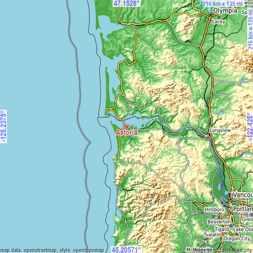
| \ | Map #1 | Map #2 | Topo.Map |
| Scale [m] | -29..220 m | -29..220 m | × |
| Scale [ft] | -95..722 ft | -95..722 ft | × |
| Average | 57 m = 187 ft | 37.7 m = 124 ft | × |
| Width | 6.77 km = 4.2 mi | 13.53 km = 8.4 mi | 216.5 km = 134.5 mi |
| Height | 6.77 km = 4.2 mi | 13.53 km = 8.4 mi | 216.5 km = 134.5 mi |
| ↑Max Latitude | 46.218295° | 46.248693° | 47.1528° |
| Latitude at center | 46.18788° | 46.18788° | 46.18788° |
| ↓Min Latitude | 46.157448° | 46.127° | 45.20571° |
| ← Min Longitude | -123.875195° | -123.919141° | -125.2375° |
| Longitude center | -123.83125° | -123.83125° | -123.83125° |
| →Max Longitude | -123.787305° | -123.743359° | -122.425° |
Nearby cities:
Cities around Astoria sort by population:
• Seaside elevation 5 m
22.8 km,  198°
198°
• Warrenton 2 m
7.6 km,  250°
250°
• Raymond 5 m
55.9 km,  7°
7°
• West Longview 2 m
64.1 km,  91°
91°
• Vernonia 188 m
61.4 km,  126°
126°
• Clatskanie 32 m
49.1 km,  101°
101°
• Cannon Beach 12 m
34.4 km, 196°
• South Bend 20 m
52.9 km,  2°
2°
• Ocean Park 9 m
37.8 km,  333°
333°
• Gearhart 6 m
19.2 km, 198°
• Long Beach 6 m
25.1 km,  316°
316°
• Cathlamet 26 m
34.5 km, 87°
Multilingual:
 En español:
Astoria elevación 10 m.
 En France:
Astoria élévation 10 m.


Sources and notes:
- [note 1] Map square and city borders are not equal. Map elevation data is calculated only from area inside that square.
- [src 1] Elevation data from geonames database provided with same terms of usage.
- [src 2] The elevation map of Astoria is generated using elevation data from NASA's 3 arcsec (90m) resolution SRTM data.
- [src 3] Base (background) map © OpenStreetMap contributors tiles are generated by Geofabrik and OpenTopoMap.
Copyright & License:
This Astoria Elevation Map is licensed under CC BY-SA. You may reuse any part from this page, if you give a proper credit by linking to this URL:
 More info on terms of use page.