Hettinger elevation
Hettinger (North Dakota, Adams County), United States elevation is 823 meters and Hettinger elevation in feet is 2700 ft above sea level [src 1]. Hettinger is a seat of a second-order administrative division (feature code) with elevation that is 544 meters (1785 ft) bigger than average city elevation in United States.
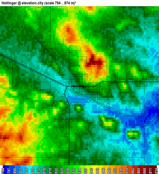
Below is the Elevation map of Hettinger, which displays elevation range with different colors. Scale of the first map is from 794 to 874 m (2605 to 2867 ft) with average elevation of 823.1 meters (=2700 ft) [note 1]
These maps also provides idea of topography and contour of this city, they are displayed at different zoom levels. More info about maps, scale and edge coordinates you can find below images.
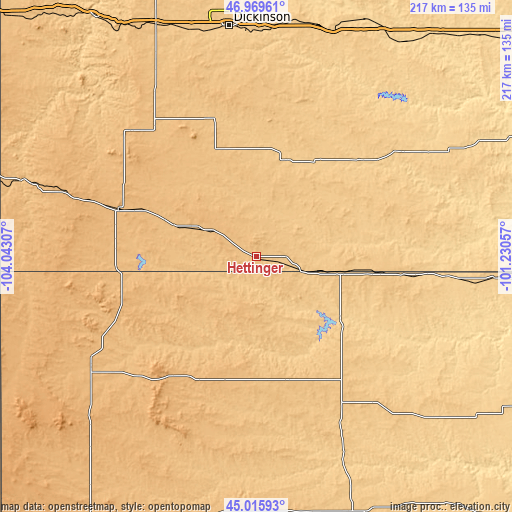
| \ | Map #1 | Topo.Map |
| Scale [m] | 794..874 m | × |
| Scale [ft] | 2605..2867 ft | × |
| Average | 823.1 m = 2700 ft | × |
| Width | 6.79 km = 4.2 mi | 217.2 km = 135 mi |
| Height | 6.79 km = 4.2 mi | 217.2 km = 135 mi |
| ↑Max Latitude | 46.031908° | 46.96961° |
| Latitude at center | 46.00139° | 46.00139° |
| ↓Min Latitude | 45.970855° | 45.01593° |
| ← Min Longitude | -102.680765° | -104.04307° |
| Longitude center | -102.63682° | -102.63682° |
| →Max Longitude | -102.592875° | -101.23057° |
Nearby cities:
Cities around Hettinger sort by population:
• Dickinson elevation 733 m
98.3 km,  353°
353°
• Baker 888 m
133.2 km,  287°
287°
• Bowman 903 m
61.8 km, 289°
• Lemmon 783 m
37.5 km,  100°
100°
• Belfield 787 m
107.3 km,  336°
336°
• Mott 726 m
47.7 km,  30°
30°
• Buffalo 878 m
84.4 km,  236°
236°
• Bison 847 m
55.2 km,  165°
165°
• Carson 701 m
94.6 km,  60°
60°
• McIntosh 705 m
99.9 km, 95°
• Medora 691 m
122.1 km,  326°
326°
• Amidon 885 m
75.1 km,  315°
315°
Multilingual:
 En español:
Hettinger elevación 823 m.
 En France:
Hettinger élévation 823 m.
 Auf Deutsch:
Hettinger höhe über dem Meeresspiegel ist 823 m.

Sources and notes:
- [note 1] Map square and city borders are not equal. Map elevation data is calculated only from area inside that square.
- [src 1] Elevation data from geonames database provided with same terms of usage.
- [src 2] The elevation map of Hettinger is generated using elevation data from NASA's 3 arcsec (90m) resolution SRTM data.
- [src 3] Base (background) map © OpenStreetMap contributors tiles are generated by Geofabrik and OpenTopoMap.
Copyright & License:
This Hettinger Elevation Map is licensed under CC BY-SA. You may reuse any part from this page, if you give a proper credit by linking to this URL:
 More info on terms of use page.