Richfield elevation
Richfield (Utah, Sevier County), United States elevation is 1636 meters and Richfield elevation in feet is 5367 ft above sea level [src 1]. Richfield is a seat of a second-order administrative division (feature code) with elevation that is 1357 meters (4452 ft) bigger than average city elevation in United States.
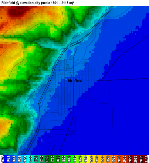
Below is the Elevation map of Richfield, which displays elevation range with different colors. Scale of the first map is from 1601 to 2118 m (5253 to 6949 ft) with average elevation of 1697.3 meters (=5569 ft) [note 1]
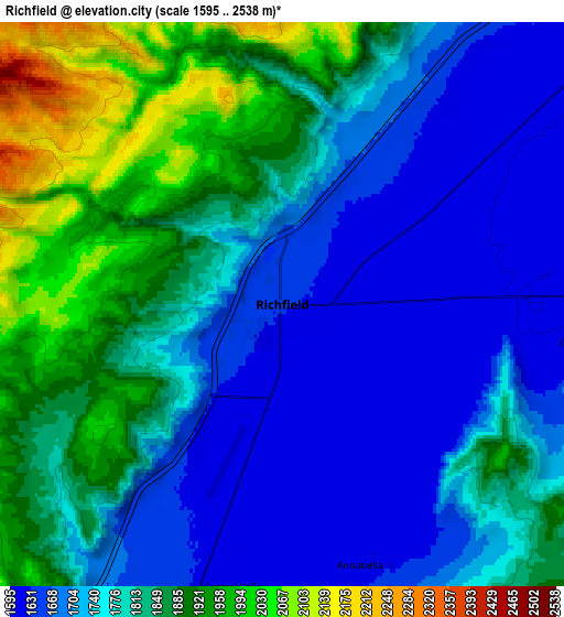
These maps also provides idea of topography and contour of this city, they are displayed at different zoom levels. More info about maps, scale and edge coordinates you can find below images.
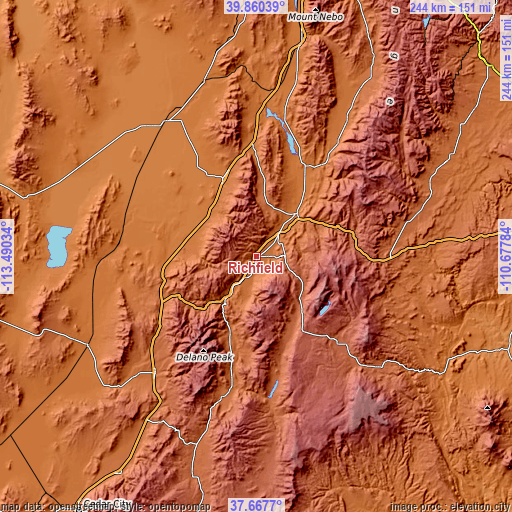
| \ | Map #1 | Map #2 | Topo.Map |
| Scale [m] | 1601..2118 m | 1595..2538 m | × |
| Scale [ft] | 5253..6949 ft | 5233..8327 ft | × |
| Average | 1697.3 m = 5569 ft | 1785.4 m = 5858 ft | × |
| Width | 7.62 km = 4.7 mi | 15.24 km = 9.5 mi | 243.8 km = 151.5 mi |
| Height | 7.62 km = 4.7 mi | 15.24 km = 9.5 mi | 243.8 km = 151.5 mi |
| ↑Max Latitude | 38.806723° | 38.84096° | 39.86039° |
| Latitude at center | 38.77247° | 38.77247° | 38.77247° |
| ↓Min Latitude | 38.7382° | 38.703914° | 37.6677° |
| ← Min Longitude | -112.128035° | -112.171981° | -113.49034° |
| Longitude center | -112.08409° | -112.08409° | -112.08409° |
| →Max Longitude | -112.040145° | -111.996199° | -110.67784° |
Nearby cities:
Cities around Richfield sort by population:
• Ephraim elevation 1693 m
78.2 km,  33°
33°
• Delta 1419 m
77.2 km,  326°
326°
• Manti 1714 m
67.3 km,  35°
35°
• Gunnison 1567 m
48.4 km, 28°
• Beaver 1803 m
73.4 km,  221°
221°
• Salina 1576 m
28.3 km, 43°
• Fillmore 1566 m
30.1 km,  316°
316°
• Monroe 1647 m
16.2 km,  191°
191°
• Centerfield 1555 m
45.4 km, 30°
• Aurora 1586 m
21.1 km, 37°
• Loa 2158 m
56.2 km,  136°
136°
• Junction 1834 m
60.6 km, 191°
Multilingual:
 En español:
Richfield elevación 1636 m.
 En France:
Richfield élévation 1636 m.
 Auf Deutsch:
Richfield höhe über dem Meeresspiegel ist 1636 m.

Sources and notes:
- [note 1] Map square and city borders are not equal. Map elevation data is calculated only from area inside that square.
- [src 1] Elevation data from geonames database provided with same terms of usage.
- [src 2] The elevation map of Richfield is generated using elevation data from NASA's 3 arcsec (90m) resolution SRTM data.
- [src 3] Base (background) map © OpenStreetMap contributors tiles are generated by Geofabrik and OpenTopoMap.
Copyright & License:
This Richfield Elevation Map is licensed under CC BY-SA. You may reuse any part from this page, if you give a proper credit by linking to this URL:
 More info on terms of use page.