Littlefield elevation
Littlefield (Texas, Lamb County), United States elevation is 1083 meters and Littlefield elevation in feet is 3553 ft above sea level [src 1]. Littlefield is a seat of a second-order administrative division (feature code) with elevation that is 804 meters (2638 ft) bigger than average city elevation in United States.
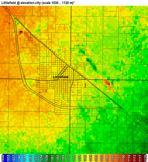
Below is the Elevation map of Littlefield, which displays elevation range with different colors. Scale of the first map is from 1030 to 1120 m (3379 to 3675 ft) with average elevation of 1081 meters (=3547 ft) [note 1]
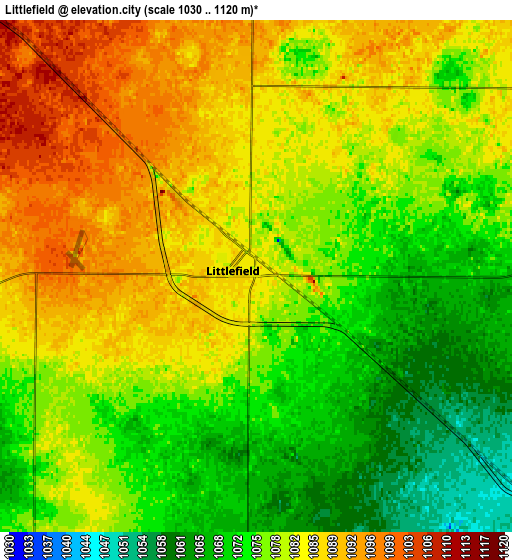
These maps also provides idea of topography and contour of this city, they are displayed at different zoom levels. More info about maps, scale and edge coordinates you can find below images.
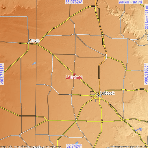
| \ | Map #1 | Map #2 | Topo.Map |
| Scale [m] | 1030..1120 m | 1030..1120 m | × |
| Scale [ft] | 3379..3675 ft | 3379..3675 ft | × |
| Average | 1081 m = 3547 ft | 1079.3 m = 3541 ft | × |
| Width | 8.11 km = 5 mi | 16.22 km = 10.1 mi | 259.5 km = 161.2 mi |
| Height | 8.11 km = 5 mi | 16.22 km = 10.1 mi | 259.5 km = 161.2 mi |
| ↑Max Latitude | 33.95377° | 33.990214° | 35.07624° |
| Latitude at center | 33.91731° | 33.91731° | 33.91731° |
| ↓Min Latitude | 33.880834° | 33.844343° | 32.7424° |
| ← Min Longitude | -102.368845° | -102.412791° | -103.73115° |
| Longitude center | -102.3249° | -102.3249° | -102.3249° |
| →Max Longitude | -102.280955° | -102.237009° | -100.91865° |
Nearby cities:
Cities around Littlefield sort by population:
• Levelland elevation 1072 m
37 km,  187°
187°
• Muleshoe 1161 m
50.3 km,  313°
313°
• Wolfforth 1012 m
54.3 km,  147°
147°
• Abernathy 1026 m
45.5 km,  101°
101°
• Shallowater 1006 m
39.4 km,  130°
130°
• Olton 1103 m
34.4 km,  30°
30°
• Hale Center 1041 m
47.3 km,  69°
69°
• Morton 1148 m
45.5 km,  241°
241°
• Sundown 1080 m
53.5 km,  196°
196°
• Anton 1029 m
19 km, 128°
• Hart 1117 m
55.5 km,  20°
20°
• Earth 1129 m
36 km,  347°
347°
Multilingual:
 En español:
Littlefield elevación 1083 m.
 En France:
Littlefield élévation 1083 m.
 Auf Deutsch:
Littlefield höhe über dem Meeresspiegel ist 1083 m.

Sources and notes:
- [note 1] Map square and city borders are not equal. Map elevation data is calculated only from area inside that square.
- [src 1] Elevation data from geonames database provided with same terms of usage.
- [src 2] The elevation map of Littlefield is generated using elevation data from NASA's 3 arcsec (90m) resolution SRTM data.
- [src 3] Base (background) map © OpenStreetMap contributors tiles are generated by Geofabrik and OpenTopoMap.
Copyright & License:
This Littlefield Elevation Map is licensed under CC BY-SA. You may reuse any part from this page, if you give a proper credit by linking to this URL:
 More info on terms of use page.