Fountain elevation
Fountain (Colorado, El Paso County), United States elevation is 1694 meters and Fountain elevation in feet is 5558 ft above sea level [src 1]. Fountain is a populated place (feature code) with elevation that is 1415 meters (4642 ft) bigger than average city elevation in United States.
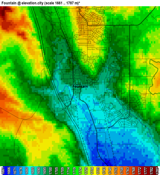
Below is the Elevation map of Fountain, which displays elevation range with different colors. Scale of the first map is from 1661 to 1787 m (5449 to 5863 ft) with average elevation of 1712.5 meters (=5618 ft) [note 1]
These maps also provides idea of topography and contour of this city, they are displayed at different zoom levels. More info about maps, scale and edge coordinates you can find below images.
| \ | Map #1 | Map #2 | Topo.Map |
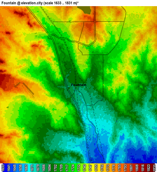
| Scale [m] | 1661..1787 m | 1633..1831 m | × |
| Scale [ft] | 5449..5863 ft | 5358..6007 ft | × |
| Average | 1712.5 m = 5618 ft | 1723.2 m = 5654 ft | × |
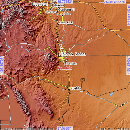
| Width | 7.63 km = 4.7 mi | 15.26 km = 9.5 mi | 244.1 km = 151.7 mi |
| Height | 7.63 km = 4.7 mi | 15.26 km = 9.5 mi | 244.1 km = 151.7 mi |
| ↑Max Latitude | 38.716517° | 38.750797° | 39.77153° |
| Latitude at center | 38.68222° | 38.68222° | 38.68222° |
| ↓Min Latitude | 38.647907° | 38.613578° | 37.57607° |
| ← Min Longitude | -104.744755° | -104.788701° | -106.10706° |
| Longitude center | -104.70081° | -104.70081° | -104.70081° |
| →Max Longitude | -104.656865° | -104.612919° | -103.29456° |
Nearby cities:
Cities around Fountain sort by population:
• Colorado Springs elevation 1838 m
19.8 km,  328°
328°
• Security-Widefield 1783 m
7.3 km,  350°
350°
• Pueblo West 1548 m
37 km,  182°
182°
• Cimarron Hills 1965 m
19.6 km,  0°
0°
• Fort Carson 1785 m
9.8 km,  308°
308°
• Black Forest 2253 m
36.8 km, 0°
• Stratmoor 1764 m
12.3 km, 326°
• Air Force Academy 2070 m
37.5 km,  337°
337°
• Manitou Springs 1946 m
27.2 km,  316°
316°
• Penrose 1629 m
40 km,  224°
224°
• Cascade-Chipita Park 2570 m
39.1 km, 318°
• Ellicott 1838 m
32.3 km,  57°
57°
Multilingual:
 En español:
Fountain elevación 1694 m.
 En France:
Fountain élévation 1694 m.
 Auf Deutsch:
Fountain höhe über dem Meeresspiegel ist 1694 m.

Sources and notes:
- [note 1] Map square and city borders are not equal. Map elevation data is calculated only from area inside that square.
- [src 1] Elevation data from geonames database provided with same terms of usage.
- [src 2] The elevation map of Fountain is generated using elevation data from NASA's 3 arcsec (90m) resolution SRTM data.
- [src 3] Base (background) map © OpenStreetMap contributors tiles are generated by Geofabrik and OpenTopoMap.
Copyright & License:
This Fountain Elevation Map is licensed under CC BY-SA. You may reuse any part from this page, if you give a proper credit by linking to this URL:
 More info on terms of use page.