Santa Clarita elevation
Santa Clarita (California, Los Angeles County), United States elevation is 368 meters and Santa Clarita elevation in feet is 1207 ft above sea level [src 1]. Santa Clarita is a populated place (feature code) with elevation that is 89 meters (292 ft) bigger than average city elevation in United States.
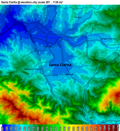
Below is the Elevation map of Santa Clarita, which displays elevation range with different colors. Scale of the first map is from 319 to 725 m (1047 to 2379 ft) with average elevation of 413.6 meters (=1357 ft) [note 1]
These maps also provides idea of topography and contour of this city, they are displayed at different zoom levels. More info about maps, scale and edge coordinates you can find below images.

| \ | Map #1 | Map #2 | Topo.Map |
| Scale [m] | 319..725 m | 287..1138 m | × |
| Scale [ft] | 1047..2379 ft | 942..3734 ft | × |
| Average | 413.6 m = 1357 ft | 506.4 m = 1661 ft | × |
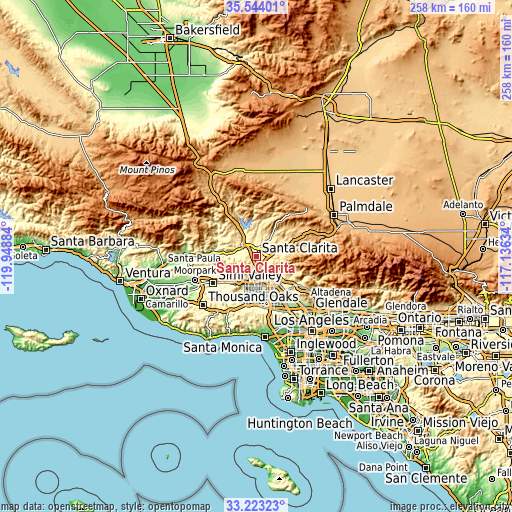
| Width | 8.06 km = 5 mi | 16.13 km = 10 mi | 258 km = 160.3 mi |
| Height | 8.06 km = 5 mi | 16.13 km = 10 mi | 258 km = 160.3 mi |
| ↑Max Latitude | 34.427916° | 34.464156° | 35.54401° |
| Latitude at center | 34.39166° | 34.39166° | 34.39166° |
| ↓Min Latitude | 34.355389° | 34.319102° | 33.22323° |
| ← Min Longitude | -118.586535° | -118.630481° | -119.94884° |
| Longitude center | -118.54259° | -118.54259° | -118.54259° |
| →Max Longitude | -118.498645° | -118.454699° | -117.13634° |
Nearby cities:
Cities around Santa Clarita sort by population:
• Valencia elevation 312 m
8.4 km,  313°
313°
• Northridge 248 m
18.2 km,  178°
178°
• Canoga Park 245 m
21.8 km,  193°
193°
• North Hills 260 m
18.1 km,  162°
162°
• Chatsworth 301 m
15.9 km,  199°
199°
• San Fernando 327 m
15.5 km,  142°
142°
• Castaic 374 m
13.1 km,  325°
325°
• Stevenson Ranch 428 m
2.9 km,  267°
267°
• Shadow Hills 361 m
22.7 km,  129°
129°
• Agua Dulce 776 m
23.1 km,  59°
59°
• Val Verde 364 m
12.1 km,  299°
299°
• Santa Susana 297 m
20.3 km,  228°
228°
Multilingual:
 En español:
Santa Clarita elevación 368 m.
 En France:
Santa Clarita élévation 368 m.
 Auf Deutsch:
Santa Clarita höhe über dem Meeresspiegel ist 368 m.

Sources and notes:
- [note 1] Map square and city borders are not equal. Map elevation data is calculated only from area inside that square.
- [src 1] Elevation data from geonames database provided with same terms of usage.
- [src 2] The elevation map of Santa Clarita is generated using elevation data from NASA's 3 arcsec (90m) resolution SRTM data.
- [src 3] Base (background) map © OpenStreetMap contributors tiles are generated by Geofabrik and OpenTopoMap.
Copyright & License:
This Santa Clarita Elevation Map is licensed under CC BY-SA. You may reuse any part from this page, if you give a proper credit by linking to this URL:
 More info on terms of use page.