Rancho Penasquitos elevation
Rancho Penasquitos (California, San Diego County), United States elevation is 173 meters and Rancho Penasquitos elevation in feet is 568 ft above sea level [src 1]. Rancho Penasquitos is a section of populated place (feature code) with elevation that is 106 meters (348 ft) smaller than average city elevation in United States.
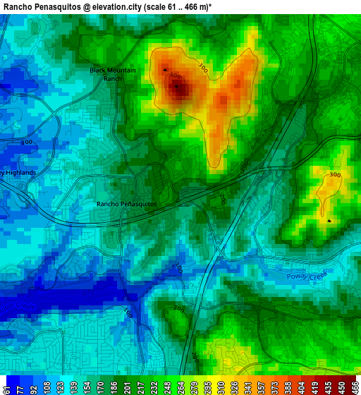
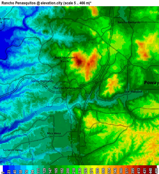
Below is the Elevation map of Rancho Penasquitos, which displays elevation range with different colors. Scale of the first map is from 61 to 466 m (200 to 1529 ft) with average elevation of 182.4 meters (=598 ft) [note 1]
These maps also provides idea of topography and contour of this city, they are displayed at different zoom levels. More info about maps, scale and edge coordinates you can find below images.
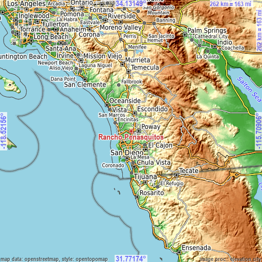
| \ | Map #1 | Map #2 | Topo.Map |
| Scale [m] | 61..466 m | 5..466 m | × |
| Scale [ft] | 200..1529 ft | 16..1529 ft | × |
| Average | 182.4 m = 598 ft | 161 m = 528 ft | × |
| Width | 8.2 km = 5.1 mi | 16.4 km = 10.2 mi | 262.4 km = 163 mi |
| Height | 8.2 km = 5.1 mi | 16.4 km = 10.2 mi | 262.4 km = 163 mi |
| ↑Max Latitude | 32.996355° | 33.033204° | 34.13149° |
| Latitude at center | 32.95949° | 32.95949° | 32.95949° |
| ↓Min Latitude | 32.92261° | 32.885714° | 31.77174° |
| ← Min Longitude | -117.159255° | -117.203201° | -118.52156° |
| Longitude center | -117.11531° | -117.11531° | -117.11531° |
| →Max Longitude | -117.071365° | -117.027419° | -115.70906° |
Nearby cities:
Cities around Rancho Penasquitos sort by population:
• Escondido elevation 199 m
18 km,  8°
8°
• Mira Mesa 136 m
5.6 km,  208°
208°
• Encinitas 26 m
18.6 km,  297°
297°
• Santee 108 m
18.9 km,  135°
135°
• Poway 157 m
7.4 km,  87°
87°
• La Jolla 35 m
19.4 km,  229°
229°
• Solana Beach 20 m
15 km,  283°
283°
• Eucalyptus Hills 201 m
18.1 km,  119°
119°
• Sorrento Valley 101 m
9.9 km, 228°
• Del Mar 37 m
14 km,  270°
270°
• Fairbanks Ranch 50 m
7.7 km, 299°
• Rancho Santa Fe 76 m
10.6 km,  309°
309°
Multilingual:
 En español:
Rancho Penasquitos elevación 173 m.
 En France:
Rancho Penasquitos élévation 173 m.
 Auf Deutsch:
Rancho Penasquitos höhe über dem Meeresspiegel ist 173 m.
 На русском:
Rancho Penasquitos высота над уровнем моря 173 м
Sources and notes:
- [note 1] Map square and city borders are not equal. Map elevation data is calculated only from area inside that square.
- [src 1] Elevation data from geonames database provided with same terms of usage.
- [src 2] The elevation map of Rancho Penasquitos is generated using elevation data from NASA's 3 arcsec (90m) resolution SRTM data.
- [src 3] Base (background) map © OpenStreetMap contributors tiles are generated by Geofabrik and OpenTopoMap.
Copyright & License:
This Rancho Penasquitos Elevation Map is licensed under CC BY-SA. You may reuse any part from this page, if you give a proper credit by linking to this URL:
 More info on terms of use page.