Placerville elevation
Placerville (California, El Dorado County), United States elevation is 570 meters and Placerville elevation in feet is 1870 ft above sea level [src 1]. Placerville is a seat of a second-order administrative division (feature code) with elevation that is 291 meters (955 ft) bigger than average city elevation in United States.
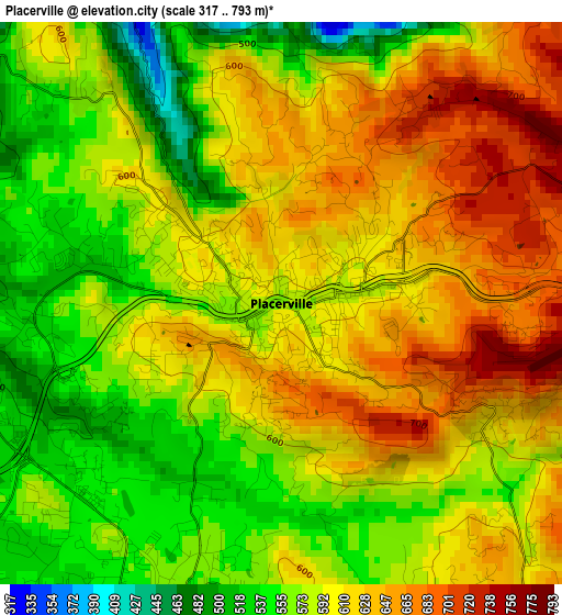
Below is the Elevation map of Placerville, which displays elevation range with different colors. Scale of the first map is from 317 to 793 m (1040 to 2602 ft) with average elevation of 598.2 meters (=1963 ft) [note 1]
These maps also provides idea of topography and contour of this city, they are displayed at different zoom levels. More info about maps, scale and edge coordinates you can find below images.

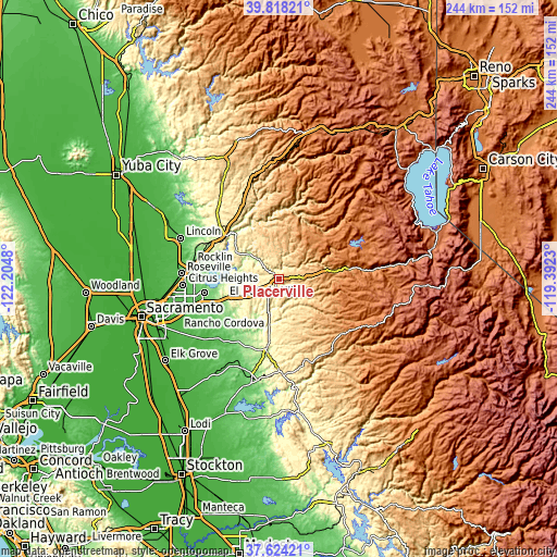
| \ | Map #1 | Map #2 | Topo.Map |
| Scale [m] | 317..793 m | 236..908 m | × |
| Scale [ft] | 1040..2602 ft | 774..2979 ft | × |
| Average | 598.2 m = 1963 ft | 589 m = 1932 ft | × |
| Width | 7.62 km = 4.7 mi | 15.25 km = 9.5 mi | 243.9 km = 151.6 mi |
| Height | 7.62 km = 4.7 mi | 15.25 km = 9.5 mi | 243.9 km = 151.6 mi |
| ↑Max Latitude | 38.763904° | 38.798161° | 39.81821° |
| Latitude at center | 38.72963° | 38.72963° | 38.72963° |
| ↓Min Latitude | 38.69534° | 38.661033° | 37.62421° |
| ← Min Longitude | -120.842495° | -120.886441° | -122.2048° |
| Longitude center | -120.79855° | -120.79855° | -120.79855° |
| →Max Longitude | -120.754605° | -120.710659° | -119.3923° |
Nearby cities:
Cities around Placerville sort by population:
• El Dorado Hills elevation 238 m
25.1 km,  258°
258°
• Granite Bay 132 m
31.9 km,  276°
276°
• Cameron Park 372 m
17.7 km,  247°
247°
• Auburn 378 m
30.4 km,  307°
307°
• Diamond Springs 552 m
4.1 km,  200°
200°
• Pollock Pines 1207 m
18.8 km,  79°
79°
• Shingle Springs 432 m
13.1 km,  237°
237°
• Cool 468 m
25.6 km, 313°
• Auburn Lake Trails 585 m
24.5 km,  327°
327°
• Georgetown 811 m
20 km,  350°
350°
• Camino 958 m
10.8 km, 84°
• Deer Park 535 m
5.7 km, 201°
Multilingual:
 En español:
Placerville elevación 570 m.
 En France:
Placerville élévation 570 m.
 Auf Deutsch:
Placerville höhe über dem Meeresspiegel ist 570 m.

Sources and notes:
- [note 1] Map square and city borders are not equal. Map elevation data is calculated only from area inside that square.
- [src 1] Elevation data from geonames database provided with same terms of usage.
- [src 2] The elevation map of Placerville is generated using elevation data from NASA's 3 arcsec (90m) resolution SRTM data.
- [src 3] Base (background) map © OpenStreetMap contributors tiles are generated by Geofabrik and OpenTopoMap.
Copyright & License:
This Placerville Elevation Map is licensed under CC BY-SA. You may reuse any part from this page, if you give a proper credit by linking to this URL:
 More info on terms of use page.