Orinda elevation
Orinda (California, Contra Costa County), United States elevation is 150 meters and Orinda elevation in feet is 492 ft above sea level [src 1]. Orinda is a populated place (feature code) with elevation that is 129 meters (423 ft) smaller than average city elevation in United States.
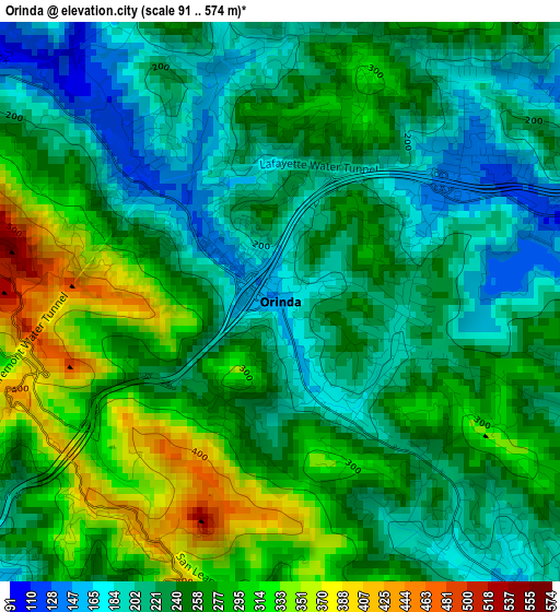
Below is the Elevation map of Orinda, which displays elevation range with different colors. Scale of the first map is from 91 to 574 m (299 to 1883 ft) with average elevation of 249.9 meters (=820 ft) [note 1]
These maps also provides idea of topography and contour of this city, they are displayed at different zoom levels. More info about maps, scale and edge coordinates you can find below images.
| \ | Map #1 | Map #2 | Topo.Map |
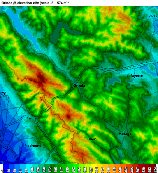
| Scale [m] | 91..574 m | -6..574 m | × |
| Scale [ft] | 299..1883 ft | -20..1883 ft | × |
| Average | 249.9 m = 820 ft | 219.2 m = 719 ft | × |
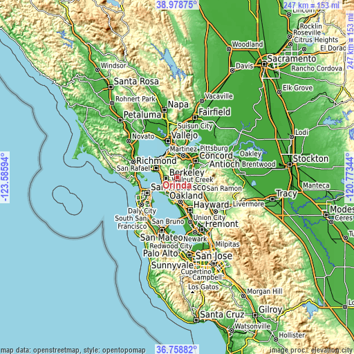
| Width | 7.71 km = 4.8 mi | 15.43 km = 9.6 mi | 246.8 km = 153.4 mi |
| Height | 7.71 km = 4.8 mi | 15.43 km = 9.6 mi | 246.8 km = 153.4 mi |
| ↑Max Latitude | 37.911829° | 37.946492° | 38.97875° |
| Latitude at center | 37.87715° | 37.87715° | 37.87715° |
| ↓Min Latitude | 37.842455° | 37.807743° | 36.75882° |
| ← Min Longitude | -122.223635° | -122.267581° | -123.58594° |
| Longitude center | -122.17969° | -122.17969° | -122.17969° |
| →Max Longitude | -122.135745° | -122.091799° | -120.77344° |
Nearby cities:
Cities around Orinda sort by population:
• Oakland elevation 24 m
11.4 km,  224°
224°
• Berkeley 55 m
8.2 km,  265°
265°
• Walnut Creek 54 m
10.6 km,  72°
72°
• Lafayette 94 m
5.5 km,  79°
79°
• Albany 13 m
10.4 km,  275°
275°
• Moraga 149 m
6.4 km,  136°
136°
• Emeryville 10 m
10.6 km,  241°
241°
• Piedmont 97 m
7.4 km, 217°
• Contra Costa Centre 33 m
12.1 km,  62°
62°
• Saranap 58 m
9.1 km, 84°
• Kensington 184 m
9.6 km,  292°
292°
• Acalanes Ridge 142 m
9.4 km, 70°
Multilingual:
 En español:
Orinda elevación 150 m.
 En France:
Orinda élévation 150 m.


Sources and notes:
- [note 1] Map square and city borders are not equal. Map elevation data is calculated only from area inside that square.
- [src 1] Elevation data from geonames database provided with same terms of usage.
- [src 2] The elevation map of Orinda is generated using elevation data from NASA's 3 arcsec (90m) resolution SRTM data.
- [src 3] Base (background) map © OpenStreetMap contributors tiles are generated by Geofabrik and OpenTopoMap.
Copyright & License:
This Orinda Elevation Map is licensed under CC BY-SA. You may reuse any part from this page, if you give a proper credit by linking to this URL:
 More info on terms of use page.