McFarland elevation
McFarland (California, Kern County), United States elevation is 110 meters and McFarland elevation in feet is 361 ft above sea level [src 1]. McFarland is a populated place (feature code) with elevation that is 169 meters (554 ft) smaller than average city elevation in United States.
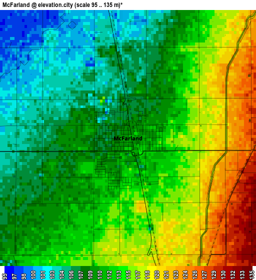
Below is the Elevation map of McFarland, which displays elevation range with different colors. Scale of the first map is from 95 to 135 m (312 to 443 ft) with average elevation of 111.9 meters (=367 ft) [note 1]
These maps also provides idea of topography and contour of this city, they are displayed at different zoom levels. More info about maps, scale and edge coordinates you can find below images.
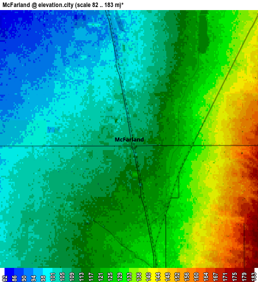
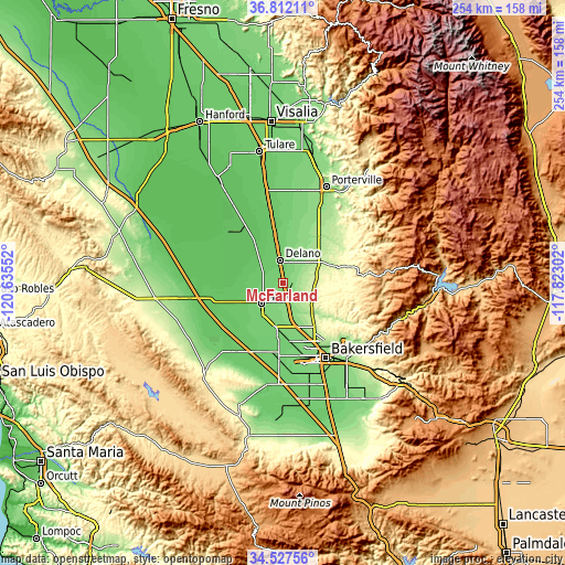
| \ | Map #1 | Map #2 | Topo.Map |
| Scale [m] | 95..135 m | 82..183 m | × |
| Scale [ft] | 312..443 ft | 269..600 ft | × |
| Average | 111.9 m = 367 ft | 116.9 m = 384 ft | × |
| Width | 7.94 km = 4.9 mi | 15.88 km = 9.9 mi | 254 km = 157.8 mi |
| Height | 7.94 km = 4.9 mi | 15.88 km = 9.9 mi | 254 km = 157.8 mi |
| ↑Max Latitude | 35.713699° | 35.749372° | 36.81211° |
| Latitude at center | 35.67801° | 35.67801° | 35.67801° |
| ↓Min Latitude | 35.642305° | 35.606584° | 34.52756° |
| ← Min Longitude | -119.273215° | -119.317161° | -120.63552° |
| Longitude center | -119.22927° | -119.22927° | -119.22927° |
| →Max Longitude | -119.185325° | -119.141379° | -117.82302° |
Nearby cities:
Cities around McFarland sort by population:
• Delano elevation 100 m
10.2 km,  350°
350°
• Oildale 147 m
34.4 km,  146°
146°
• Wasco 101 m
13.7 km,  227°
227°
• Shafter 107 m
20.1 km,  191°
191°
• Rosedale 116 m
33.6 km,  166°
166°
• Earlimart 88 m
23.2 km, 350°
• Greenacres 120 m
34.5 km,  161°
161°
• Terra Bella 150 m
35.8 km,  27°
27°
• Pixley 83 m
32.8 km, 350°
• Richgrove 160 m
17.1 km,  39°
39°
• Teviston 83 m
28.2 km, 350°
• Alpaugh 64 m
32.9 km,  315°
315°
Multilingual:
 En español:
McFarland elevación 110 m.
 En France:
McFarland élévation 110 m.
 Auf Deutsch:
McFarland höhe über dem Meeresspiegel ist 110 m.

Sources and notes:
- [note 1] Map square and city borders are not equal. Map elevation data is calculated only from area inside that square.
- [src 1] Elevation data from geonames database provided with same terms of usage.
- [src 2] The elevation map of McFarland is generated using elevation data from NASA's 3 arcsec (90m) resolution SRTM data.
- [src 3] Base (background) map © OpenStreetMap contributors tiles are generated by Geofabrik and OpenTopoMap.
Copyright & License:
This McFarland Elevation Map is licensed under CC BY-SA. You may reuse any part from this page, if you give a proper credit by linking to this URL:
 More info on terms of use page.