Buena Park elevation
Buena Park (California, Orange County), United States elevation is 24 meters and Buena Park elevation in feet is 79 ft above sea level [src 1]. Buena Park is a populated place (feature code) with elevation that is 255 meters (837 ft) smaller than average city elevation in United States.
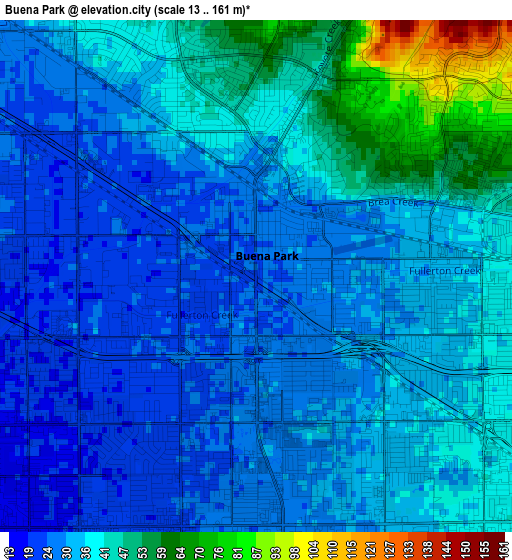
Below is the Elevation map of Buena Park, which displays elevation range with different colors. Scale of the first map is from 13 to 161 m (43 to 528 ft) with average elevation of 35.4 meters (=116 ft) [note 1]
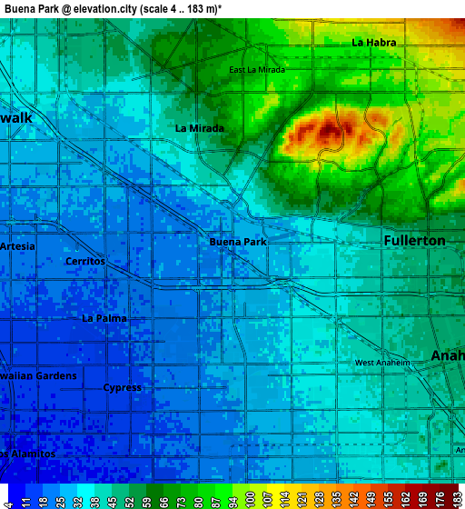
These maps also provides idea of topography and contour of this city, they are displayed at different zoom levels. More info about maps, scale and edge coordinates you can find below images.
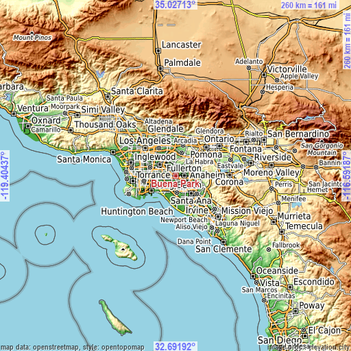
| \ | Map #1 | Map #2 | Topo.Map |
| Scale [m] | 13..161 m | 4..183 m | × |
| Scale [ft] | 43..528 ft | 13..600 ft | × |
| Average | 35.4 m = 116 ft | 43.3 m = 142 ft | × |
| Width | 8.11 km = 5 mi | 16.23 km = 10.1 mi | 259.7 km = 161.4 mi |
| Height | 8.11 km = 5 mi | 16.23 km = 10.1 mi | 259.7 km = 161.4 mi |
| ↑Max Latitude | 33.903991° | 33.940457° | 35.02713° |
| Latitude at center | 33.86751° | 33.86751° | 33.86751° |
| ↓Min Latitude | 33.831013° | 33.794501° | 32.69192° |
| ← Min Longitude | -118.042065° | -118.086011° | -119.40437° |
| Longitude center | -117.99812° | -117.99812° | -117.99812° |
| →Max Longitude | -117.954175° | -117.910229° | -116.59187° |
Nearby cities:
Cities around Buena Park sort by population:
• Anaheim elevation 55 m
8.5 km,  114°
114°
• Fullerton 52 m
6.7 km,  87°
87°
• Norwalk 29 m
8.6 km,  296°
296°
• La Habra 92 m
8.6 km,  33°
33°
• Cerritos 19 m
6.2 km,  260°
260°
• La Mirada 62 m
5.7 km,  346°
346°
• Cypress 14 m
6.7 km,  212°
212°
• Stanton 26 m
7.2 km,  176°
176°
• Artesia 22 m
7.8 km,  268°
268°
• La Palma 19 m
5.1 km,  242°
242°
• Hawaiian Gardens 13 m
8 km, 239°
• East La Mirada 75 m
6.4 km,  7°
7°
Multilingual:
 En español:
Buena Park elevación 24 m.
 En France:
Buena Park élévation 24 m.
 Auf Deutsch:
Buena Park höhe über dem Meeresspiegel ist 24 m.

Sources and notes:
- [note 1] Map square and city borders are not equal. Map elevation data is calculated only from area inside that square.
- [src 1] Elevation data from geonames database provided with same terms of usage.
- [src 2] The elevation map of Buena Park is generated using elevation data from NASA's 3 arcsec (90m) resolution SRTM data.
- [src 3] Base (background) map © OpenStreetMap contributors tiles are generated by Geofabrik and OpenTopoMap.
Copyright & License:
This Buena Park Elevation Map is licensed under CC BY-SA. You may reuse any part from this page, if you give a proper credit by linking to this URL:
 More info on terms of use page.