Anaheim elevation
Anaheim (California, Orange County), United States elevation is 55 meters and Anaheim elevation in feet is 180 ft above sea level [src 1]. Anaheim is a populated place (feature code) with elevation that is 224 meters (735 ft) smaller than average city elevation in United States.
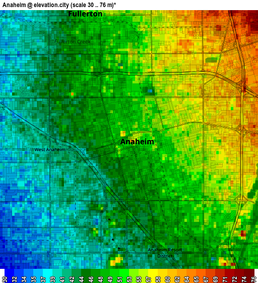
Below is the Elevation map of Anaheim, which displays elevation range with different colors. Scale of the first map is from 30 to 76 m (98 to 249 ft) with average elevation of 48.4 meters (=159 ft) [note 1]
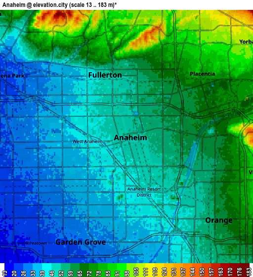
These maps also provides idea of topography and contour of this city, they are displayed at different zoom levels. More info about maps, scale and edge coordinates you can find below images.
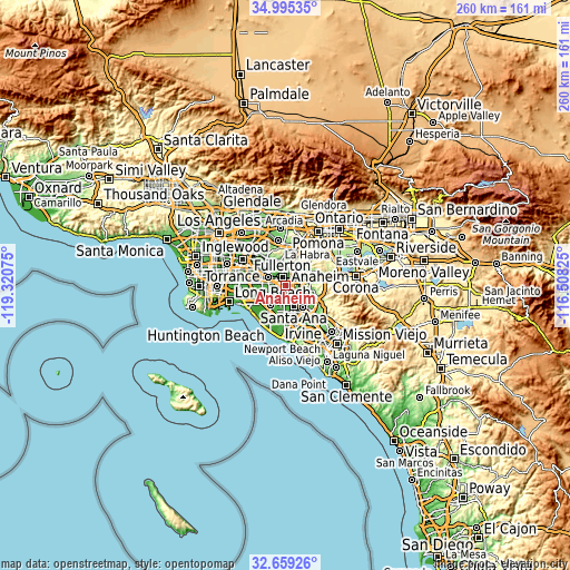
| \ | Map #1 | Map #2 | Topo.Map |
| Scale [m] | 30..76 m | 13..183 m | × |
| Scale [ft] | 98..249 ft | 43..600 ft | × |
| Average | 48.4 m = 159 ft | 55.5 m = 182 ft | × |
| Width | 8.12 km = 5 mi | 16.23 km = 10.1 mi | 259.7 km = 161.4 mi |
| Height | 8.12 km = 5 mi | 16.23 km = 10.1 mi | 259.8 km = 161.4 mi |
| ↑Max Latitude | 33.871785° | 33.908264° | 34.99535° |
| Latitude at center | 33.83529° | 33.83529° | 33.83529° |
| ↓Min Latitude | 33.798779° | 33.762253° | 32.65926° |
| ← Min Longitude | -117.958445° | -118.002391° | -119.32075° |
| Longitude center | -117.9145° | -117.9145° | -117.9145° |
| →Max Longitude | -117.870555° | -117.826609° | -116.50825° |
Nearby cities:
Cities around Anaheim sort by population:
• Santa Ana elevation 39 m
10.9 km,  156°
156°
• Garden Grove 26 m
7.3 km,  200°
200°
• Orange 61 m
7.7 km,  132°
132°
• Fullerton 52 m
4 km,  345°
345°
• Buena Park 24 m
8.5 km,  294°
294°
• Yorba Linda 116 m
11.1 km,  57°
57°
• La Habra 92 m
11.1 km,  344°
344°
• Placentia 80 m
5.8 km,  44°
44°
• Cypress 14 m
11.5 km,  259°
259°
• Brea 112 m
9.1 km,  8°
8°
• Stanton 26 m
8.1 km,  243°
243°
• Villa Park 108 m
9.6 km,  103°
103°
Multilingual:
 En español:
Anaheim elevación 55 m.
 En France:
Anaheim élévation 55 m.


Sources and notes:
- [note 1] Map square and city borders are not equal. Map elevation data is calculated only from area inside that square.
- [src 1] Elevation data from geonames database provided with same terms of usage.
- [src 2] The elevation map of Anaheim is generated using elevation data from NASA's 3 arcsec (90m) resolution SRTM data.
- [src 3] Base (background) map © OpenStreetMap contributors tiles are generated by Geofabrik and OpenTopoMap.
Copyright & License:
This Anaheim Elevation Map is licensed under CC BY-SA. You may reuse any part from this page, if you give a proper credit by linking to this URL:
 More info on terms of use page.