Benicia elevation
Benicia (California, Solano County), United States elevation is 5 meters and Benicia elevation in feet is 16 ft above sea level [src 1]. Benicia is a populated place (feature code) with elevation that is 274 meters (899 ft) smaller than average city elevation in United States.
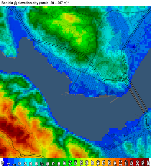
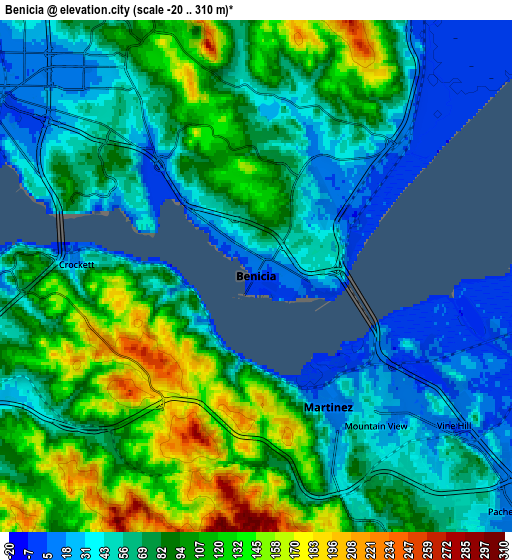
Below is the Elevation map of Benicia, which displays elevation range with different colors. Scale of the first map is from -20 to 267 m (-66 to 876 ft) with average elevation of 66.1 meters (=217 ft) [note 1]
These maps also provides idea of topography and contour of this city, they are displayed at different zoom levels. More info about maps, scale and edge coordinates you can find below images.
| \ | Map #1 | Map #2 | Topo.Map |
| Scale [m] | -20..267 m | -20..310 m | × |
| Scale [ft] | -66..876 ft | -66..1017 ft | × |
| Average | 66.1 m = 217 ft | 80.2 m = 263 ft | × |
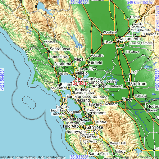
| Width | 7.7 km = 4.8 mi | 15.39 km = 9.6 mi | 246.3 km = 153 mi |
| Height | 7.7 km = 4.8 mi | 15.39 km = 9.6 mi | 246.3 km = 153 mi |
| ↑Max Latitude | 38.083968° | 38.118549° | 39.14836° |
| Latitude at center | 38.04937° | 38.04937° | 38.04937° |
| ↓Min Latitude | 38.014756° | 37.980125° | 36.93363° |
| ← Min Longitude | -122.202525° | -122.246471° | -123.56483° |
| Longitude center | -122.15858° | -122.15858° | -122.15858° |
| →Max Longitude | -122.114635° | -122.070689° | -120.75233° |
Nearby cities:
Cities around Benicia sort by population:
• Concord elevation 25 m
13.7 km,  125°
125°
• Vallejo 22 m
10.5 km,  305°
305°
• Martinez 19 m
4 km,  147°
147°
• Pleasant Hill 16 m
14.2 km,  142°
142°
• Hercules 22 m
11.9 km,  252°
252°
• Pinole 34 m
13.3 km, 247°
• El Sobrante 60 m
14.4 km,  236°
236°
• Rodeo 1 m
9.7 km,  259°
259°
• Vine Hill 11 m
7.1 km, 129°
• Pacheco 21 m
10.3 km, 135°
• Crockett 39 m
4.8 km,  274°
274°
• Mountain View 33 m
5.8 km, 141°
Multilingual:
 En español:
Benicia elevación 5 m.
 En France:
Benicia élévation 5 m.


Sources and notes:
- [note 1] Map square and city borders are not equal. Map elevation data is calculated only from area inside that square.
- [src 1] Elevation data from geonames database provided with same terms of usage.
- [src 2] The elevation map of Benicia is generated using elevation data from NASA's 3 arcsec (90m) resolution SRTM data.
- [src 3] Base (background) map © OpenStreetMap contributors tiles are generated by Geofabrik and OpenTopoMap.
Copyright & License:
This Benicia Elevation Map is licensed under CC BY-SA. You may reuse any part from this page, if you give a proper credit by linking to this URL:
 More info on terms of use page.