Bakersfield elevation
Bakersfield (California, Kern County), United States elevation is 130 meters and Bakersfield elevation in feet is 427 ft above sea level [src 1]. Bakersfield is a seat of a second-order administrative division (feature code) with elevation that is 149 meters (489 ft) smaller than average city elevation in United States.
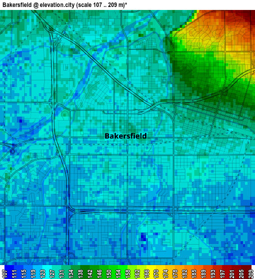
Below is the Elevation map of Bakersfield, which displays elevation range with different colors. Scale of the first map is from 107 to 209 m (351 to 686 ft) with average elevation of 128.3 meters (=421 ft) [note 1]
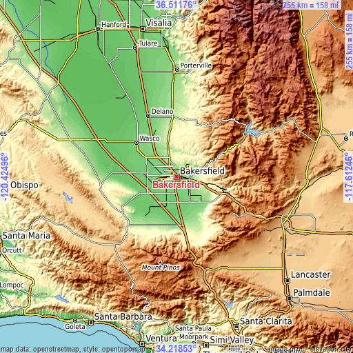
These maps also provides idea of topography and contour of this city, they are displayed at different zoom levels. More info about maps, scale and edge coordinates you can find below images.
| \ | Map #1 | Map #2 | Topo.Map |
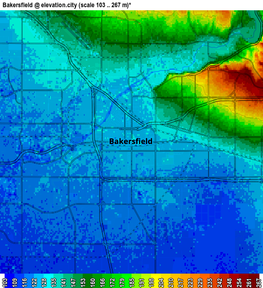
| Scale [m] | 107..209 m | 103..267 m | × |
| Scale [ft] | 351..686 ft | 338..876 ft | × |
| Average | 128.3 m = 421 ft | 134.5 m = 441 ft | × |
| Width | 7.97 km = 5 mi | 15.94 km = 9.9 mi | 255 km = 158.4 mi |
| Height | 7.97 km = 5 mi | 15.94 km = 9.9 mi | 255 km = 158.4 mi |
| ↑Max Latitude | 35.409115° | 35.444924° | 36.51176° |
| Latitude at center | 35.37329° | 35.37329° | 35.37329° |
| ↓Min Latitude | 35.337449° | 35.301592° | 34.21853° |
| ← Min Longitude | -119.062655° | -119.106601° | -120.42496° |
| Longitude center | -119.01871° | -119.01871° | -119.01871° |
| →Max Longitude | -118.974765° | -118.930819° | -117.61246° |
Nearby cities:
Cities around Bakersfield sort by population:
• Oildale elevation 147 m
5.2 km,  359°
359°
• Wasco 101 m
38.1 km,  310°
310°
• Arvin 137 m
25.1 km,  136°
136°
• Shafter 107 m
26.9 km,  301°
301°
• Lamont 123 m
15.8 km, 143°
• Rosedale 116 m
11.5 km,  275°
275°
• McFarland 110 m
38.9 km,  330°
330°
• Greenacres 120 m
8.3 km, 277°
• Bear Valley Springs 1255 m
42.7 km,  123°
123°
• Greenfield 109 m
11.7 km,  172°
172°
• Weedpatch 117 m
17.7 km,  147°
147°
• Buttonwillow 86 m
41 km,  274°
274°
Multilingual:
 En español:
Bakersfield elevación 130 m.
 En France:
Bakersfield élévation 130 m.
 Auf Deutsch:
Bakersfield höhe über dem Meeresspiegel ist 130 m.

Sources and notes:
- [note 1] Map square and city borders are not equal. Map elevation data is calculated only from area inside that square.
- [src 1] Elevation data from geonames database provided with same terms of usage.
- [src 2] The elevation map of Bakersfield is generated using elevation data from NASA's 3 arcsec (90m) resolution SRTM data.
- [src 3] Base (background) map © OpenStreetMap contributors tiles are generated by Geofabrik and OpenTopoMap.
Copyright & License:
This Bakersfield Elevation Map is licensed under CC BY-SA. You may reuse any part from this page, if you give a proper credit by linking to this URL:
 More info on terms of use page.