Agoura Hills elevation
Agoura Hills (California, Los Angeles County), United States elevation is 504 meters and Agoura Hills elevation in feet is 1654 ft above sea level [src 1]. Agoura Hills is a populated place (feature code) with elevation that is 225 meters (738 ft) bigger than average city elevation in United States.
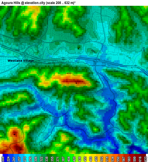
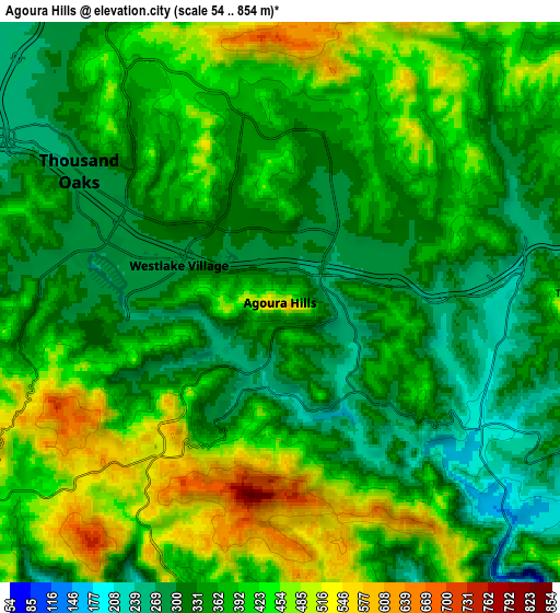
Below is the Elevation map of Agoura Hills, which displays elevation range with different colors. Scale of the first map is from 208 to 632 m (682 to 2073 ft) with average elevation of 328.3 meters (=1077 ft) [note 1]
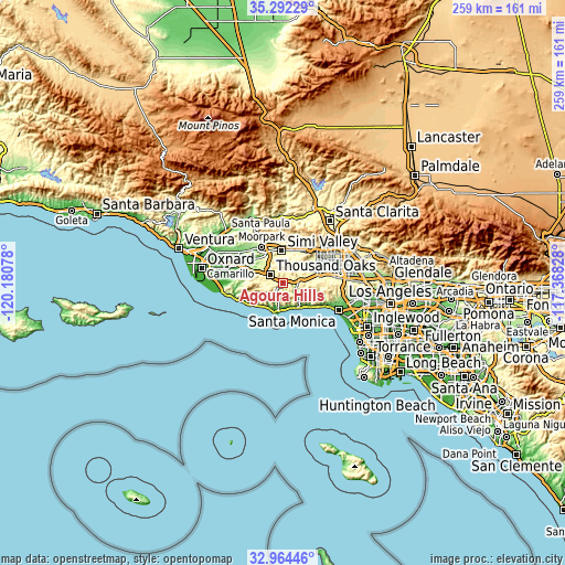
These maps also provides idea of topography and contour of this city, they are displayed at different zoom levels. More info about maps, scale and edge coordinates you can find below images.
| \ | Map #1 | Map #2 | Topo.Map |
| Scale [m] | 208..632 m | 54..854 m | × |
| Scale [ft] | 682..2073 ft | 177..2802 ft | × |
| Average | 328.3 m = 1077 ft | 378.6 m = 1242 ft | × |
| Width | 8.09 km = 5 mi | 16.18 km = 10.1 mi | 258.8 km = 160.8 mi |
| Height | 8.09 km = 5 mi | 16.18 km = 10.1 mi | 258.8 km = 160.8 mi |
| ↑Max Latitude | 34.172756° | 34.209106° | 35.29229° |
| Latitude at center | 34.13639° | 34.13639° | 34.13639° |
| ↓Min Latitude | 34.100008° | 34.063611° | 32.96446° |
| ← Min Longitude | -118.818475° | -118.862421° | -120.18078° |
| Longitude center | -118.77453° | -118.77453° | -118.77453° |
| →Max Longitude | -118.730585° | -118.686639° | -117.36828° |
Nearby cities:
Cities around Agoura Hills sort by population:
• Thousand Oaks elevation 274 m
6.9 km,  303°
303°
• Simi Valley 236 m
14.8 km,  357°
357°
• Woodland Hills 277 m
15.9 km,  77°
77°
• West Hills 273 m
13.8 km,  60°
60°
• Calabasas 288 m
12.7 km, 79°
• Agoura 283 m
3.5 km, 77°
• Oak Park 335 m
4.9 km,  12°
12°
• Malibu 44 m
12.3 km,  182°
182°
• Westlake Village 286 m
3.1 km,  290°
290°
• Casa Conejo 203 m
16.4 km, 288°
• Hidden Hills 323 m
11.6 km, 76°
• Santa Susana 297 m
16.2 km,  21°
21°
Multilingual:
 En español:
Agoura Hills elevación 504 m.
 En France:
Agoura Hills élévation 504 m.
 Auf Deutsch:
Agoura Hills höhe über dem Meeresspiegel ist 504 m.

Sources and notes:
- [note 1] Map square and city borders are not equal. Map elevation data is calculated only from area inside that square.
- [src 1] Elevation data from geonames database provided with same terms of usage.
- [src 2] The elevation map of Agoura Hills is generated using elevation data from NASA's 3 arcsec (90m) resolution SRTM data.
- [src 3] Base (background) map © OpenStreetMap contributors tiles are generated by Geofabrik and OpenTopoMap.
Copyright & License:
This Agoura Hills Elevation Map is licensed under CC BY-SA. You may reuse any part from this page, if you give a proper credit by linking to this URL:
 More info on terms of use page.