Waterford elevation
Waterford (Wisconsin, Racine County), United States elevation is 236 meters and Waterford elevation in feet is 774 ft above sea level [src 1]. Waterford is a populated place (feature code) with elevation that is 43 meters (141 ft) smaller than average city elevation in United States.
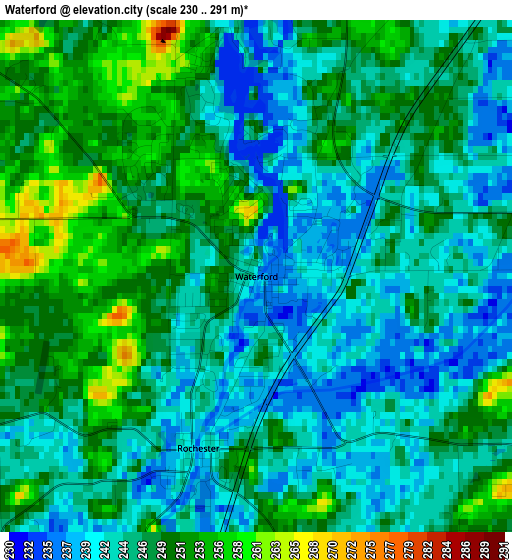
Below is the Elevation map of Waterford, which displays elevation range with different colors. Scale of the first map is from 230 to 291 m (755 to 955 ft) with average elevation of 246.5 meters (=809 ft) [note 1]
These maps also provides idea of topography and contour of this city, they are displayed at different zoom levels. More info about maps, scale and edge coordinates you can find below images.
| \ | Map #1 | Map #2 | Topo.Map |
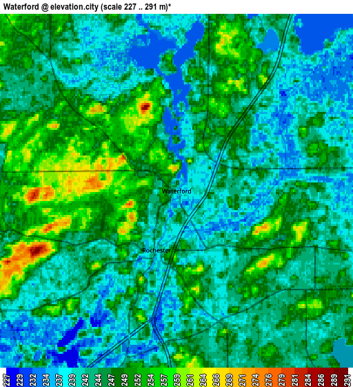
| Scale [m] | 230..291 m | 227..291 m | × |
| Scale [ft] | 755..955 ft | 745..955 ft | × |
| Average | 246.5 m = 809 ft | 245 m = 804 ft | × |
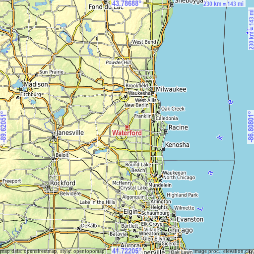
| Width | 7.17 km = 4.5 mi | 14.35 km = 8.9 mi | 229.6 km = 142.7 mi |
| Height | 7.17 km = 4.5 mi | 14.35 km = 8.9 mi | 229.6 km = 142.7 mi |
| ↑Max Latitude | 42.795325° | 42.827563° | 43.78688° |
| Latitude at center | 42.76307° | 42.76307° | 42.76307° |
| ↓Min Latitude | 42.730798° | 42.69851° | 41.72205° |
| ← Min Longitude | -88.258205° | -88.302151° | -89.62051° |
| Longitude center | -88.21426° | -88.21426° | -88.21426° |
| →Max Longitude | -88.170315° | -88.126369° | -86.80801° |
Nearby cities:
Cities around Waterford sort by population:
• Burlington elevation 236 m
10.7 km,  208°
208°
• Mukwonago 258 m
15.1 km,  319°
319°
• Wind Lake 242 m
8.7 km,  31°
31°
• Tichigan 243 m
7.4 km,  10°
10°
• Union Grove 237 m
15.7 km,  122°
122°
• East Troy 260 m
15.8 km,  279°
279°
• Rochester 240 m
2.5 km,  198°
198°
• Bohners Lake 260 m
16.5 km, 199°
• Browns Lake 243 m
8 km,  190°
190°
• Big Bend 253 m
13.2 km,  2°
2°
• Eagle Lake 250 m
9.4 km,  131°
131°
• Potter Lake 265 m
12.8 km,  300°
300°
Multilingual:
 En español:
Waterford elevación 236 m.
 En France:
Waterford élévation 236 m.
 Auf Deutsch:
Waterford höhe über dem Meeresspiegel ist 236 m.

Sources and notes:
- [note 1] Map square and city borders are not equal. Map elevation data is calculated only from area inside that square.
- [src 1] Elevation data from geonames database provided with same terms of usage.
- [src 2] The elevation map of Waterford is generated using elevation data from NASA's 3 arcsec (90m) resolution SRTM data.
- [src 3] Base (background) map © OpenStreetMap contributors tiles are generated by Geofabrik and OpenTopoMap.
Copyright & License:
This Waterford Elevation Map is licensed under CC BY-SA. You may reuse any part from this page, if you give a proper credit by linking to this URL:
 More info on terms of use page.