Big Bend elevation
Big Bend (Wisconsin, Waukesha County), United States elevation is 253 meters and Big Bend elevation in feet is 830 ft above sea level [src 1]. Big Bend is a populated place (feature code) with elevation that is 26 meters (85 ft) smaller than average city elevation in United States.
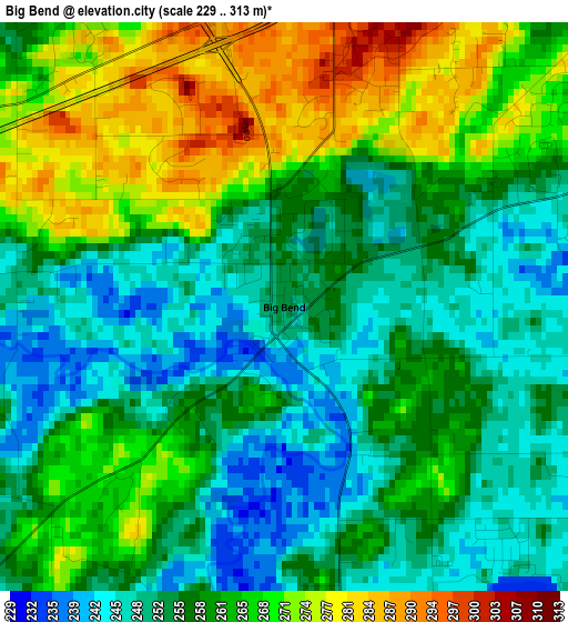
Below is the Elevation map of Big Bend, which displays elevation range with different colors. Scale of the first map is from 229 to 313 m (751 to 1027 ft) with average elevation of 259.3 meters (=851 ft) [note 1]
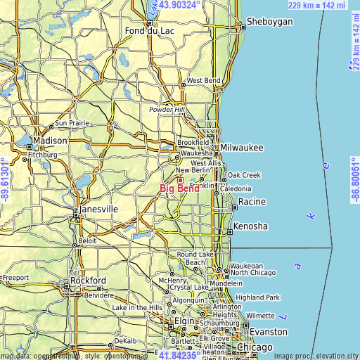
These maps also provides idea of topography and contour of this city, they are displayed at different zoom levels. More info about maps, scale and edge coordinates you can find below images.
| \ | Map #1 | Topo.Map |
| Scale [m] | 229..313 m | × |
| Scale [ft] | 751..1027 ft | × |
| Average | 259.3 m = 851 ft | × |
| Width | 7.16 km = 4.4 mi | 229.1 km = 142.4 mi |
| Height | 7.16 km = 4.4 mi | 229.1 km = 142.4 mi |
| ↑Max Latitude | 42.913593° | 43.90324° |
| Latitude at center | 42.8814° | 42.8814° |
| ↓Min Latitude | 42.84919° | 41.84235° |
| ← Min Longitude | -88.250705° | -89.61301° |
| Longitude center | -88.20676° | -88.20676° |
| →Max Longitude | -88.162815° | -86.80051° |
Nearby cities:
Cities around Big Bend sort by population:
• Waukesha elevation 252 m
14.6 km,  352°
352°
• New Berlin 281 m
13.3 km,  37°
37°
• Franklin 246 m
13.7 km,  86°
86°
• Muskego 247 m
6.2 km,  63°
63°
• Hales Corners 239 m
14.3 km, 64°
• Mukwonago 258 m
10.5 km,  260°
260°
• Waterford 236 m
13.2 km,  182°
182°
• Wind Lake 242 m
7 km,  145°
145°
• Tichigan 243 m
5.9 km,  172°
172°
• Rochester 240 m
15.6 km,  185°
185°
• North Prairie 293 m
17.2 km,  290°
290°
• Potter Lake 265 m
13.4 km,  240°
240°
Multilingual:
 En español:
Big Bend elevación 253 m.
 En France:
Big Bend élévation 253 m.
 Auf Deutsch:
Big Bend höhe über dem Meeresspiegel ist 253 m.

Sources and notes:
- [note 1] Map square and city borders are not equal. Map elevation data is calculated only from area inside that square.
- [src 1] Elevation data from geonames database provided with same terms of usage.
- [src 2] The elevation map of Big Bend is generated using elevation data from NASA's 3 arcsec (90m) resolution SRTM data.
- [src 3] Base (background) map © OpenStreetMap contributors tiles are generated by Geofabrik and OpenTopoMap.
Copyright & License:
This Big Bend Elevation Map is licensed under CC BY-SA. You may reuse any part from this page, if you give a proper credit by linking to this URL:
 More info on terms of use page.