Viroqua elevation
Viroqua (Wisconsin, Vernon County), United States elevation is 387 meters and Viroqua elevation in feet is 1270 ft above sea level [src 1]. Viroqua is a seat of a second-order administrative division (feature code) with elevation that is 108 meters (354 ft) bigger than average city elevation in United States.
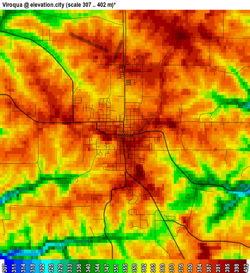
Below is the Elevation map of Viroqua, which displays elevation range with different colors. Scale of the first map is from 307 to 402 m (1007 to 1319 ft) with average elevation of 372.2 meters (=1221 ft) [note 1]
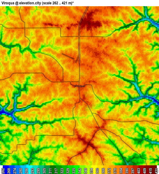
These maps also provides idea of topography and contour of this city, they are displayed at different zoom levels. More info about maps, scale and edge coordinates you can find below images.
| \ | Map #1 | Map #2 | Topo.Map |
| Scale [m] | 307..402 m | 262..421 m | × |
| Scale [ft] | 1007..1319 ft | 860..1381 ft | × |
| Average | 372.2 m = 1221 ft | 362.3 m = 1189 ft | × |
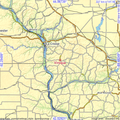
| Width | 7.08 km = 4.4 mi | 14.16 km = 8.8 mi | 226.6 km = 140.8 mi |
| Height | 7.08 km = 4.4 mi | 14.16 km = 8.8 mi | 226.6 km = 140.8 mi |
| ↑Max Latitude | 43.588758° | 43.62058° | 44.56739° |
| Latitude at center | 43.55692° | 43.55692° | 43.55692° |
| ↓Min Latitude | 43.525065° | 43.493193° | 42.52921° |
| ← Min Longitude | -90.932685° | -90.976631° | -92.29499° |
| Longitude center | -90.88874° | -90.88874° | -90.88874° |
| →Max Longitude | -90.844795° | -90.800849° | -89.48249° |
Nearby cities:
Cities around Viroqua sort by population:
• La Crosse elevation 203 m
39.2 km,  313°
313°
• North La Crosse 196 m
43.2 km,  318°
318°
• Onalaska 215 m
45.8 km, 322°
• Sparta 243 m
43.5 km,  8°
8°
• West Salem 229 m
41.1 km,  337°
337°
• La Crescent 210 m
45 km, 312°
• French Island 199 m
44.9 km, 318°
• Westby 398 m
11.5 km, 14°
• Bangor 226 m
38.3 km,  347°
347°
• Hillsboro 305 m
45.1 km,  76°
76°
• Cashton 415 m
22.4 km,  23°
23°
• Portland 396 m
23.7 km, 5°
Multilingual:
 En español:
Viroqua elevación 387 m.
 En France:
Viroqua élévation 387 m.


Sources and notes:
- [note 1] Map square and city borders are not equal. Map elevation data is calculated only from area inside that square.
- [src 1] Elevation data from geonames database provided with same terms of usage.
- [src 2] The elevation map of Viroqua is generated using elevation data from NASA's 3 arcsec (90m) resolution SRTM data.
- [src 3] Base (background) map © OpenStreetMap contributors tiles are generated by Geofabrik and OpenTopoMap.
Copyright & License:
This Viroqua Elevation Map is licensed under CC BY-SA. You may reuse any part from this page, if you give a proper credit by linking to this URL:
 More info on terms of use page.