Portage elevation
Portage (Wisconsin, Columbia County), United States elevation is 248 meters and Portage elevation in feet is 814 ft above sea level [src 1]. Portage is a seat of a second-order administrative division (feature code) with elevation that is 31 meters (102 ft) smaller than average city elevation in United States.
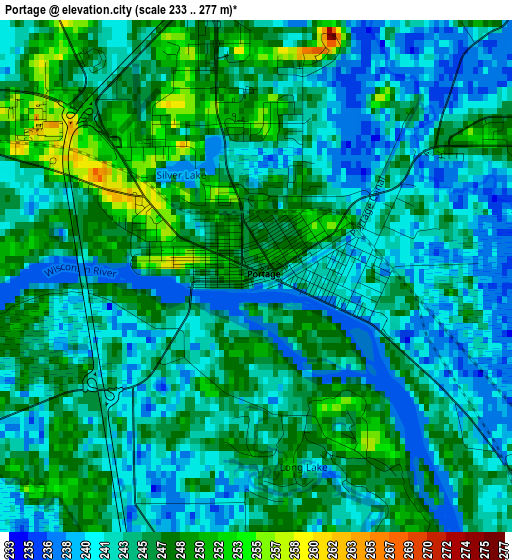
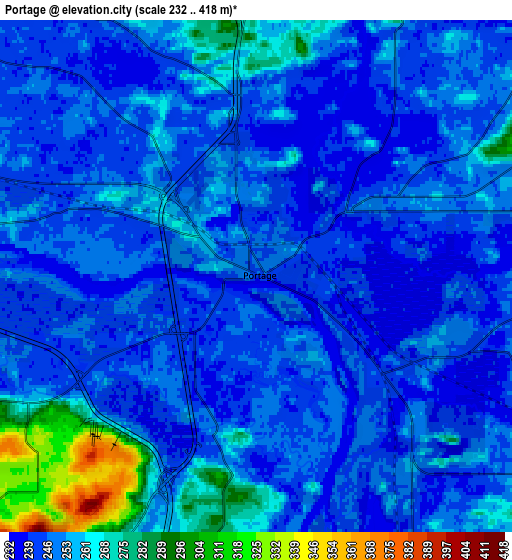
Below is the Elevation map of Portage, which displays elevation range with different colors. Scale of the first map is from 233 to 277 m (764 to 909 ft) with average elevation of 244.3 meters (=802 ft) [note 1]
These maps also provides idea of topography and contour of this city, they are displayed at different zoom levels. More info about maps, scale and edge coordinates you can find below images.
| \ | Map #1 | Map #2 | Topo.Map |
| Scale [m] | 233..277 m | 232..418 m | × |
| Scale [ft] | 764..909 ft | 761..1371 ft | × |
| Average | 244.3 m = 802 ft | 252.2 m = 827 ft | × |
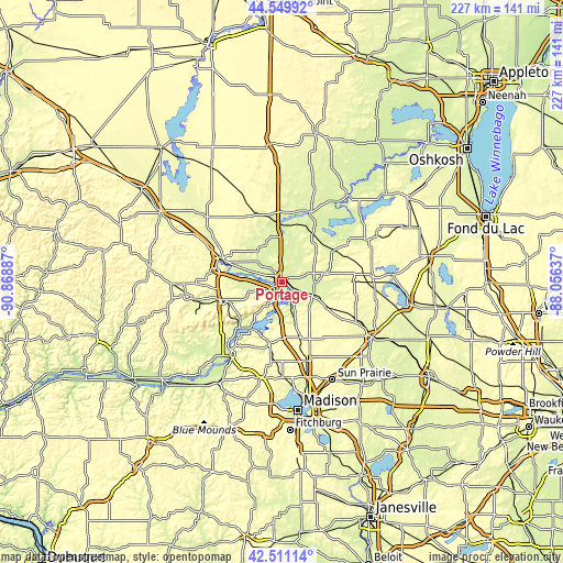
| Width | 7.08 km = 4.4 mi | 14.17 km = 8.8 mi | 226.7 km = 140.9 mi |
| Height | 7.08 km = 4.4 mi | 14.17 km = 8.8 mi | 226.7 km = 140.9 mi |
| ↑Max Latitude | 43.570998° | 43.602829° | 44.54992° |
| Latitude at center | 43.53915° | 43.53915° | 43.53915° |
| ↓Min Latitude | 43.507285° | 43.475404° | 42.51114° |
| ← Min Longitude | -89.506565° | -89.550511° | -90.86887° |
| Longitude center | -89.46262° | -89.46262° | -89.46262° |
| →Max Longitude | -89.418675° | -89.374729° | -88.05637° |
Nearby cities:
Cities around Portage sort by population:
• Baraboo elevation 274 m
23.9 km,  251°
251°
• De Forest 290 m
33.8 km,  163°
163°
• Lake Wisconsin 269 m
20.5 km,  206°
206°
• Lodi 251 m
25.6 km,  191°
191°
• Lake Delton 281 m
27.5 km,  284°
284°
• Wisconsin Dells 279 m
26.7 km,  291°
291°
• Poynette 258 m
17.2 km, 163°
• Pardeeville 251 m
13.1 km,  90°
90°
• Montello 244 m
30.3 km,  22°
22°
• West Baraboo 271 m
25.8 km, 253°
• Dane 325 m
32.2 km, 185°
• Rio 289 m
20.6 km,  119°
119°
Multilingual:
 En español:
Portage elevación 248 m.
 En France:
Portage élévation 248 m.


Sources and notes:
- [note 1] Map square and city borders are not equal. Map elevation data is calculated only from area inside that square.
- [src 1] Elevation data from geonames database provided with same terms of usage.
- [src 2] The elevation map of Portage is generated using elevation data from NASA's 3 arcsec (90m) resolution SRTM data.
- [src 3] Base (background) map © OpenStreetMap contributors tiles are generated by Geofabrik and OpenTopoMap.
Copyright & License:
This Portage Elevation Map is licensed under CC BY-SA. You may reuse any part from this page, if you give a proper credit by linking to this URL:
 More info on terms of use page.