Stowe elevation
Stowe (Vermont, Lamoille County), United States elevation is 222 meters and Stowe elevation in feet is 728 ft above sea level [src 1]. Stowe is a populated place (feature code) with elevation that is 57 meters (187 ft) smaller than average city elevation in United States.
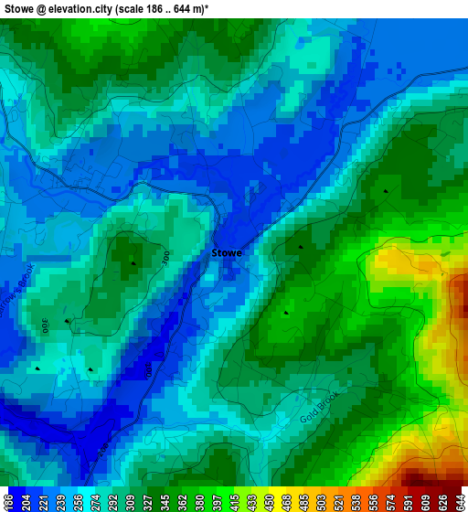
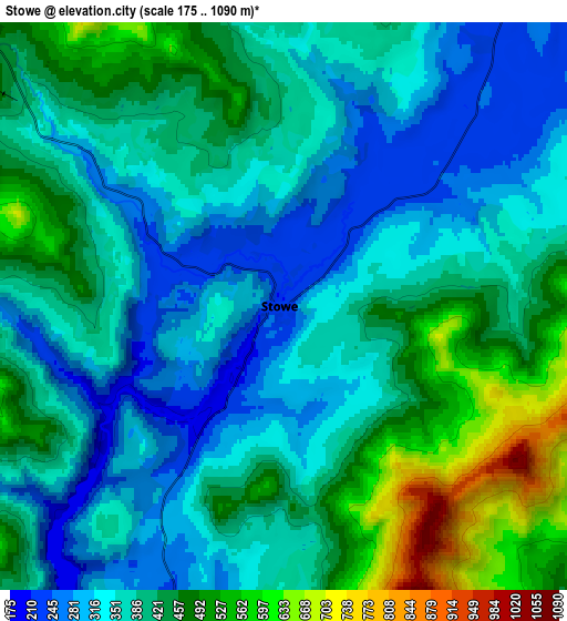
Below is the Elevation map of Stowe, which displays elevation range with different colors. Scale of the first map is from 186 to 644 m (610 to 2113 ft) with average elevation of 296.6 meters (=973 ft) [note 1]
These maps also provides idea of topography and contour of this city, they are displayed at different zoom levels. More info about maps, scale and edge coordinates you can find below images.
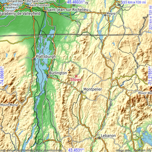
| \ | Map #1 | Map #2 | Topo.Map |
| Scale [m] | 186..644 m | 175..1090 m | × |
| Scale [ft] | 610..2113 ft | 574..3576 ft | × |
| Average | 296.6 m = 973 ft | 393 m = 1289 ft | × |
| Width | 6.97 km = 4.3 mi | 13.95 km = 8.7 mi | 223.2 km = 138.7 mi |
| Height | 6.97 km = 4.3 mi | 13.95 km = 8.7 mi | 223.2 km = 138.7 mi |
| ↑Max Latitude | 44.496684° | 44.528022° | 45.46031° |
| Latitude at center | 44.46533° | 44.46533° | 44.46533° |
| ↓Min Latitude | 44.433959° | 44.402571° | 43.4531° |
| ← Min Longitude | -72.728505° | -72.772451° | -74.09081° |
| Longitude center | -72.68456° | -72.68456° | -72.68456° |
| →Max Longitude | -72.640615° | -72.596669° | -71.27831° |
Nearby cities:
Cities around Stowe sort by population:
• Essex Junction elevation 104 m
33.9 km,  274°
274°
• Barre 187 m
33.2 km,  154°
154°
• Williston 152 m
30.6 km,  264°
264°
• Montpelier 163 m
24.4 km,  159°
159°
• Morristown 234 m
11.3 km,  25°
25°
• Morrisville 208 m
12.7 km, 32°
• Waterbury 135 m
15.3 km,  201°
201°
• Moretown 191 m
24.6 km,  194°
194°
• Johnson 154 m
18.9 km,  0°
0°
• Hardwick 252 m
25.5 km,  80°
80°
• Jericho 180 m
25.2 km,  279°
279°
• Hyde Park 206 m
15.3 km,  20°
20°
Multilingual:
 En español:
Stowe elevación 222 m.
 En France:
Stowe élévation 222 m.


Sources and notes:
- [note 1] Map square and city borders are not equal. Map elevation data is calculated only from area inside that square.
- [src 1] Elevation data from geonames database provided with same terms of usage.
- [src 2] The elevation map of Stowe is generated using elevation data from NASA's 3 arcsec (90m) resolution SRTM data.
- [src 3] Base (background) map © OpenStreetMap contributors tiles are generated by Geofabrik and OpenTopoMap.
Copyright & License:
This Stowe Elevation Map is licensed under CC BY-SA. You may reuse any part from this page, if you give a proper credit by linking to this URL:
 More info on terms of use page.