Jericho elevation
Jericho (Vermont, Chittenden County), United States elevation is 180 meters and Jericho elevation in feet is 591 ft above sea level [src 1]. Jericho is a populated place (feature code) with elevation that is 99 meters (325 ft) smaller than average city elevation in United States.
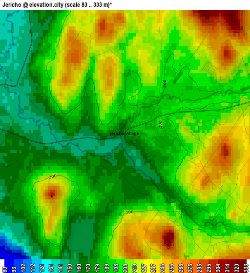
Below is the Elevation map of Jericho, which displays elevation range with different colors. Scale of the first map is from 83 to 333 m (272 to 1093 ft) with average elevation of 202 meters (=663 ft) [note 1]
These maps also provides idea of topography and contour of this city, they are displayed at different zoom levels. More info about maps, scale and edge coordinates you can find below images.
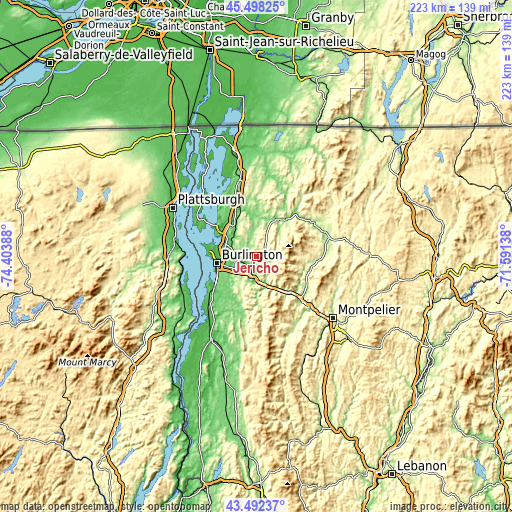
| \ | Map #1 | Topo.Map |
| Scale [m] | 83..333 m | × |
| Scale [ft] | 272..1093 ft | × |
| Average | 202 m = 663 ft | × |
| Width | 6.97 km = 4.3 mi | 223 km = 138.6 mi |
| Height | 6.97 km = 4.3 mi | 223 km = 138.6 mi |
| ↑Max Latitude | 44.535273° | 45.49825° |
| Latitude at center | 44.50394° | 44.50394° |
| ↓Min Latitude | 44.47259° | 43.49237° |
| ← Min Longitude | -73.041575° | -74.40388° |
| Longitude center | -72.99763° | -72.99763° |
| →Max Longitude | -72.953685° | -71.59138° |
Nearby cities:
Cities around Jericho sort by population:
• Burlington elevation 61 m
17.3 km,  259°
259°
• South Burlington 95 m
14.4 km,  253°
253°
• Colchester 83 m
12.7 km,  290°
290°
• Essex Junction 104 m
9.1 km, 260°
• Williston 152 m
9.3 km,  217°
217°
• Winooski 60 m
15 km, 264°
• Hinesburg 104 m
21.4 km,  204°
204°
• Stowe 222 m
25.2 km,  99°
99°
• Charlotte 51 m
30.1 km, 224°
• Milton 93 m
17.5 km,  329°
329°
• Waterbury 135 m
26.6 km,  133°
133°
• Johnson 154 m
29.1 km,  59°
59°
Multilingual:
 En español:
Jericho elevación 180 m.
 En France:
Jericho élévation 180 m.


Sources and notes:
- [note 1] Map square and city borders are not equal. Map elevation data is calculated only from area inside that square.
- [src 1] Elevation data from geonames database provided with same terms of usage.
- [src 2] The elevation map of Jericho is generated using elevation data from NASA's 3 arcsec (90m) resolution SRTM data.
- [src 3] Base (background) map © OpenStreetMap contributors tiles are generated by Geofabrik and OpenTopoMap.
Copyright & License:
This Jericho Elevation Map is licensed under CC BY-SA. You may reuse any part from this page, if you give a proper credit by linking to this URL:
 More info on terms of use page.