Dell Rapids elevation
Dell Rapids (South Dakota, Minnehaha County), United States elevation is 460 meters and Dell Rapids elevation in feet is 1509 ft above sea level [src 1]. Dell Rapids is a populated place (feature code) with elevation that is 181 meters (594 ft) bigger than average city elevation in United States.
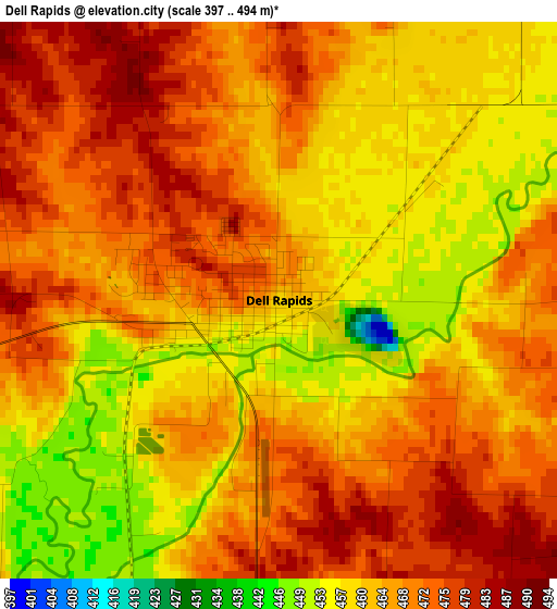
Below is the Elevation map of Dell Rapids, which displays elevation range with different colors. Scale of the first map is from 397 to 494 m (1302 to 1621 ft) with average elevation of 465.4 meters (=1527 ft) [note 1]
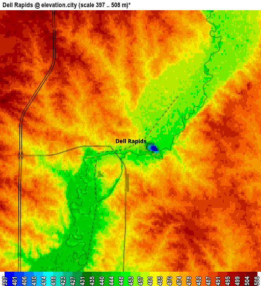
These maps also provides idea of topography and contour of this city, they are displayed at different zoom levels. More info about maps, scale and edge coordinates you can find below images.
| \ | Map #1 | Map #2 | Topo.Map |
| Scale [m] | 397..494 m | 397..508 m | × |
| Scale [ft] | 1302..1621 ft | 1302..1667 ft | × |
| Average | 465.4 m = 1527 ft | 473.9 m = 1555 ft | × |
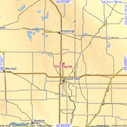
| Width | 7.05 km = 4.4 mi | 14.1 km = 8.8 mi | 225.6 km = 140.2 mi |
| Height | 7.05 km = 4.4 mi | 14.1 km = 8.8 mi | 225.6 km = 140.2 mi |
| ↑Max Latitude | 43.857776° | 43.889455° | 44.83199° |
| Latitude at center | 43.82608° | 43.82608° | 43.82608° |
| ↓Min Latitude | 43.794367° | 43.762638° | 42.80293° |
| ← Min Longitude | -96.750105° | -96.794051° | -98.11241° |
| Longitude center | -96.70616° | -96.70616° | -96.70616° |
| →Max Longitude | -96.662215° | -96.618269° | -95.29991° |
Nearby cities:
Cities around Dell Rapids sort by population:
• Sioux Falls elevation 449 m
30.7 km,  179°
179°
• Brandon 413 m
27.9 km,  157°
157°
• Madison 511 m
38.3 km,  301°
301°
• Harrisburg 436 m
43.9 km, 179°
• Tea 452 m
43.5 km,  193°
193°
• Luverne 451 m
44 km,  115°
115°
• Pipestone 530 m
36.7 km,  58°
58°
• Hartford 481 m
29.5 km,  220°
220°
• Flandreau 476 m
26.4 km,  19°
19°
• Crooks 483 m
19.8 km,  205°
205°
• Garretson 460 m
20.3 km,  126°
126°
• Baltic 448 m
7.7 km,  200°
200°
Multilingual:
 En español:
Dell Rapids elevación 460 m.
 En France:
Dell Rapids élévation 460 m.
 Auf Deutsch:
Dell Rapids höhe über dem Meeresspiegel ist 460 m.

Sources and notes:
- [note 1] Map square and city borders are not equal. Map elevation data is calculated only from area inside that square.
- [src 1] Elevation data from geonames database provided with same terms of usage.
- [src 2] The elevation map of Dell Rapids is generated using elevation data from NASA's 3 arcsec (90m) resolution SRTM data.
- [src 3] Base (background) map © OpenStreetMap contributors tiles are generated by Geofabrik and OpenTopoMap.
Copyright & License:
This Dell Rapids Elevation Map is licensed under CC BY-SA. You may reuse any part from this page, if you give a proper credit by linking to this URL:
 More info on terms of use page.