Rutherford elevation
Rutherford (Pennsylvania, Dauphin County), United States elevation is 157 meters and Rutherford elevation in feet is 515 ft above sea level [src 1]. Rutherford is a populated place (feature code) with elevation that is 122 meters (400 ft) smaller than average city elevation in United States.
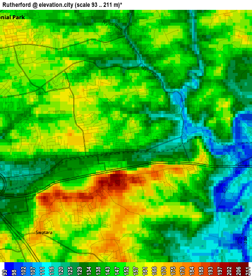
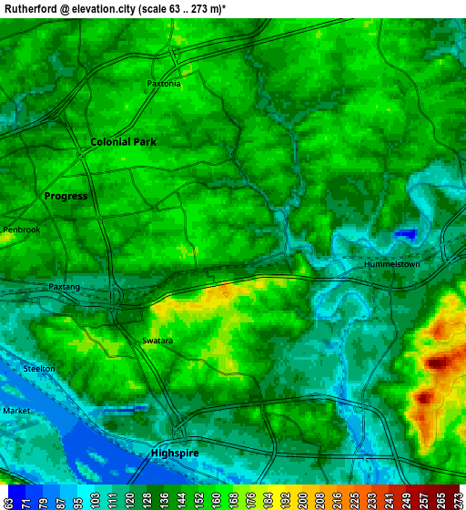
Below is the Elevation map of Rutherford, which displays elevation range with different colors. Scale of the first map is from 93 to 211 m (305 to 692 ft) with average elevation of 144.7 meters (=475 ft) [note 1]
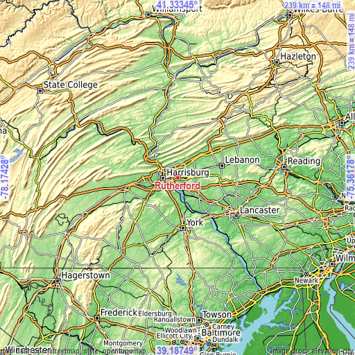
These maps also provides idea of topography and contour of this city, they are displayed at different zoom levels. More info about maps, scale and edge coordinates you can find below images.
| \ | Map #1 | Map #2 | Topo.Map |
| Scale [m] | 93..211 m | 63..273 m | × |
| Scale [ft] | 305..692 ft | 207..896 ft | × |
| Average | 144.7 m = 475 ft | 137.6 m = 451 ft | × |
| Width | 7.46 km = 4.6 mi | 14.91 km = 9.3 mi | 238.6 km = 148.3 mi |
| Height | 7.46 km = 4.6 mi | 14.91 km = 9.3 mi | 238.6 km = 148.3 mi |
| ↑Max Latitude | 40.302503° | 40.336009° | 41.33345° |
| Latitude at center | 40.26898° | 40.26898° | 40.26898° |
| ↓Min Latitude | 40.235441° | 40.201885° | 39.18749° |
| ← Min Longitude | -76.811975° | -76.855921° | -78.17428° |
| Longitude center | -76.76803° | -76.76803° | -76.76803° |
| →Max Longitude | -76.724085° | -76.680139° | -75.36178° |
Nearby cities:
Cities around Rutherford sort by population:
• Colonial Park elevation 156 m
5 km,  314°
314°
• Progress 156 m
5.7 km,  288°
288°
• Linglestown 167 m
7.4 km,  346°
346°
• Steelton 94 m
7.3 km,  239°
239°
• Paxtonia 160 m
5.8 km,  337°
337°
• Hummelstown 121 m
5.1 km,  94°
94°
• Lawnton 121 m
3.3 km,  248°
248°
• Penbrook 151 m
6.8 km,  275°
275°
• Highspire 99 m
6.7 km,  196°
196°
• Paxtang 117 m
5.5 km,  258°
258°
• Bressler 151 m
6.2 km,  225°
225°
• Enhaut 149 m
6.5 km, 230°
Multilingual:
 En español:
Rutherford elevación 157 m.
 En France:
Rutherford élévation 157 m.
 Auf Deutsch:
Rutherford höhe über dem Meeresspiegel ist 157 m.

Sources and notes:
- [note 1] Map square and city borders are not equal. Map elevation data is calculated only from area inside that square.
- [src 1] Elevation data from geonames database provided with same terms of usage.
- [src 2] The elevation map of Rutherford is generated using elevation data from NASA's 3 arcsec (90m) resolution SRTM data.
- [src 3] Base (background) map © OpenStreetMap contributors tiles are generated by Geofabrik and OpenTopoMap.
Copyright & License:
This Rutherford Elevation Map is licensed under CC BY-SA. You may reuse any part from this page, if you give a proper credit by linking to this URL:
 More info on terms of use page.