Russellton elevation
Russellton (Pennsylvania, Allegheny County), United States elevation is 289 meters and Russellton elevation in feet is 948 ft above sea level [src 1]. Russellton is a populated place (feature code) with elevation that is 10 meters (33 ft) bigger than average city elevation in United States.
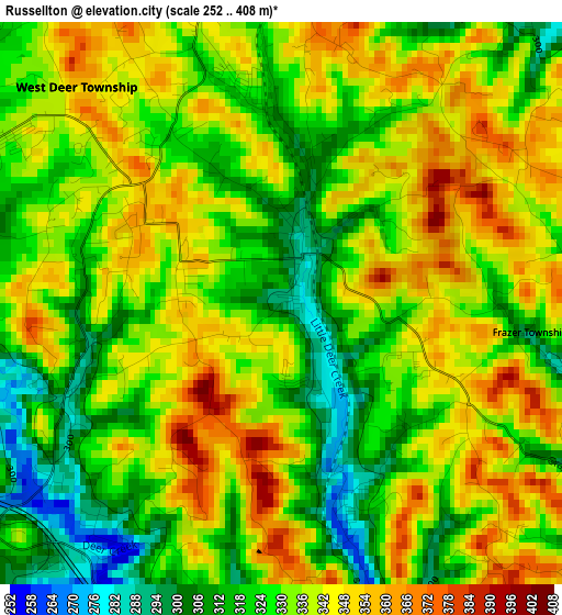
Below is the Elevation map of Russellton, which displays elevation range with different colors. Scale of the first map is from 252 to 408 m (827 to 1339 ft) with average elevation of 332.9 meters (=1092 ft) [note 1]
These maps also provides idea of topography and contour of this city, they are displayed at different zoom levels. More info about maps, scale and edge coordinates you can find below images.
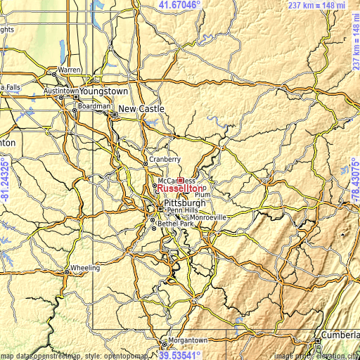
| \ | Map #1 | Topo.Map |
| Scale [m] | 252..408 m | × |
| Scale [ft] | 827..1339 ft | × |
| Average | 332.9 m = 1092 ft | × |
| Width | 7.42 km = 4.6 mi | 237.4 km = 147.5 mi |
| Height | 7.42 km = 4.6 mi | 237.4 km = 147.5 mi |
| ↑Max Latitude | 40.644812° | 41.67046° |
| Latitude at center | 40.61146° | 40.61146° |
| ↓Min Latitude | 40.578091° | 39.53541° |
| ← Min Longitude | -79.880945° | -81.24325° |
| Longitude center | -79.837° | -79.837° |
| →Max Longitude | -79.793055° | -78.43075° |
Nearby cities:
Cities around Russellton sort by population:
• New Kensington elevation 239 m
7.7 km,  127°
127°
• Lower Burrell 228 m
9.3 km, 133°
• Oakmont 234 m
10 km,  182°
182°
• Fox Chapel 302 m
11.5 km,  198°
198°
• Arnold 240 m
6.9 km,  120°
120°
• Tarentum 243 m
6.6 km,  99°
99°
• Springdale 248 m
9 km,  150°
150°
• Brackenridge 255 m
8.1 km,  92°
92°
• Gibsonia 317 m
11.4 km,  280°
280°
• Bakerstown 333 m
9.5 km,  297°
297°
• Cheswick 231 m
8.4 km,  157°
157°
• Curtisville 324 m
3.6 km,  341°
341°
Multilingual:
 En español:
Russellton elevación 289 m.
 En France:
Russellton élévation 289 m.
 Auf Deutsch:
Russellton höhe über dem Meeresspiegel ist 289 m.

Sources and notes:
- [note 1] Map square and city borders are not equal. Map elevation data is calculated only from area inside that square.
- [src 1] Elevation data from geonames database provided with same terms of usage.
- [src 2] The elevation map of Russellton is generated using elevation data from NASA's 3 arcsec (90m) resolution SRTM data.
- [src 3] Base (background) map © OpenStreetMap contributors tiles are generated by Geofabrik and OpenTopoMap.
Copyright & License:
This Russellton Elevation Map is licensed under CC BY-SA. You may reuse any part from this page, if you give a proper credit by linking to this URL:
 More info on terms of use page.