Murrysville elevation
Murrysville (Pennsylvania, Westmoreland County), United States elevation is 278 meters and Murrysville elevation in feet is 912 ft above sea level [src 1]. Murrysville is a populated place (feature code) with elevation that is 1 meters (3 ft) smaller than average city elevation in United States.
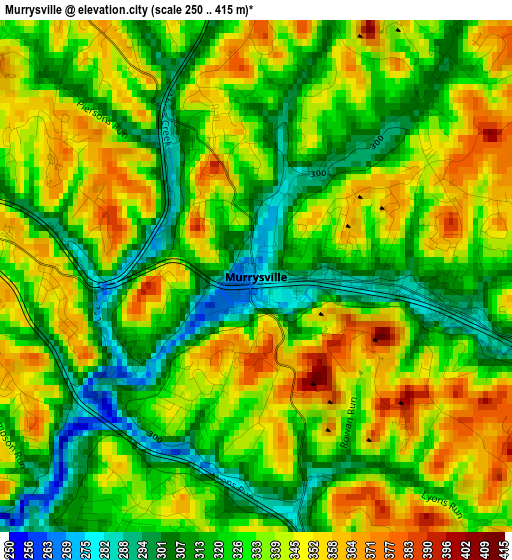
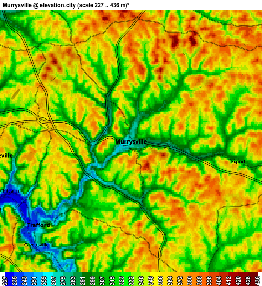
Below is the Elevation map of Murrysville, which displays elevation range with different colors. Scale of the first map is from 250 to 415 m (820 to 1362 ft) with average elevation of 331.5 meters (=1088 ft) [note 1]
These maps also provides idea of topography and contour of this city, they are displayed at different zoom levels. More info about maps, scale and edge coordinates you can find below images.
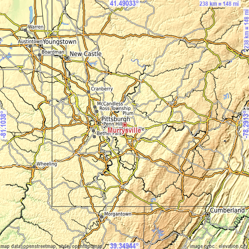
| \ | Map #1 | Map #2 | Topo.Map |
| Scale [m] | 250..415 m | 227..436 m | × |
| Scale [ft] | 820..1362 ft | 745..1430 ft | × |
| Average | 331.5 m = 1088 ft | 341 m = 1119 ft | × |
| Width | 7.44 km = 4.6 mi | 14.88 km = 9.2 mi | 238 km = 147.9 mi |
| Height | 7.44 km = 4.6 mi | 14.88 km = 9.2 mi | 238 km = 147.9 mi |
| ↑Max Latitude | 40.461844° | 40.495271° | 41.49033° |
| Latitude at center | 40.4284° | 40.4284° | 40.4284° |
| ↓Min Latitude | 40.39494° | 40.361463° | 39.34944° |
| ← Min Longitude | -79.741495° | -79.785441° | -81.1038° |
| Longitude center | -79.69755° | -79.69755° | -79.69755° |
| →Max Longitude | -79.653605° | -79.609659° | -78.2913° |
Nearby cities:
Cities around Murrysville sort by population:
• Monroeville elevation 367 m
7.7 km,  264°
264°
• Plum 344 m
9.1 km,  331°
331°
• North Versailles 357 m
10.9 km,  240°
240°
• Turtle Creek 227 m
11.1 km, 256°
• Level Green 316 m
4.3 km,  206°
206°
• Irwin 294 m
11.6 km,  181°
181°
• Manor 284 m
10.8 km,  167°
167°
• Pitcairn 239 m
7.4 km,  247°
247°
• Trafford 258 m
7 km,  227°
227°
• Delmont 382 m
10.9 km,  98°
98°
• Wilmerding 240 m
10.4 km, 246°
• East McKeesport 351 m
10.5 km, 241°
Multilingual:
 En español:
Murrysville elevación 278 m.
 En France:
Murrysville élévation 278 m.
 Auf Deutsch:
Murrysville höhe über dem Meeresspiegel ist 278 m.

Sources and notes:
- [note 1] Map square and city borders are not equal. Map elevation data is calculated only from area inside that square.
- [src 1] Elevation data from geonames database provided with same terms of usage.
- [src 2] The elevation map of Murrysville is generated using elevation data from NASA's 3 arcsec (90m) resolution SRTM data.
- [src 3] Base (background) map © OpenStreetMap contributors tiles are generated by Geofabrik and OpenTopoMap.
Copyright & License:
This Murrysville Elevation Map is licensed under CC BY-SA. You may reuse any part from this page, if you give a proper credit by linking to this URL:
 More info on terms of use page.