Turtle Creek elevation
Turtle Creek (Pennsylvania, Allegheny County), United States elevation is 227 meters and Turtle Creek elevation in feet is 745 ft above sea level [src 1]. Turtle Creek is a populated place (feature code) with elevation that is 52 meters (171 ft) smaller than average city elevation in United States.
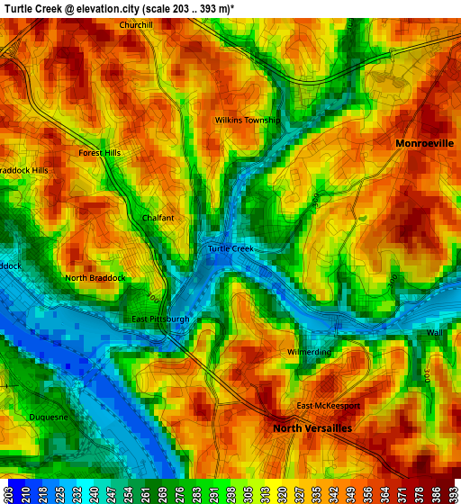
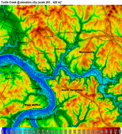
Below is the Elevation map of Turtle Creek, which displays elevation range with different colors. Scale of the first map is from 203 to 393 m (666 to 1289 ft) with average elevation of 309.1 meters (=1014 ft) [note 1]
These maps also provides idea of topography and contour of this city, they are displayed at different zoom levels. More info about maps, scale and edge coordinates you can find below images.
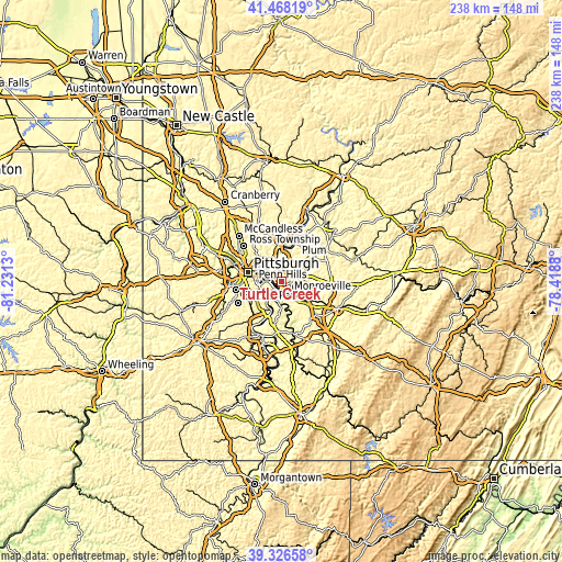
| \ | Map #1 | Map #2 | Topo.Map |
| Scale [m] | 203..393 m | 203..420 m | × |
| Scale [ft] | 666..1289 ft | 666..1378 ft | × |
| Average | 309.1 m = 1014 ft | 315.7 m = 1036 ft | × |
| Width | 7.44 km = 4.6 mi | 14.88 km = 9.2 mi | 238.1 km = 147.9 mi |
| Height | 7.44 km = 4.6 mi | 14.88 km = 9.2 mi | 238.1 km = 147.9 mi |
| ↑Max Latitude | 40.439355° | 40.472793° | 41.46819° |
| Latitude at center | 40.4059° | 40.4059° | 40.4059° |
| ↓Min Latitude | 40.372429° | 40.338941° | 39.32658° |
| ← Min Longitude | -79.868995° | -79.912941° | -81.2313° |
| Longitude center | -79.82505° | -79.82505° | -79.82505° |
| →Max Longitude | -79.781105° | -79.737159° | -78.4188° |
Nearby cities:
Cities around Turtle Creek sort by population:
• Monroeville elevation 367 m
3.6 km,  61°
61°
• North Versailles 357 m
3.2 km,  155°
155°
• Forest Hills 295 m
2.6 km,  306°
306°
• Duquesne 279 m
4 km,  227°
227°
• North Braddock 307 m
1.5 km,  240°
240°
• Pitcairn 239 m
4 km,  94°
94°
• Churchill 329 m
3.9 km,  337°
337°
• Wilmerding 240 m
2.1 km,  142°
142°
• Braddock 234 m
3.7 km,  265°
265°
• East McKeesport 351 m
3 km,  148°
148°
• Braddock Hills 309 m
3.6 km,  290°
290°
• East Pittsburgh 271 m
1.6 km, 225°
Multilingual:
 En español:
Turtle Creek elevación 227 m.
 En France:
Turtle Creek élévation 227 m.
 Auf Deutsch:
Turtle Creek höhe über dem Meeresspiegel ist 227 m.

Sources and notes:
- [note 1] Map square and city borders are not equal. Map elevation data is calculated only from area inside that square.
- [src 1] Elevation data from geonames database provided with same terms of usage.
- [src 2] The elevation map of Turtle Creek is generated using elevation data from NASA's 3 arcsec (90m) resolution SRTM data.
- [src 3] Base (background) map © OpenStreetMap contributors tiles are generated by Geofabrik and OpenTopoMap.
Copyright & License:
This Turtle Creek Elevation Map is licensed under CC BY-SA. You may reuse any part from this page, if you give a proper credit by linking to this URL:
 More info on terms of use page.