Leola elevation
Leola (Pennsylvania, Lancaster County), United States elevation is 133 meters and Leola elevation in feet is 436 ft above sea level [src 1]. Leola is a populated place (feature code) with elevation that is 146 meters (479 ft) smaller than average city elevation in United States.
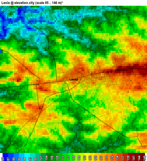
Below is the Elevation map of Leola, which displays elevation range with different colors. Scale of the first map is from 85 to 146 m (279 to 479 ft) with average elevation of 114.9 meters (=377 ft) [note 1]
These maps also provides idea of topography and contour of this city, they are displayed at different zoom levels. More info about maps, scale and edge coordinates you can find below images.
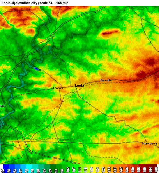
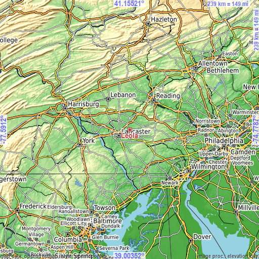
| \ | Map #1 | Map #2 | Topo.Map |
| Scale [m] | 85..146 m | 54..168 m | × |
| Scale [ft] | 279..479 ft | 177..551 ft | × |
| Average | 114.9 m = 377 ft | 114.9 m = 377 ft | × |
| Width | 7.48 km = 4.6 mi | 14.95 km = 9.3 mi | 239.2 km = 148.6 mi |
| Height | 7.48 km = 4.6 mi | 14.95 km = 9.3 mi | 239.2 km = 148.6 mi |
| ↑Max Latitude | 40.121482° | 40.155078° | 41.15521° |
| Latitude at center | 40.08787° | 40.08787° | 40.08787° |
| ↓Min Latitude | 40.054241° | 40.020595° | 39.00352° |
| ← Min Longitude | -76.228895° | -76.272841° | -77.5912° |
| Longitude center | -76.18495° | -76.18495° | -76.18495° |
| →Max Longitude | -76.141005° | -76.097059° | -74.7787° |
Nearby cities:
Cities around Leola sort by population:
• Lancaster elevation 116 m
11.7 km,  241°
241°
• Ephrata 113 m
10.2 km,  2°
2°
• Lititz 119 m
12.9 km,  306°
306°
• New Holland 151 m
8.6 km,  79°
79°
• Akron 160 m
7.8 km,  349°
349°
• Rothsville 154 m
9 km,  321°
321°
• Strasburg 146 m
11.6 km,  179°
179°
• Brownstown 103 m
4.7 km,  328°
328°
• Lampeter 129 m
11.8 km,  203°
203°
• Intercourse 134 m
8.8 km,  129°
129°
• Paradise 114 m
9.9 km,  151°
151°
• Blue Ball 138 m
12.2 km,  73°
73°
Multilingual:
 En español:
Leola elevación 133 m.
 En France:
Leola élévation 133 m.


Sources and notes:
- [note 1] Map square and city borders are not equal. Map elevation data is calculated only from area inside that square.
- [src 1] Elevation data from geonames database provided with same terms of usage.
- [src 2] The elevation map of Leola is generated using elevation data from NASA's 3 arcsec (90m) resolution SRTM data.
- [src 3] Base (background) map © OpenStreetMap contributors tiles are generated by Geofabrik and OpenTopoMap.
Copyright & License:
This Leola Elevation Map is licensed under CC BY-SA. You may reuse any part from this page, if you give a proper credit by linking to this URL:
 More info on terms of use page.