Fleetwood elevation
Fleetwood (Pennsylvania, Berks County), United States elevation is 134 meters and Fleetwood elevation in feet is 440 ft above sea level [src 1]. Fleetwood is a populated place (feature code) with elevation that is 145 meters (476 ft) smaller than average city elevation in United States.
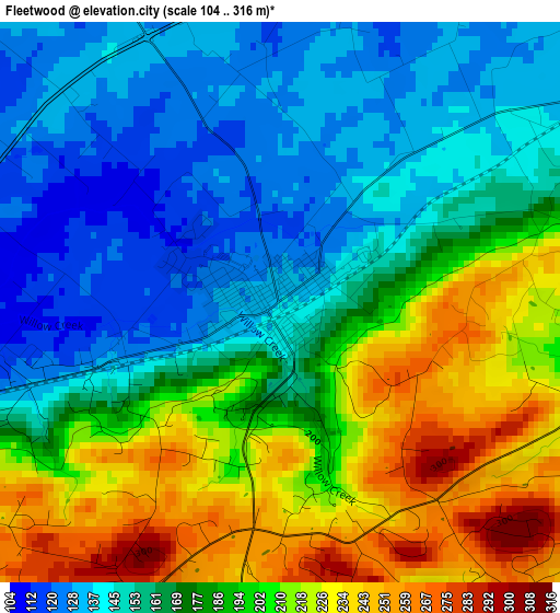
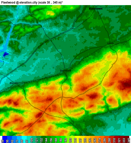
Below is the Elevation map of Fleetwood, which displays elevation range with different colors. Scale of the first map is from 104 to 316 m (341 to 1037 ft) with average elevation of 179.4 meters (=589 ft) [note 1]
These maps also provides idea of topography and contour of this city, they are displayed at different zoom levels. More info about maps, scale and edge coordinates you can find below images.
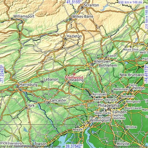
| \ | Map #1 | Map #2 | Topo.Map |
| Scale [m] | 104..316 m | 38..345 m | × |
| Scale [ft] | 341..1037 ft | 125..1132 ft | × |
| Average | 179.4 m = 589 ft | 173.9 m = 571 ft | × |
| Width | 7.44 km = 4.6 mi | 14.87 km = 9.2 mi | 238 km = 147.9 mi |
| Height | 7.44 km = 4.6 mi | 14.87 km = 9.2 mi | 237.9 km = 147.8 mi |
| ↑Max Latitude | 40.487411° | 40.520825° | 41.5155° |
| Latitude at center | 40.45398° | 40.45398° | 40.45398° |
| ↓Min Latitude | 40.420532° | 40.387068° | 39.37542° |
| ← Min Longitude | -75.861925° | -75.905871° | -77.22423° |
| Longitude center | -75.81798° | -75.81798° | -75.81798° |
| →Max Longitude | -75.774035° | -75.730089° | -74.41173° |
Nearby cities:
Cities around Fleetwood sort by population:
• Blandon elevation 117 m
6 km,  256°
256°
• Kutztown 131 m
7.8 km,  25°
25°
• Laureldale 117 m
11.2 km,  229°
229°
• River View Park 95 m
13.7 km,  240°
240°
• Hyde Park 100 m
12.5 km, 226°
• Topton 148 m
11.3 km,  60°
60°
• Leesport 89 m
12.6 km,  266°
266°
• Temple 108 m
10.1 km, 240°
• South Temple 254 m
9.2 km, 229°
• Muhlenberg Park 83 m
13 km, 233°
• Oley 135 m
7.8 km,  161°
161°
• Stony Creek Mills 117 m
12.8 km,  200°
200°
Multilingual:
 En español:
Fleetwood elevación 134 m.
 En France:
Fleetwood élévation 134 m.
 Auf Deutsch:
Fleetwood höhe über dem Meeresspiegel ist 134 m.

Sources and notes:
- [note 1] Map square and city borders are not equal. Map elevation data is calculated only from area inside that square.
- [src 1] Elevation data from geonames database provided with same terms of usage.
- [src 2] The elevation map of Fleetwood is generated using elevation data from NASA's 3 arcsec (90m) resolution SRTM data.
- [src 3] Base (background) map © OpenStreetMap contributors tiles are generated by Geofabrik and OpenTopoMap.
Copyright & License:
This Fleetwood Elevation Map is licensed under CC BY-SA. You may reuse any part from this page, if you give a proper credit by linking to this URL:
 More info on terms of use page.