Farrell elevation
Farrell (Pennsylvania, Mercer County), United States elevation is 297 meters and Farrell elevation in feet is 974 ft above sea level [src 1]. Farrell is a populated place (feature code) with elevation that is 18 meters (59 ft) bigger than average city elevation in United States.
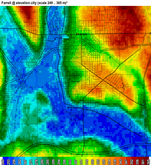
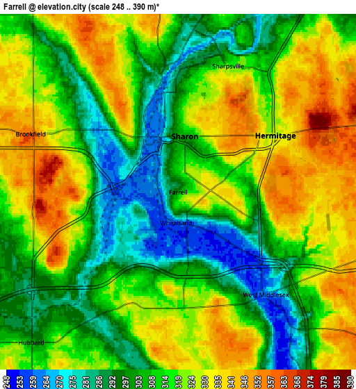
Below is the Elevation map of Farrell, which displays elevation range with different colors. Scale of the first map is from 249 to 365 m (817 to 1198 ft) with average elevation of 292 meters (=958 ft) [note 1]
These maps also provides idea of topography and contour of this city, they are displayed at different zoom levels. More info about maps, scale and edge coordinates you can find below images.
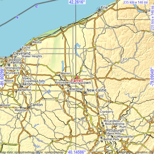
| \ | Map #1 | Map #2 | Topo.Map |
| Scale [m] | 249..365 m | 248..390 m | × |
| Scale [ft] | 817..1198 ft | 814..1280 ft | × |
| Average | 292 m = 958 ft | 314.6 m = 1032 ft | × |
| Width | 7.35 km = 4.6 mi | 14.7 km = 9.1 mi | 235.2 km = 146.1 mi |
| Height | 7.35 km = 4.6 mi | 14.7 km = 9.1 mi | 235.2 km = 146.1 mi |
| ↑Max Latitude | 41.245331° | 41.278364° | 42.2616° |
| Latitude at center | 41.21228° | 41.21228° | 41.21228° |
| ↓Min Latitude | 41.179213° | 41.146129° | 40.14586° |
| ← Min Longitude | -80.540685° | -80.584631° | -81.90299° |
| Longitude center | -80.49674° | -80.49674° | -80.49674° |
| →Max Longitude | -80.452795° | -80.408849° | -79.09049° |
Nearby cities:
Cities around Farrell sort by population:
• Youngstown elevation 267 m
17.9 km,  225°
225°
• Hermitage 327 m
4.7 km,  59°
59°
• Sharon 308 m
2.3 km,  6°
6°
• Campbell 316 m
17.2 km,  209°
209°
• Hubbard 299 m
8.7 km,  224°
224°
• Sharpsville 314 m
5.6 km,  21°
21°
• West Hill 318 m
3 km,  320°
320°
• New Wilmington 314 m
17 km,  126°
126°
• Churchill 325 m
15.1 km,  248°
248°
• Masury 280 m
3.4 km,  267°
267°
• Reynolds Heights 325 m
17.1 km,  30°
30°
• Brookfield Center 326 m
6 km,  301°
301°
Multilingual:
 En español:
Farrell elevación 297 m.
 En France:
Farrell élévation 297 m.


Sources and notes:
- [note 1] Map square and city borders are not equal. Map elevation data is calculated only from area inside that square.
- [src 1] Elevation data from geonames database provided with same terms of usage.
- [src 2] The elevation map of Farrell is generated using elevation data from NASA's 3 arcsec (90m) resolution SRTM data.
- [src 3] Base (background) map © OpenStreetMap contributors tiles are generated by Geofabrik and OpenTopoMap.
Copyright & License:
This Farrell Elevation Map is licensed under CC BY-SA. You may reuse any part from this page, if you give a proper credit by linking to this URL:
 More info on terms of use page.