Exton elevation
Exton (Pennsylvania, Chester County), United States elevation is 97 meters and Exton elevation in feet is 318 ft above sea level [src 1]. Exton is a populated place (feature code) with elevation that is 182 meters (597 ft) smaller than average city elevation in United States.
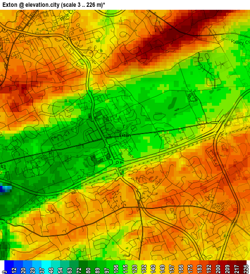
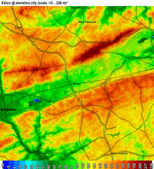
Below is the Elevation map of Exton, which displays elevation range with different colors. Scale of the first map is from 3 to 226 m (10 to 741 ft) with average elevation of 141.6 meters (=465 ft) [note 1]
These maps also provides idea of topography and contour of this city, they are displayed at different zoom levels. More info about maps, scale and edge coordinates you can find below images.
| \ | Map #1 | Map #2 | Topo.Map |
| Scale [m] | 3..226 m | -14..226 m | × |
| Scale [ft] | 10..741 ft | -46..741 ft | × |
| Average | 141.6 m = 465 ft | 133.4 m = 438 ft | × |
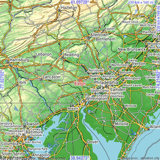
| Width | 7.48 km = 4.6 mi | 14.97 km = 9.3 mi | 239.5 km = 148.8 mi |
| Height | 7.48 km = 4.6 mi | 14.97 km = 9.3 mi | 239.4 km = 148.8 mi |
| ↑Max Latitude | 40.062641° | 40.096266° | 41.09728° |
| Latitude at center | 40.029° | 40.029° | 40.029° |
| ↓Min Latitude | 39.995342° | 39.961667° | 38.94373° |
| ← Min Longitude | -75.664715° | -75.708661° | -77.02702° |
| Longitude center | -75.62077° | -75.62077° | -75.62077° |
| →Max Longitude | -75.576825° | -75.532879° | -74.21452° |
Nearby cities:
Cities around Exton sort by population:
• West Chester elevation 136 m
7.6 km,  171°
171°
• Phoenixville 47 m
14.4 km,  38°
38°
• Downingtown 74 m
7.5 km,  250°
250°
• Chester Springs 85 m
7.4 km,  2°
2°
• Lionville 168 m
4.3 km,  309°
309°
• Paoli 157 m
12.4 km,  83°
83°
• Chesterbrook 60 m
14.7 km,  69°
69°
• Berwyn 160 m
15.6 km, 83°
• Malvern 174 m
9.1 km, 84°
• Thorndale 115 m
11.3 km, 249°
• Eagleview 132 m
6.1 km,  303°
303°
• Caln 99 m
14.2 km, 252°
Multilingual:
 En español:
Exton elevación 97 m.
 En France:
Exton élévation 97 m.


Sources and notes:
- [note 1] Map square and city borders are not equal. Map elevation data is calculated only from area inside that square.
- [src 1] Elevation data from geonames database provided with same terms of usage.
- [src 2] The elevation map of Exton is generated using elevation data from NASA's 3 arcsec (90m) resolution SRTM data.
- [src 3] Base (background) map © OpenStreetMap contributors tiles are generated by Geofabrik and OpenTopoMap.
Copyright & License:
This Exton Elevation Map is licensed under CC BY-SA. You may reuse any part from this page, if you give a proper credit by linking to this URL:
 More info on terms of use page.