Boyertown elevation
Boyertown (Pennsylvania, Berks County), United States elevation is 129 meters and Boyertown elevation in feet is 423 ft above sea level [src 1]. Boyertown is a populated place (feature code) with elevation that is 150 meters (492 ft) smaller than average city elevation in United States.
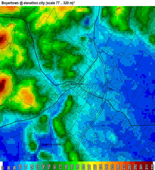
Below is the Elevation map of Boyertown, which displays elevation range with different colors. Scale of the first map is from 77 to 320 m (253 to 1050 ft) with average elevation of 134.5 meters (=441 ft) [note 1]
These maps also provides idea of topography and contour of this city, they are displayed at different zoom levels. More info about maps, scale and edge coordinates you can find below images.
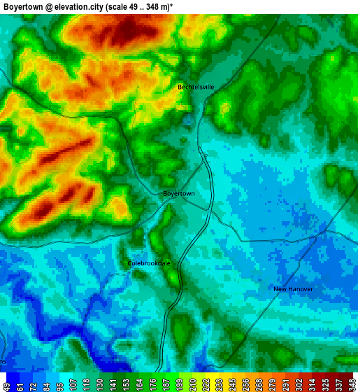
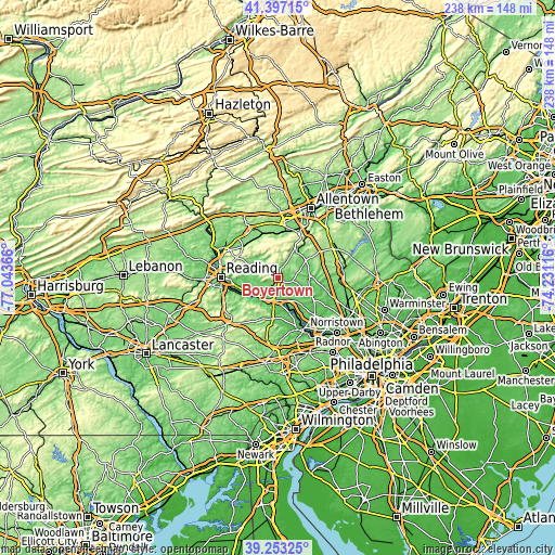
| \ | Map #1 | Map #2 | Topo.Map |
| Scale [m] | 77..320 m | 49..348 m | × |
| Scale [ft] | 253..1050 ft | 161..1142 ft | × |
| Average | 134.5 m = 441 ft | 144 m = 472 ft | × |
| Width | 7.45 km = 4.6 mi | 14.9 km = 9.3 mi | 238.4 km = 148.1 mi |
| Height | 7.45 km = 4.6 mi | 14.9 km = 9.3 mi | 238.4 km = 148.1 mi |
| ↑Max Latitude | 40.367201° | 40.400675° | 41.39715° |
| Latitude at center | 40.33371° | 40.33371° | 40.33371° |
| ↓Min Latitude | 40.300203° | 40.266679° | 39.25325° |
| ← Min Longitude | -75.681355° | -75.725301° | -77.04366° |
| Longitude center | -75.63741° | -75.63741° | -75.63741° |
| →Max Longitude | -75.593465° | -75.549519° | -74.23116° |
Nearby cities:
Cities around Boyertown sort by population:
• Pottstown elevation 51 m
9.9 km,  186°
186°
• Sanatoga 75 m
10.5 km,  160°
160°
• Gilbertsville 106 m
2.8 km,  123°
123°
• Pennsburg 118 m
13.9 km,  62°
62°
• Stowe 62 m
9.6 km,  200°
200°
• Pottsgrove 83 m
8 km, 164°
• Amity Gardens 74 m
10.6 km,  231°
231°
• Halfway House 121 m
5.8 km,  184°
184°
• South Pottstown 45 m
10.5 km, 186°
• Kenilworth 57 m
11.4 km, 178°
• New Berlinville 124 m
1.4 km,  16°
16°
• Bally 145 m
8.7 km,  29°
29°
Multilingual:
 En español:
Boyertown elevación 129 m.
 En France:
Boyertown élévation 129 m.
 Auf Deutsch:
Boyertown höhe über dem Meeresspiegel ist 129 m.

Sources and notes:
- [note 1] Map square and city borders are not equal. Map elevation data is calculated only from area inside that square.
- [src 1] Elevation data from geonames database provided with same terms of usage.
- [src 2] The elevation map of Boyertown is generated using elevation data from NASA's 3 arcsec (90m) resolution SRTM data.
- [src 3] Base (background) map © OpenStreetMap contributors tiles are generated by Geofabrik and OpenTopoMap.
Copyright & License:
This Boyertown Elevation Map is licensed under CC BY-SA. You may reuse any part from this page, if you give a proper credit by linking to this URL:
 More info on terms of use page.