Westfield Center elevation
Westfield Center (Ohio, Medina County), United States elevation is 340 meters and Westfield Center elevation in feet is 1115 ft above sea level [src 1]. Westfield Center is a populated place (feature code) with elevation that is 61 meters (200 ft) bigger than average city elevation in United States.
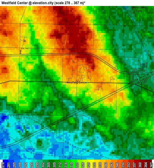
Below is the Elevation map of Westfield Center, which displays elevation range with different colors. Scale of the first map is from 278 to 367 m (912 to 1204 ft) with average elevation of 318 meters (=1043 ft) [note 1]
These maps also provides idea of topography and contour of this city, they are displayed at different zoom levels. More info about maps, scale and edge coordinates you can find below images.
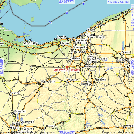
| \ | Map #1 | Topo.Map |
| Scale [m] | 278..367 m | × |
| Scale [ft] | 912..1204 ft | × |
| Average | 318 m = 1043 ft | × |
| Width | 7.37 km = 4.6 mi | 235.9 km = 146.6 mi |
| Height | 7.37 km = 4.6 mi | 235.9 km = 146.6 mi |
| ↑Max Latitude | 41.059584° | 42.07877° |
| Latitude at center | 41.02644° | 41.02644° |
| ↓Min Latitude | 40.993279° | 39.95703° |
| ← Min Longitude | -81.977145° | -83.33945° |
| Longitude center | -81.9332° | -81.9332° |
| →Max Longitude | -81.889255° | -80.52695° |
Nearby cities:
Cities around Westfield Center sort by population:
• Brunswick elevation 359 m
24.7 km,  18°
18°
• Wooster 303 m
24.6 km,  180°
180°
• Medina 332 m
13.7 km,  25°
25°
• Wadsworth 357 m
17.1 km,  90°
90°
• Norton 322 m
24.7 km, 89°
• Rittman 297 m
13.8 km,  112°
112°
• Doylestown 381 m
20.8 km, 107°
• Lodi 282 m
6.7 km,  276°
276°
• Seville 302 m
6.2 km, 107°
• Creston 301 m
5.5 km,  142°
142°
• West Salem 339 m
16 km,  247°
247°
• Smithville 323 m
19.2 km,  161°
161°
Multilingual:
 En español:
Westfield Center elevación 340 m.
 En France:
Westfield Center élévation 340 m.
 Auf Deutsch:
Westfield Center höhe über dem Meeresspiegel ist 340 m.

Sources and notes:
- [note 1] Map square and city borders are not equal. Map elevation data is calculated only from area inside that square.
- [src 1] Elevation data from geonames database provided with same terms of usage.
- [src 2] The elevation map of Westfield Center is generated using elevation data from NASA's 3 arcsec (90m) resolution SRTM data.
- [src 3] Base (background) map © OpenStreetMap contributors tiles are generated by Geofabrik and OpenTopoMap.
Copyright & License:
This Westfield Center Elevation Map is licensed under CC BY-SA. You may reuse any part from this page, if you give a proper credit by linking to this URL:
 More info on terms of use page.