North Canton elevation
North Canton (Ohio, Stark County), United States elevation is 352 meters and North Canton elevation in feet is 1155 ft above sea level [src 1]. North Canton is a populated place (feature code) with elevation that is 73 meters (240 ft) bigger than average city elevation in United States.
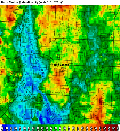
Below is the Elevation map of North Canton, which displays elevation range with different colors. Scale of the first map is from 316 to 379 m (1037 to 1243 ft) with average elevation of 342.3 meters (=1123 ft) [note 1]
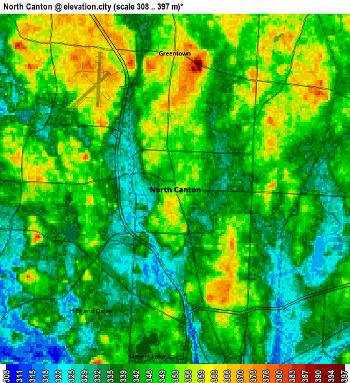
These maps also provides idea of topography and contour of this city, they are displayed at different zoom levels. More info about maps, scale and edge coordinates you can find below images.
| \ | Map #1 | Map #2 | Topo.Map |
| Scale [m] | 316..379 m | 308..397 m | × |
| Scale [ft] | 1037..1243 ft | 1010..1302 ft | × |
| Average | 342.3 m = 1123 ft | 344 m = 1129 ft | × |
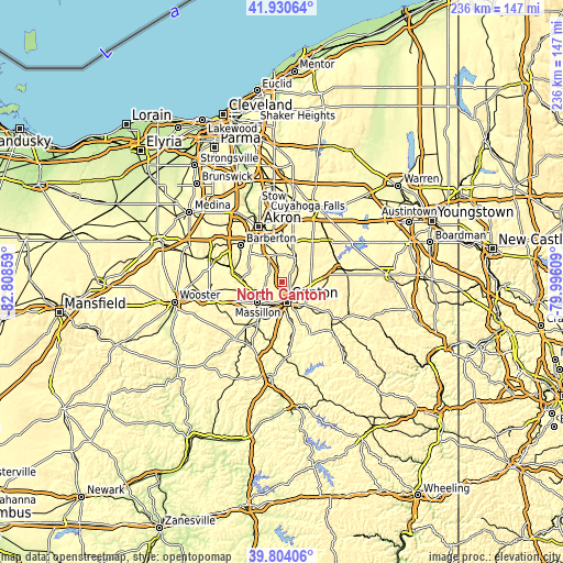
| Width | 7.39 km = 4.6 mi | 14.78 km = 9.2 mi | 236.5 km = 147 mi |
| Height | 7.39 km = 4.6 mi | 14.78 km = 9.2 mi | 236.4 km = 146.9 mi |
| ↑Max Latitude | 40.90911° | 40.942313° | 41.93064° |
| Latitude at center | 40.87589° | 40.87589° | 40.87589° |
| ↓Min Latitude | 40.842653° | 40.8094° | 39.80406° |
| ← Min Longitude | -81.446285° | -81.490231° | -82.80859° |
| Longitude center | -81.40234° | -81.40234° | -81.40234° |
| →Max Longitude | -81.358395° | -81.314449° | -79.99609° |
Nearby cities:
Cities around North Canton sort by population:
• Canton elevation 329 m
8.8 km,  166°
166°
• Massillon 292 m
13.3 km,  228°
228°
• Green 351 m
10.3 km,  318°
318°
• New Franklin 334 m
13.8 km,  302°
302°
• Louisville 347 m
12.8 km,  109°
109°
• Perry Heights 335 m
10.8 km,  213°
213°
• Greentown 366 m
5.7 km,  359°
359°
• Uniontown 347 m
11 km, 357°
• Greensburg 359 m
8.1 km, 319°
• Hartville 354 m
11.4 km,  31°
31°
• Genoa 349 m
11.7 km, 207°
• East Canton 357 m
14.1 km,  134°
134°
Multilingual:
 En español:
North Canton elevación 352 m.
 En France:
North Canton élévation 352 m.
 Auf Deutsch:
North Canton höhe über dem Meeresspiegel ist 352 m.

Sources and notes:
- [note 1] Map square and city borders are not equal. Map elevation data is calculated only from area inside that square.
- [src 1] Elevation data from geonames database provided with same terms of usage.
- [src 2] The elevation map of North Canton is generated using elevation data from NASA's 3 arcsec (90m) resolution SRTM data.
- [src 3] Base (background) map © OpenStreetMap contributors tiles are generated by Geofabrik and OpenTopoMap.
Copyright & License:
This North Canton Elevation Map is licensed under CC BY-SA. You may reuse any part from this page, if you give a proper credit by linking to this URL:
 More info on terms of use page.