Greenville elevation
Greenville (Ohio, Darke County), United States elevation is 319 meters and Greenville elevation in feet is 1047 ft above sea level [src 1]. Greenville is a seat of a second-order administrative division (feature code) with elevation that is 40 meters (131 ft) bigger than average city elevation in United States.
Below is the Elevation map of Greenville, which displays elevation range with different colors. Scale of the first map is from 302 to 339 m (991 to 1112 ft) with average elevation of 315.9 meters (=1036 ft) [note 1]
These maps also provides idea of topography and contour of this city, they are displayed at different zoom levels. More info about maps, scale and edge coordinates you can find below images.
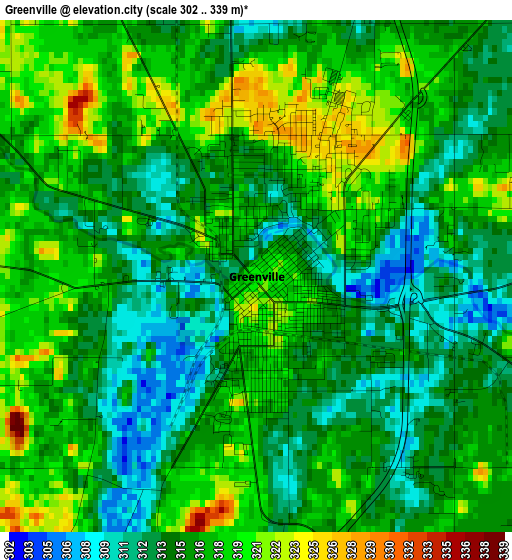
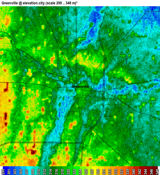
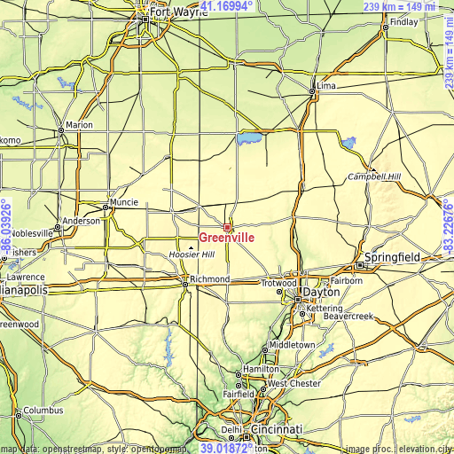
| \ | Map #1 | Map #2 | Topo.Map |
| Scale [m] | 302..339 m | 299..348 m | × |
| Scale [ft] | 991..1112 ft | 981..1142 ft | × |
| Average | 315.9 m = 1036 ft | 316.7 m = 1039 ft | × |
| Width | 7.47 km = 4.6 mi | 14.95 km = 9.3 mi | 239.2 km = 148.6 mi |
| Height | 7.47 km = 4.6 mi | 14.95 km = 9.3 mi | 239.2 km = 148.6 mi |
| ↑Max Latitude | 40.136435° | 40.170023° | 41.16994° |
| Latitude at center | 40.10283° | 40.10283° | 40.10283° |
| ↓Min Latitude | 40.069208° | 40.03557° | 39.01872° |
| ← Min Longitude | -84.676955° | -84.720901° | -86.03926° |
| Longitude center | -84.63301° | -84.63301° | -84.63301° |
| →Max Longitude | -84.589065° | -84.545119° | -83.22676° |
Nearby cities:
Cities around Greenville sort by population:
• West Milton elevation 275 m
30.3 km,  120°
120°
• Union City 347 m
18.6 km,  306°
306°
• Versailles 301 m
18.3 km,  43°
43°
• Covington 283 m
23.8 km,  86°
86°
• Arcanum 319 m
14.3 km,  151°
151°
• Bradford 300 m
17.5 km,  79°
79°
• Lewisburg 302 m
29.6 km,  164°
164°
• Union City 321 m
18 km, 306°
• New Paris 315 m
30.6 km,  206°
206°
• Pleasant Hill 285 m
25.2 km,  103°
103°
• Ansonia 304 m
12.4 km,  358°
358°
• Lynn 359 m
26.8 km,  257°
257°
Multilingual:
 En español:
Greenville elevación 319 m.
 En France:
Greenville élévation 319 m.
 Auf Deutsch:
Greenville höhe über dem Meeresspiegel ist 319 m.

Sources and notes:
- [note 1] Map square and city borders are not equal. Map elevation data is calculated only from area inside that square.
- [src 1] Elevation data from geonames database provided with same terms of usage.
- [src 2] The elevation map of Greenville is generated using elevation data from NASA's 3 arcsec (90m) resolution SRTM data.
- [src 3] Base (background) map © OpenStreetMap contributors tiles are generated by Geofabrik and OpenTopoMap.
Copyright & License:
This Greenville Elevation Map is licensed under CC BY-SA. You may reuse any part from this page, if you give a proper credit by linking to this URL:
 More info on terms of use page.